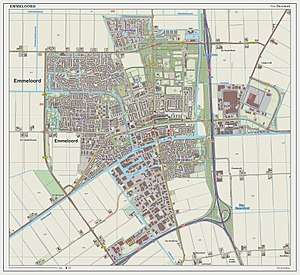
Emmeloord
Emmeloord is the administrative center of the municipality of Noordoostpolder, Flevoland, Netherlands.
Emmeloord | |
|---|---|
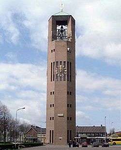 The Poldertoren in Emmeloord | |
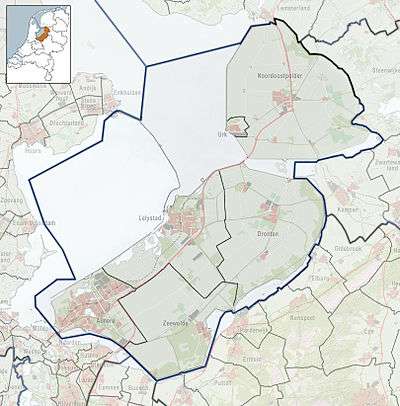 Emmeloord Location of Emmeloord in the province of Flevoland | |
| Coordinates: 52°42′35″N 5°45′3″E | |
| Country | Netherlands |
| Province | Flevoland |
| Municipality | Noordoostpolder |
| Population (1 January 2019) | |
| • Total | 26,055[1] |
Overview
At the heart of the Noordoostpolder, where the three main drainage canals Lemstervaart, Urkervaart and Zwolsevaart[2] intersect, is the city of Emmeloord (1943). Named after an abandoned village on the island of Schokland, Emmeloord is located in a polder: land reclaimed from the IJsselmeer, which earlier was part of the sea. Planned from the outset to be the first and the only major town of the polder, it is the local government and services centre.
The first district built was called the Onkruidbuurt ("weed neighbourhood"). Street names were chosen from the weeds that were growing all around on the former sea floor, like reed (Rietstraat), thistle (Distelstraat) and sea aster (Zeeasterstraat).
From Emmeloord three main canals take their water to three pumping stations: the Buma near Lemmer (north), the Smeenge at Vollenhove (south-east) and the Vissering on Urk (south-west).
In the center of Emmeloord there is a 65 meter tall water tower called the Poldertoren. The tower is the central point of the Noordoostpolder and could be seen from almost every location in the early years of the Noordoostpolder, when there were no tall trees. In Japan there is a replica of this water tower.
Surrounding villages
Ten smaller villages, conceived more as agricultural communities, were planned in a wide circle around Emmeloord, with the distances between them determined to be easily reachable by bicycle. In order from first to last, these settlements were Marknesse (1946), Ens (1948), Kraggenburg (1948), Luttelgeest 1950, Bant (1951), Rutten (1952), Creil (1953), Nagele (1954), Espel (1956) and finally Tollebeek (1956).
Transportation
There is no railway station in Emmeloord, but good bus connections exist to the nearest stations. Only relevant rail connections are mentioned in below table:
| Station | Destinations | Bus route to station |
|---|---|---|
| Lelystad Centrum, Lelystad | Almere, Amsterdam, Amsterdam Airport Schiphol, The Hague, Rotterdam | Bus 140 |
| Kampen, Kampen | Zwolle | Bus 141, 641 |
| Zwolle, Zwolle | Emmen, Almelo, Enschede, Deventer, Arnhem, 's-Hertogenbosch, Amersfoort, Utrecht | Bus 71, 641 |
| Heerenveen, Heerenveen | Leeuwarden | Bus 315, 324 (Qliner) |
The connection with Heerenveen, Drachten and Groningen is ensured by Arriva Qliner intercity buses.
Emmeloord lies at the intersection of the A6 motorway and the N50 dual carriageway, providing a rapid connection to Amsterdam, Zwolle and Friesland.
Gallery
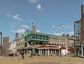 View from the town square De Deel on the Beursstraat (left) and the west-entrance of the shopping street Lange Nering, 2013
 Reformed church De Hoeksteen
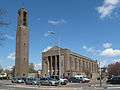 Roman Catholic church Heilige Michael
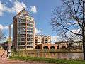 View of a pencil shaped apartment building adjacent to canal Espelervaart
 View of a bridge over canal Urkervaart
 Canal Lemstervaart
References
- (in Dutch) Feiten en cijfers Archived 2014-04-19 at the Wayback Machine, Municipality of Noordoostpolder
- Peilbesluit stedelijk gebied gemeente Noordoostpolder
External links
| Wikimedia Commons has media related to Emmeloord. |
- http://www.emmeloord.info/ (Dutch)
- http://www.noordoostpolder.nl/ (Dutch)