Ellington Township, Adams County, Illinois
Ellington Township is one of twenty-two townships in Adams County, Illinois, United States. As of the 2010 census, its population was 2,855 and it contained 1,097 housing units.[2] The southwest corner of the township is now part of Quincy Township.
Ellington Township | |
|---|---|
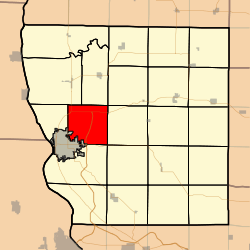 Location in Adams County | |
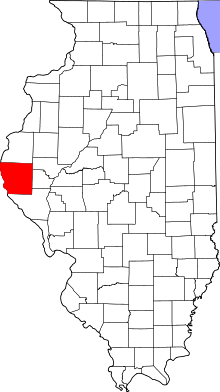 Adams County's location in Illinois | |
| Coordinates: 39°58′46″N 91°18′48″W | |
| Country | United States |
| State | Illinois |
| County | Adams |
| Established | November 6, 1849 |
| Area | |
| • Total | 34.3 sq mi (89 km2) |
| • Land | 34.27 sq mi (88.8 km2) |
| • Water | 0.03 sq mi (0.08 km2) 0.09% |
| Elevation | 722 ft (220 m) |
| Population (2010) | |
| • Estimate (2016)[1] | 2,819 |
| • Density | 83.3/sq mi (32.2/km2) |
| Time zone | UTC-6 (CST) |
| • Summer (DST) | UTC-5 (CDT) |
| ZIP codes | 62301, 62338, 62359 |
| FIPS code | 17-001-23412 |
Geography
According to the 2010 census, the township has a total area of 34.3 square miles (89 km2), of which 34.27 square miles (88.8 km2) (or 99.91%) is land and 0.03 square miles (0.078 km2) (or 0.09%) is water.[2]
Unincorporated towns
(This list is based on USGS data and may include former settlements.)
Cemeteries
The township contains five cemeteries: Ellington Church, Kemp, Laughlin, Powell and Voorhees.
Major highways


Airports and landing strips
- Ellington Field
- Mast Field
School districts
- Community Unit School District 4
- Quincy School District 172
Political districts
- Illinois' 17th congressional district
- State House District 93
- State Senate District 47
External links
References
- "Population and Housing Unit Estimates". Retrieved June 9, 2017.
- "Population, Housing Units, Area, and Density: 2010 - County -- County Subdivision and Place -- 2010 Census Summary File 1". United States Census. Archived from the original on 2020-02-12. Retrieved 2013-05-28.
- "Census of Population and Housing". Census.gov. Retrieved June 4, 2016.
Places adjacent to Ellington Township, Adams County, Illinois | ||||||||||
|---|---|---|---|---|---|---|---|---|---|---|
| ||||||||||
Municipalities and communities of Adams County, Illinois, United States | ||
|---|---|---|
| City | Map of Illinois highlighting Adams County | |
| Town | ||
| Villages | ||
| Townships | ||
| Unincorporated communities | ||
This article is issued from Wikipedia. The text is licensed under Creative Commons - Attribution - Sharealike. Additional terms may apply for the media files.