Elizabethtown, North Carolina
Elizabethtown is a town in Bladen County, North Carolina, United States. The population was 3,583 at the 2010 census.[4] It is the county seat of Bladen County.[5]
Elizabethtown, North Carolina | |
|---|---|
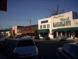 A view of Broad Street | |
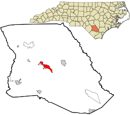 Location in Bladen County and the state of North Carolina. | |
| Coordinates: 34°37′32″N 78°36′44″W | |
| Country | United States |
| State | North Carolina |
| County | Bladen |
| Government | |
| • Mayor | Sylvia Campbell |
| Area | |
| • Total | 4.7 sq mi (12.1 km2) |
| • Land | 4.6 sq mi (12.0 km2) |
| • Water | 0.04 sq mi (0.1 km2) |
| Elevation | 108 ft (33 m) |
| Population (2010) | |
| • Total | 3,583 |
| • Estimate (2018)[1] | 3,469 |
| • Density | 770/sq mi (300/km2) |
| Time zone | UTC-5 (Eastern (EST)) |
| • Summer (DST) | UTC-4 (EDT) |
| ZIP code | 28337 |
| Area code(s) | 910 |
| FIPS code | 37-20600[2] |
| GNIS feature ID | 1025308[3] |
| Website | www |
History
Some hold Elizabethtown is named for Elizabeth, the wife of George Carteret,[6] while others believe it was named for the love interest of a local landowner.[7]
The Mt. Horeb Presbyterian Church and Cemetery and Trinity Methodist Church are listed on the National Register of Historic Places.[8]
Geography
Elizabethtown is located at 34°37′32″N 78°36′44″W (34.625691, −78.612270).[9]
According to the United States Census Bureau, the town has a total area of 4.7 square miles (12.1 km2), of which 4.6 square miles (12.0 km2) is land and 0.039 square miles (0.1 km2), or 0.73%, is water.[4]
Demographics
| Historical population | |||
|---|---|---|---|
| Census | Pop. | %± | |
| 1870 | 62 | — | |
| 1880 | 212 | 241.9% | |
| 1900 | 144 | — | |
| 1910 | 117 | −18.7% | |
| 1920 | 335 | 186.3% | |
| 1930 | 765 | 128.4% | |
| 1940 | 1,123 | 46.8% | |
| 1950 | 1,611 | 43.5% | |
| 1960 | 1,625 | 0.9% | |
| 1970 | 1,418 | −12.7% | |
| 1980 | 3,551 | 150.4% | |
| 1990 | 3,704 | 4.3% | |
| 2000 | 3,698 | −0.2% | |
| 2010 | 3,583 | −3.1% | |
| Est. 2018 | 3,469 | [1] | −3.2% |
| U.S. Decennial Census[10] | |||
At the 2000 census there were 3,698 people, 1,536 households, and 907 families in the town. The population density was 805.9 people per square mile (311.1/km²). There were 1,688 housing units at an average density of 367.9 per square mile (142.0/km²). The racial makeup of the town was 48.05% White, 48.97% African American, 0.43% Native American, 0.30% Asian, 0.03% Pacific Islander, 1.30% from other races, and 0.92% from two or more races. Hispanic or Latino of any race were 2.54%.[2]
Of the 1,536 households 26.6% had children under the age of 18 living with them, 36.4% were married couples living together, 19.2% had a female householder with no husband present, and 40.9% were non-families. 38.6% of households were one person and 16.6% were one person aged 65 or older. The average household size was 2.21 and the average family size was 2.93.
The age distribution was 22.4% under the age of 18, 7.7% from 18 to 24, 23.8% from 25 to 44, 24.4% from 45 to 64, and 21.7% 65 or older. The median age was 42 years. For every 100 females, there were 79.9 males. For every 100 females age 18 and over, there were 72.5 males.
The median household income was $21,944 and the median family income was $38,750. Males had a median income of $36,133 versus $25,417 for females. The per capita income for the town was $15,303. About 24.6% of families and 31.1% of the population were below the poverty line, including 47.3% of those under age 18 and 27.8% of those age 65 or over.
References
- "Population and Housing Unit Estimates". Retrieved November 9, 2019.
- "U.S. Census website". United States Census Bureau. Retrieved 2008-01-31.
- "US Board on Geographic Names". United States Geological Survey. 2007-10-25. Retrieved 2008-01-31.
- "Geographic Identifiers: 2010 Demographic Profile Data (G001): Elizabethtown town, North Carolina". U.S. Census Bureau, American Factfinder. Archived from the original on February 12, 2020. Retrieved February 6, 2014.
- "Find a County". National Association of Counties. Archived from the original on 2011-05-31. Retrieved 2011-06-07.
- Gannett, Henry (1905). The Origin of Certain Place Names in the United States. Govt. Print. Off. pp. 116.
- Proffitt, Martie (Apr 17, 1983). "Local history offers tasty tidbits". Star-News. pp. 1C. Retrieved 1 November 2015.
- "National Register Information System". National Register of Historic Places. National Park Service. July 9, 2010.
- "US Gazetteer files: 2010, 2000, and 1990". United States Census Bureau. 2011-02-12. Retrieved 2011-04-23.
- "Census of Population and Housing". Census.gov. Retrieved June 4, 2015.
External links
- Town of Elizabethtown official website
- Bladen Journal, Google news archive. —PDFs of 2,696 issues, dating from 1929 to 1985.
Municipalities and communities of Bladen County, North Carolina, United States | ||
|---|---|---|
| Towns |  | |
| CDPs | ||
| Unincorporated communities | ||
| Authority control |
|
|---|