Elizabeth Street, Melbourne
Elizabeth Street is one of the main streets in the central business district of Melbourne, Victoria, Australia, part of the Hoddle Grid laid out in 1837. It is presumed to have been named in honour of governor Richard Bourke's wife.[1]
Elizabeth Street | |
|---|---|
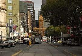 | |
Elizabeth Street looking south toward Flinders Street station, 2010 | |
| |
 Elizabeth Street | |
| Coordinates | |
| General information | |
| Type | Street |
| Opened | 1837 |
| Major junctions | |
| North end | Grattan Street |
| Haymarket Queensberry Street Victoria Street Franklin Street La Trobe Street Lonsdale Street Bourke Street Collins Street | |
| South end | Flinders Street |
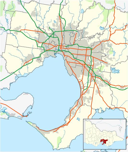
| Location(s) | |
| Suburb(s) | Melbourne, Carlton |
The street is famous as a retail shopping precinct, particularly for motorcycles and cameras. It is also connected with key shopping and tourist destinations such as Bourke Street Mall, Melbourne's GPO, Melbourne Central Shopping Centre and Queen Victoria Market.
Geography

The street runs roughly north-south in-between Queen Street and Swanston Street. At the southern end the street terminates at Flinders Street station, whilst the northern end terminates at Grattan Street, north of the Haymarket Roundabout.
Haymarket connects Elizabeth Street to Peel Street towards the south-west, Flemington Road to the north-west, Royal Parade to the north and Grattan Street to the East. This complex, high-traffic roundabout is further complicated by trams travelling through it on varying routes.[2] Traffic lights were installed on the roundabout in 2011 to limit the dangerous complexity of the intersection, it having previously functioned as a normal roundabout.[2]
Floods
Elizabeth Street is the lowest point in the Melbourne central business district, with land rising both to the east and west, and more gradually to the north. The street was built on top of a historic natural creek and has suffered numerous floods in Melbourne's history.[3]
Flash flooding south towards the Yarra River occurred in 1882, 1972 and more recently during the 2010 Victorian storms.[3] The Elizabeth Street drain runs from Carlton in the north to the Yarra River in the south, carrying storm water from the inner northern suburbs and city centre.[4] This drain is a significant source of pollutants entering the lower Yarra.[5]
Notable buildings

Elizabeth Street is home to many historically important buildings, modern structures and works of art. These various works are listed on both the Victorian Heritage Register and National Trust of Australia.
Victorian Heritage Register
- Flinders Street Station
- Melbourne City Building
- General Post Office
- Underground Toilets
- Mitchell House
- Block Arcade
- Royal Arcade
- Queen Victoria Market
- Hosies Hotel Mural
- Former Melford Motors
- St Francis Church[6]
National Trust
.jpg)
- 289 Elizabeth Street
- Angus & Robertson Building
- London Hotel
- Royal Saxon Hotel
- Argus Building
- Paton Building
- Brooks' Chambers
- Michaels Building
- Ampol House (demolished by the University of Melbourne and replaced with the Peter Doherty Institute)
- Former Colonial Bank
- Former Kodak Factory Complex
- Former Hosies Hotel & Richard Beck Mural
- Womens Christian Temperance Union Drinking Fountain
- Heape Court Warehouses[7]
Motorcycle and Camera Precincts


There are a large number of retail shops on Elizabeth Street, though perhaps most famously the street is home to a number of photography retailers and a considerable number of motorcycle dealers. The street has been the home of motorbike retailing in inner Melbourne since 1903, the longest-existing such area in the world.[9]
Transport
As well as Flinders Street station at the southern end, the western exit of Melbourne Central railway station is located at the intersection of Latrobe and Elizabeth Streets. A number of tram services run along the street, including route 19 trams to Coburg North, route 59 trams to Airport West and route 57 trams to West Maribyrnong.
See also
![]()
References
- The Royal Historical Society of Victoria: "Melbourne’s streets and lanes: what’s in a name?" Archived 10 June 2016 at the Wayback Machine, brochure published 2004 or later, retrieved 4 April 2013
- "Trams DownUnder - Message 147857". tdu.to. Retrieved 21 January 2017.
- "Melbourne city grid | Ergo". ergo.slv.vic.gov.au. Retrieved 21 January 2017.
- "THE ELIZABETH-STREET DRAIN. - The Argus (Melbourne, Vic. : 1848 - 1957) - 22 Jul 1884". Trove. Retrieved 21 January 2017.
- "Melbourne's underground river: Museum Victoria". museumvictoria.com.au. Archived from the original on 2 February 2017. Retrieved 21 January 2017.
- "VHD". vhd.heritagecouncil.vic.gov.au. Retrieved 21 January 2017.
- "VHD". vhd.heritagecouncil.vic.gov.au. Retrieved 21 January 2017.
- Tom (31 August 2015). "Melbourne's Elizabeth Street in 1870". Cool Old Photos. Retrieved 19 February 2019.
- "Melbourne Motorcycle Zone: Elizabeth St (Motorcycle precincts)". Motorcycle Trader - New and Classic Motorcycles. 12 January 2015. Retrieved 21 January 2017.
External links
![]()
- Elizabeth Street in flood, 1882 State Library Victoria, accessed 23 March 2015.
- Elizabeth Street in flood, 1862 State Library Victoria, accessed 23 March 2015.
- Elizabeth Street flood, 1972