Eldorado, Oklahoma
Eldorado is a town in Jackson County, Oklahoma, United States. The population was 446 at the 2010 census.
Eldorado, Oklahoma | |
|---|---|
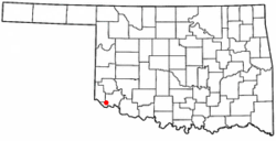 Location of Eldorado, Oklahoma | |
| Coordinates: 34°28′21″N 99°38′58″W | |
| Country | United States |
| State | Oklahoma |
| County | Jackson |
| Area | |
| • Total | 0.73 sq mi (1.89 km2) |
| • Land | 0.73 sq mi (1.89 km2) |
| • Water | 0.00 sq mi (0.00 km2) |
| Elevation | 1,453 ft (443 m) |
| Population (2010) | |
| • Total | 446 |
| • Estimate (2018)[2] | 414 |
| • Density | 566.35/sq mi (218.67/km2) |
| Time zone | UTC-6 (Central (CST)) |
| • Summer (DST) | UTC-5 (CDT) |
| ZIP code | 73537 |
| Area code(s) | 580 |
| FIPS code | 40-23350[3] |
| GNIS feature ID | 1092519[4] |
The Southern Baptist pastor, W. A. Criswell, was born in Eldorado in 1909. He was the long-term pastor of the First Baptist Church of Dallas, Texas.
Geography
Eldorado is located at 34°28′21″N 99°38′58″W (34.472560, -99.649330).[5]
According to the United States Census Bureau, the town has a total area of 0.8 square miles (2.1 km2), all of it land.
Demographics
| Historical population | |||
|---|---|---|---|
| Census | Pop. | %± | |
| 1910 | 926 | — | |
| 1920 | 967 | 4.4% | |
| 1930 | 1,183 | 22.3% | |
| 1940 | 929 | −21.5% | |
| 1950 | 732 | −21.2% | |
| 1960 | 708 | −3.3% | |
| 1970 | 737 | 4.1% | |
| 1980 | 688 | −6.6% | |
| 1990 | 573 | −16.7% | |
| 2000 | 527 | −8.0% | |
| 2010 | 446 | −15.4% | |
| Est. 2018 | 414 | [2] | −7.2% |
| U.S. Decennial Census[6] | |||
At the 2010 census, there were 446 people living in the town.[7] The population density was 560 people per square mile (220/km²). There were 274 housing units at an average density of 389.9 per square mile (150.9/km²). The racial makeup of the town was 90.70% White, 1.14% Native American, 0.19% Asian, 6.83% from other races, and 1.14% from two or more races. Hispanic or Latino of any race were 8.35% of the population.
Of the 234 households 25.6% had children under the age of 18 living with them, 47.4% were married couples living together, 10.7% had a female householder with no husband present, and 38.0% were non-families. 35.9% of households were one person and 23.9% were one person aged 65 or older. The average household size was 2.25 and the average family size was 2.90.
The age distribution was 23.7% under the age of 18, 9.3% from 18 to 24, 19.4% from 25 to 44, 18.8% from 45 to 64, and 28.8% 65 or older. The median age was 43 years. For every 100 females, there were 84.3 males. For every 100 females age 18 and over, there were 87.9 males.
The median household income was $21,806 and the median family income was $26,354. Males had a median income of $25,000 versus $15,000 for females. The per capita income for the town was $12,003. About 20.3% of families and 23.8% of the population were below the poverty line, including 24.8% of those under age 18 and 25.0% of those age 65 or over.
References
- "2018 U.S. Gazetteer Files". United States Census Bureau. Retrieved Feb 12, 2020.
- "Population and Housing Unit Estimates". Retrieved June 4, 2019.
- "U.S. Census website". United States Census Bureau. Retrieved 2008-01-31.
- "US Board on Geographic Names". United States Geological Survey. 2007-10-25. Retrieved 2008-01-31.
- "US Gazetteer files: 2010, 2000, and 1990". United States Census Bureau. 2011-02-12. Retrieved 2011-04-23.
- "Census of Population and Housing". Census.gov. Retrieved June 4, 2015.
- "2010 City Population and Housing Occupancy Status". U.S. Census Bureau. Retrieved October 18, 2013.
External links
Municipalities and communities of Jackson County, Oklahoma, United States | ||
|---|---|---|
| City | 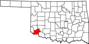 Jackson County map | |
| Towns | ||
| Unincorporated communities | ||
| Ghost towns | ||