El Palmer Airport
El Palmer Airport (ICAO: MSSA), also known as Santa Ana Airport was an airstrip serving a number of communities in west-central Santa Ana Department, 11 kilometres (6.8 mi) northwest of the city of Santa Ana, El Salvador. It is currently (since at least 2003) used as a dragstrip, called the Santa Ana Airport Pista Singuil car racing track.[2][3]
El Palmer Airport | |||||||||||
|---|---|---|---|---|---|---|---|---|---|---|---|
| Summary | |||||||||||
| Airport type | Closed | ||||||||||
| Serves | Santa Ana | ||||||||||
| Elevation AMSL | 2,229 ft / 679 m | ||||||||||
| Coordinates | 14°04′00″N 89°37′57″W | ||||||||||
| Map | |||||||||||
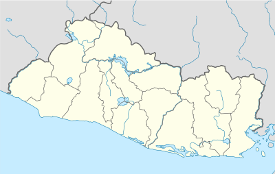 MSSA Location of the facility in El Salvador | |||||||||||
| Runways | |||||||||||
| |||||||||||
Source: Google Maps[1] | |||||||||||
Google Earth Historical Imagery (1/2003) shows a 6 metres (20 ft) wide, 600 metres (2,000 ft) long concrete strip with light poles running alongside its length. The (6/2013) image and later show overhead sign gantries crossing the pavement at the south end and at mid-length.
See also

- Transport in El Salvador
- List of airports in El Salvador
References
- Google Maps - El Palmer
- "Santa Ana Airport racing track". Google Maps. Google. Retrieved 12 August 2018.
- "Pista Singuil El Salvador". YouTube. Google. Retrieved 12 August 2018.
This article is issued from Wikipedia. The text is licensed under Creative Commons - Attribution - Sharealike. Additional terms may apply for the media files.