Efringen-Kirchen
Efringen-Kirchen is a municipality in the district of Lörrach in Baden-Württemberg, Germany.
Efringen-Kirchen | |
|---|---|
 Coat of arms | |
Location of Efringen-Kirchen 
| |
 Efringen-Kirchen 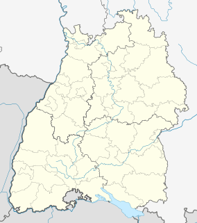 Efringen-Kirchen | |
| Coordinates: 47°39′20″N 7°33′57″E | |
| Country | Germany |
| State | Baden-Württemberg |
| Admin. region | Freiburg |
| District | Lörrach |
| Subdivisions | 9 |
| Government | |
| • Mayor | Wolfgang Fürstenberger |
| Area | |
| • Total | 43.74 km2 (16.89 sq mi) |
| Elevation | 258 m (846 ft) |
| Population (2018-12-31)[1] | |
| • Total | 8,642 |
| • Density | 200/km2 (510/sq mi) |
| Time zone | CET/CEST (UTC+1/+2) |
| Postal codes | 79588 |
| Dialling codes | 07628 |
| Vehicle registration | LÖ |
| Website | www.efringen-kirchen.de |
Fortifications
During World War I fortifications were built at Istein, these were destroyed at the end of the war. In 1936 plans were drawn up to turn the location into the "Gibraltar of the West" with two kilometres of underground passages linking gun emplacements and bunkers. The site was to host an underground garage for over 100 tanks, 3600 men and as part of the West Wall it would dwarf similar Maginot Line fortifications. Work began in 1937 and Hermann Göring visited in the Spring of 1938. By 1939 several installations were complete but as the war progressed advantageously for the Germans in 1940 the site remained unfinished.[2]
Communities within Efringen-Kirchen
- Blansingen
- Efringen
- Egringen
- Huttingen
- Istein
- Kirchen
- Kleinkems
- Mappach
- Maugenhard
- Welmlingen
- Wintersweiler[3]
Notes
- "Bevölkerung nach Nationalität und Geschlecht am 31. Dezember 2018". Statistisches Landesamt Baden-Württemberg (in German). July 2019.
- Kaufmann JE, Kaufmann HW: "Fortress third Reich", page 128. DA Capo Press, 2003.
- Efringen-Kirchen im Markgräflerland
External links
- (in German) Information about and images
| Authority control |
|
|---|
This article is issued from Wikipedia. The text is licensed under Creative Commons - Attribution - Sharealike. Additional terms may apply for the media files.