Eden Valley, Minnesota
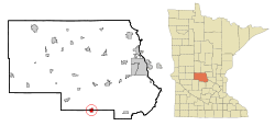
Eden Valley is a city in Meeker and Stearns counties in the U.S. state of Minnesota. The population was 1,042 at the 2010 census.[6] Most of Eden Valley is in Meeker County; the Stearns County portion is part of the St. Cloud Metropolitan Statistical Area.
Eden Valley | |
|---|---|
 | |
| Coordinates: 45°20′N 94°33′W | |
| Country | United States |
| State | Minnesota |
| Counties | Meeker, Stearns |
| Area | |
| • Total | 1.22 sq mi (3.15 km2) |
| • Land | 1.21 sq mi (3.14 km2) |
| • Water | 0.00 sq mi (0.01 km2) |
| Elevation | 1,115 ft (340 m) |
| Population | |
| • Total | 1,042 |
| • Estimate (2018)[3] | 1,036 |
| • Density | 853.84/sq mi (329.65/km2) |
| Time zone | UTC-6 (Central (CST)) |
| • Summer (DST) | UTC-5 (CDT) |
| ZIP code | 55329 |
| Area code(s) | 320 |
| FIPS code | 27-18134[4] |
| GNIS feature ID | 0643168[5] |
| Website | ci |
History
Eden Valley is a railway village near the little town of Manannah. Eden Valley is very unusual in that the town is located in two Minnesota counties: Meeker and Stearns. (Most of Eden Valley is in Meeker County; the Stearns County portion is part of the St. Cloud Metropolitan Statistical Area.) The town was platted in 1886, and it was named by officers of the St. Paul, Minneapolis and Sault Ste. Marie Railroad (Soo Line). Why they picked the name is unknown. The part of the city in Stearns County began as Pappelbusch (often spelled Popple Bush) in Manannah Township in 1877. (The site was two and one-half miles east of the present Eden Valley.) That's a German name meaning "stand of popple trees.” August Loegering came to the site in about 1880. He bought a farm on the border of Stearns and Meeker Counties, opened a general store and a post office which he called Logering (1884-1893). To name a town, in those days, you simply had to establish a post office. The post office department left an “e” out of his name. When the Minneapolis and Pacific Railroad built through sections 2 and 3 of the present city, all the businesses moved there, so Logering disappeared. The post office, begun as Eden Lake in Stearns County in 1872, was transferred to the new village of Eden Valley in 1887. Eden Valley was incorporated as a village on April 25, 1894. More than a dozen lakes can be found within a 10-mile radius of Eden Valley including Lake Koronis, Rice Lake, and the famed Horseshoe Chain of Lakes. The 2010 census listed the Eden Valley population as 1042 people. Minnesota State Highways 22 (State Street) and 55 are two of the main routes in the community.
On September 15, 1886, Edward F. Burns, born in Oregon, bought the first lot that was sold in Eden Valley. He was the treasurer of the school district and a justice of the peace. He built a building and, on October 19, he started a meat market and farm produce exchange, and supplied the railroad contractors with provisions. He also bought wheat and dealt in wood. In February 1887, he sold out.
William Hukriede, the owner of the Mansard House hotel in town, was from Germany. He emigrated to America with his wife and two sons, one was Henry, and he purchased a farm on section 23, in Manannah township. He made his home on the farm until the fall of 1887, when, along with his son Henry, he moved to Eden Valley and bought the Mansard House. Henry, besides being the partner of his father in the Mansard House, also had a blacksmith's shop in Eden Valley. He had gone to Litchfield to learn the blacksmith's trade but came back in the spring of 1886.
John Carney came to Rice County with his parents when he was four. He made his home with his parents and learned the blacksmith's trade. In 1886, he came to Eden Valley and opened a blacksmith shop, but the next spring he started dealing in hardware, farm machinery, and pumps.
Lansing V. Brown came on November 15, 1886, to take charge of the Minneapolis & Pacific Railroad Company's depot and he became the agent for the American Express Company in the fall of 1886 also.
Samuel Cossairt, was the managing partner of the general merchandise store named S. Cossairt & Co. In 1866 his parents and others of his family came to Meeker County in the vicinity of Eden Valley and settled there. There were no neighbors between them and Manannah or Forest City. In October 1886, Samuel was appointed postmaster of Eden Lake, and when the office was changed to Eden Valley, he was reappointed. At the age of twenty-three, he, along with E. L. Parker, opened a store in Litchfield. Three months later, the firm started a branch in Eden Valley, with Samuel as the manager and he ran it until March 1888. Then, he bought our Parker and he and his father, Silas, and brother, George B., started S. Cossairt & Co.
Geography
According to the United States Census Bureau, the city has a total area of 1.22 square miles (3.16 km2), all of it land.[7]
Minnesota State Highways 22 and 55 are two of the main routes in the community.
Demographics
| Historical population | |||
|---|---|---|---|
| Census | Pop. | %± | |
| 1890 | 327 | — | |
| 1900 | 604 | 84.7% | |
| 1910 | 740 | 22.5% | |
| 1920 | 665 | −10.1% | |
| 1930 | 612 | −8.0% | |
| 1940 | 716 | 17.0% | |
| 1950 | 792 | 10.6% | |
| 1960 | 793 | 0.1% | |
| 1970 | 776 | −2.1% | |
| 1980 | 763 | −1.7% | |
| 1990 | 732 | −4.1% | |
| 2000 | 866 | 18.3% | |
| 2010 | 1,042 | 20.3% | |
| Est. 2018 | 1,036 | [3] | −0.6% |
| U.S. Decennial Census[8] | |||
2010 census
As of the census[2] of 2010, there were 1,042 people, 434 households, and 262 families living in the city. The population density was 854.1 inhabitants per square mile (329.8/km2). There were 485 housing units at an average density of 397.5 per square mile (153.5/km2). The racial makeup of the city was 96.2% White, 0.4% African American, 0.6% Native American, 0.1% Asian, 0.6% from other races, and 2.2% from two or more races. Hispanic or Latino of any race were 3.2% of the population.
There were 434 households of which 32.7% had children under the age of 18 living with them, 41.9% were married couples living together, 13.4% had a female householder with no husband present, 5.1% had a male householder with no wife present, and 39.6% were non-families. 33.2% of all households were made up of individuals and 12.9% had someone living alone who was 65 years of age or older. The average household size was 2.40 and the average family size was 3.01.
The median age in the city was 34.5 years. 27.4% of residents were under the age of 18; 7.5% were between the ages of 18 and 24; 28.8% were from 25 to 44; 21% were from 45 to 64; and 15.4% were 65 years of age or older. The gender makeup of the city was 51.1% male and 48.9% female.
2000 census
As of the census[4] of 2000, there were 866 people, 360 households, and 221 families living in the city. The population density was 674.6 people per square mile (261.2/km²). There were 376 housing units at an average density of 292.9 per square mile (113.4/km²). The racial makeup of the city was 97.81% White, 0.69% African American, 0.35% Native American, 0.58% Asian, 0.58% from other races. Hispanic or Latino of any race were 1.96% of the population.
There were 360 households out of which 28.9% had children under the age of 18 living with them, 45.0% were married couples living together, 11.1% had a female householder with no husband present, and 38.6% were non-families. 32.5% of all households were made up of individuals and 16.7% had someone living alone who was 65 years of age or older. The average household size was 2.37 and the average family size was 3.01.
In the city, the population was spread out with 25.1% under the age of 18, 13.0% from 18 to 24, 26.1% from 25 to 44, 15.5% from 45 to 64, and 20.3% who were 65 years of age or older. The median age was 34 years. For every 100 females, there were 95.9 males. For every 100 females age 18 and over, there were 97.3 males.
The median income for a household in the city was $25,781, and the median income for a family was $39,125. Males had a median income of $29,107 versus $20,227 for females. The per capita income for the city was $13,501. About 9.1% of families and 14.8% of the population were below the poverty line, including 14.2% of those under age 18 and 23.3% of those age 65 or over.
In popular culture
Gloria Burgle serves as police chief of a fictional depiction of Eden Valley in the third season of the FX series Fargo. The show is filmed in Calgary.
References
- "2017 U.S. Gazetteer Files". United States Census Bureau. Retrieved Jan 3, 2019.
- "U.S. Census website". United States Census Bureau. Retrieved 2012-11-13.
- "Population and Housing Unit Estimates". Retrieved February 18, 2020.
- "U.S. Census website". United States Census Bureau. Retrieved 2008-01-31.
- "US Board on Geographic Names". United States Geological Survey. 2007-10-25. Retrieved 2008-01-31.
- "2010 Census Redistricting Data (Public Law 94-171) Summary File". American FactFinder. U.S. Census Bureau, 2010 Census. Retrieved 23 April 2011.
- "US Gazetteer files 2010". United States Census Bureau. Archived from the original on 2012-01-25. Retrieved 2012-11-13.
- "Census of Population and Housing". Census.gov. Retrieved June 4, 2015.
External links
Municipalities and communities of Meeker County, Minnesota, United States | ||
|---|---|---|
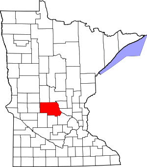
| Cities |  Map of Minnesota highlighting Meeker County | |
| Townships | ||
| Unincorporated communities | ||
| Footnotes | ‡This populated place also has portions in an adjacent county or counties | |
Municipalities and communities of Stearns County, Minnesota, United States | ||
|---|---|---|
| Cities |
|  Map of Minnesota highlighting Stearns County |
| Townships |
| |
| CDP | ||
| Unincorporated communities | ||
| Ghost towns/Neighborhoods | ||
| Footnotes | ‡This populated place also has portions in an adjacent county or counties | |
| Core City | 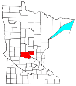 | ||||
|---|---|---|---|---|---|
| Surrounding communities |
| ||||
| Counties | |||||
‡ indicates that it is partially in the metropolitan area. § indicates a CDP | |||||