Eaton Socon
Eaton Socon /iːtən soʊkən/ is an area of St Neots town, having been a village, in Cambridgeshire, England.
| Eaton Socon | |
|---|---|
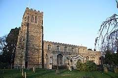 The parish[1] church, Eaton Socon | |
 Village "Cage" (punishment lock-up), School Lane, close to the church | |
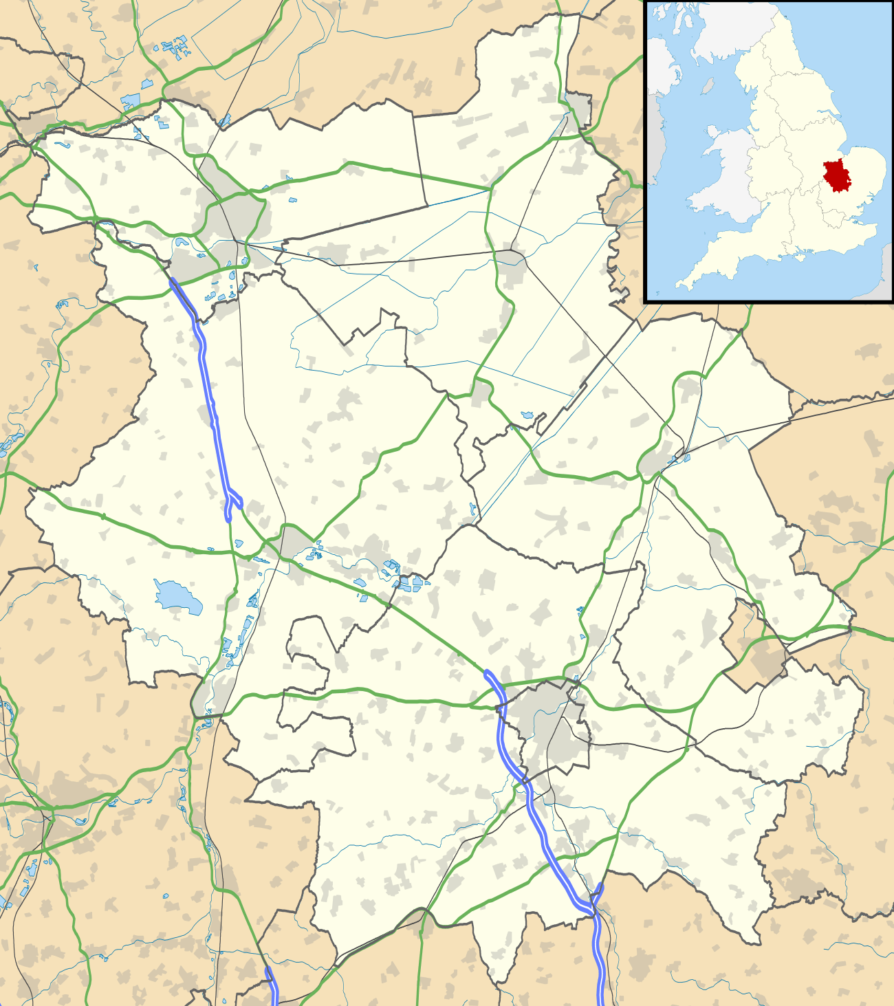 Eaton Socon Location within Cambridgeshire | |
| Area | 2.08 km2 (0.80 sq mi) |
| Population | 9,042 [2] |
| • Density | 4,347/km2 (11,260/sq mi) |
| OS grid reference | TL165595 |
| District | |
| Shire county | |
| Region | |
| Country | England |
| Sovereign state | United Kingdom |
| Post town | ST NEOTS |
| Postcode district | PE19 |
| Dialling code | 01480 |
| Police | Cambridgeshire |
| Fire | Cambridgeshire |
| Ambulance | East of England |
| UK Parliament | |
It was originally in Bedfordshire, along with the similar parish (and ex-village) to the north of Eaton Ford, but officially became part of the town in 1965. Its housing grew and its population more than doubled: 1931 to 2001.[3][lower-alpha 1] It was absorbed into Huntingdonshire, which was in turn absorbed into Cambridgeshire. The population was, as at the year 2011, 5,704. And, is now as of 2020 at 9,042
History
The village is mentioned as "Eaton" in the Domesday Book, when the manor belonged to Eudo Dapifer. In the 13th century it became a "Soke", which meant it was independent of the local Hundred Court at Barford. In time, "Soke" became "Socon". The parish had a manor or epithet of "Sudbury".
Near the river are the remains of Eaton Socon Castle.
The church burned down due to a 1930 organ fire but was rebuilt in the original style. It was a 15th-century enlargement and completion of a 14th-century form. It had unusual poppyhead bench-ends. The fire damaged the chancel less than the rest, enabling reconstruction of its delicate 15th-century windows. The architect of the 1930s was Albert Richardson and local craftspeople were employed.[4]
The village has a conservation area centred on listed buildings including modest thatched cottages along the Great North Road and side roads such as Peppercorns Lane and School Lane.
Amenities
Eaton Socon slopes down to the west bank of the River Great Ouse. Its weir was constructed in 1967 and has associated lock gates to allow river navigation. The riverbank hosts a large inn, The River Mill Tavern.
The parish church of St Mary the Virgin stands on the picturesque green in the centre of the village.
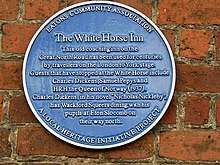
Great North Road is lined with local businesses. The White Horse pub dates to the 13th century, was a Royal Mail staging post and is mentioned by Charles Dickens in Nicholas Nickleby.
Events
Traditional May Day celebrations take place every year on the green.
Housing and demography
| Type | Number | Percentage |
|---|---|---|
| Whole house or bungalow: Detached | 566 | 22.7% |
| Whole house or bungalow: Semi-detached | 788 | 31.7% |
| Whole house or bungalow: Terraced (including end-terrace) | 796 | 32.0% |
| Flat, maisonette or apartment: Purpose-built block of flats or tenement | 290 | 11.7% |
Most, 65.8%, of housing is owned (with/without mortgage); the next largest category is 22.5% which is socially rented, including 5.4% from the district council directly.[2] 1.7% of the 2,489 homes had (in 2011) no usual residents.[2]
Transport
The A1 ran along the central street running the length of the village (Great North Road) until its bypass skirting to the west, of 1971. A second bypass opened in 1985 to enable traffic travelling between that road and Cambridge to avoid Eaton Socon, Eaton Ford and St Neots. 17.9% of households have no car/van.[2]
Government
A second tier of local government operates, Huntingdonshire District Council, headquartered in Huntingdon. It has 52 councillors representing 29 wards.[5] It collects all council tax and administers/provides building regulations, planning and environmental checks/approvals, day centres, assessed housing benefits, parks, waste collections, a communal leisure budget and supports tourism.[6] Eaton Socon lately approximates to the St Neots Eaton Socon ward having two councillors.[5][7] District councillors serve four-year terms after District elections.
The first tier of local government is Cambridgeshire County Council, headquartered in Cambridge. This provides county-wide services such as in road infrastructure, fire and rescue, education, social services, libraries and heritage.[8] Cambridgeshire County Council consists of 69 councillors representing 60 electoral divisions.[9] Eaton Socon is of late in electoral division St Neots Eaton Socon and Eynesbury [7] having two councillors.[9]
In parliamentary elections voters contribute to the Huntingdon seat (constituency).[7] This is represented (in the House of Commons) by Jonathan Djanogly (Con.) since 2001, succeeding Sir John Major (Con.) (1983 to 2001).
Footnotes
- The c.1990 growth including western areas centred on Monarch Road and Nelson Road's upper part
References
- "A church near you" Church of England directory of ecclesiastical parishes - map of Eaton Socon E.P.
- https://www.nomisweb.co.uk/reports/localarea?compare=E05002781
- 2,240 in 1931 to 3,264 in 1961 including Eaton Ford. http://www.visionofbritain.org.uk/unit/10217775/cube/TOT_POP
- Betjeman, J. (ed.) (1968) Collins Pocket Guide to English Parish Churches: the South. London: Collins; p. 102
- "Huntingdonshire District Council: Councillors". www.huntingdonshire.gov.uk. Huntingdonshire District Council. Retrieved 23 February 2016.
- "Huntingdonshire District Council". www.huntingdonshire.gov.uk. Huntingdonshire District Council. Retrieved 23 February 2016.
- "Ordnance Survey Election Maps". www.ordnancesurvey.co.uk. Ordnance Survey. Retrieved 23 February 2016.
- "Cambridgeshire County Council". www.cambridgeshire.gov.uk. Cambridgeshire County Council. Retrieved 23 February 2016.
- "Cambridgeshire County Council: Councillors". www.cambridgeshire.gov.uk. Cambridgeshire County Council. Archived from the original on 22 February 2016. Retrieved 15 February 2016.
External links
| Wikimedia Commons has media related to Eaton Socon. |
- Eatons Community Association
- Eaton Socon on the Great North Road
- www.stneots-tc.gov.uk – Contains information on Eaton Socon
- Genealogy of Eaton Socon (and Hamlets)