Eastwood, Louisiana
Eastwood is a census-designated place (CDP) in Bossier Parish, Louisiana, United States. The population was 4,093 at the 2010 census.[1] It is part of the Shreveport–Bossier City Metropolitan Statistical Area.
Eastwood, Louisiana | |
|---|---|
 Eastwood, Louisiana Location of Eastwood in Louisiana | |
| Coordinates: 32°33′26″N 93°34′07″W | |
| Country | United States |
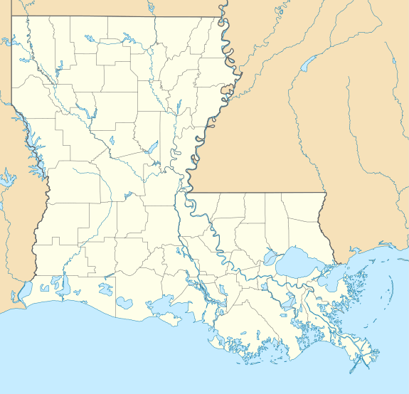
| State | Louisiana |
| Parish | Bossier |
| Area | |
| • Total | 6.4 sq mi (16.6 km2) |
| Elevation | 239 ft (73 m) |
| Population (2010) | |
| • Total | 4,093 |
| • Density | 640/sq mi (250/km2) |
| Time zone | UTC-6 (CST) |
| • Summer (DST) | UTC-5 (CDT) |
| Area code(s) | 318 |
Geography
Eastwood is located at 32°33′26″N 93°34′7″W (32.557317, -93.568480).[2] It is bordered to the west by the Red Chute CDP, and the town of Haughton is nearby to the southeast. U.S. Routes 80 and 79 pass east–west through the center of Eastwood, and Interstate 20 forms the southern edge of the CDP but with no direct access to it. Via Highways 80/79, it is 11 miles (18 km) west to downtown Shreveport.
According to the United States Census Bureau, the Eastwood CDP has a total area of 6.4 square miles (16.6 km2), all land.[1]
Demographics
As of the census[3] of 2000, there were 3,374 people, 1,225 households, and 957 families residing in the CDP. The population density was 535.7 people per square mile (206.8/km²). There were 1,376 housing units at an average density of 218.5 per square mile (84.3/km²). The racial makeup of the CDP was 90.60% White, 6.14% African American, 0.56% Native American, 0.65% Asian, 0.03% Pacific Islander, 0.47% from other races, and 1.54% from two or more races. Hispanic or Latino of any race were 1.96% of the population.
There were 1,225 households out of which 38.9% had children under the age of 18 living with them, 63.9% were married couples living together, 10.3% had a female householder with no husband present, and 21.8% were non-families. 17.3% of all households were made up of individuals and 6.4% had someone living alone who was 65 years of age or older. The average household size was 2.75 and the average family size was 3.10.
In the CDP, the population was spread out with 29.2% under the age of 18, 7.4% from 18 to 24, 30.9% from 25 to 44, 21.5% from 45 to 64, and 11.2% who were 65 years of age or older. The median age was 35 years. For every 100 females, there were 96.8 males. For every 100 females age 18 and over, there were 93.8 males.
The median income for a household in the CDP was $48,370, and the median income for a family was $55,625. Males had a median income of $35,076 versus $23,682 for females. The per capita income for the CDP was $18,952. About 5.5% of families and 7.2% of the population were below the poverty line, including 7.9% of those under age 18 and none of those age 65 or over.
References
- "Geographic Identifiers: 2010 Demographic Profile Data (G001): Eastwood CDP, Louisiana". U.S. Census Bureau, American Factfinder. Archived from the original on February 12, 2020. Retrieved December 3, 2013.
- "US Gazetteer files: 2010, 2000, and 1990". United States Census Bureau. 2011-02-12. Retrieved 2011-04-23.
- "U.S. Census website". United States Census Bureau. Retrieved 2008-01-31.
Municipalities and communities of Bossier Parish, Louisiana, United States | ||
|---|---|---|
Parish seat: Benton | ||
| Cities | 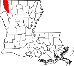 | |
| Towns | ||
| CDPs | ||
| Other unincorporated communities |
| |
| Footnotes | ‡This populated place also has portions in an adjacent parish or parishes | |