Dyce
Dyce (Scottish Gaelic: Deis) is an area of the city of Aberdeen, Scotland, about 6 miles (9.7 km) north west of Aberdeen city centre, and best known as the location of the city's airport. It is on the River Don.
Dyce
| |
|---|---|
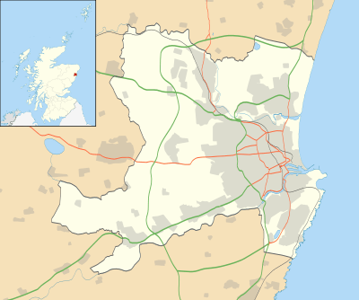 Dyce Location within the City of Aberdeen | |
| Population | 5,811 [1] |
| Language | English Scots (Doric) |
| OS grid reference | NJ885125 |
| • Edinburgh | 99 mi (159 km)[2] |
| • London | 408 mi (657 km)[2] |
| Council area | |
| Lieutenancy area | |
| Country | Scotland |
| Sovereign state | United Kingdom |
| Post town | Aberdeen |
| Postcode district | AB21 |
| Dialling code | 01224 |
| Police | Scotland |
| Fire | Scottish |
| Ambulance | Scottish |
| UK Parliament | |
| Scottish Parliament | |
| Website | aberdeencity.gov.uk |
History
Dyce is the site of an early medieval church dedicated to the 8th century missionary and bishop Saint Fergus, otherwise associated with Glamis, Angus. Today the cemetery, north of the airport, and overlooking the River Don, hosts the roofless but otherwise virtually complete former St. Fergus Chapel, within which Pictish and early Christian stones from the 7th–9th centuries, found in or around the churchyard, are displayed (Historic Scotland; open at all times without entrance charge).
The Chapel is a unicameral late medieval building with alterations perhaps of the 17th or 18th centuries. Two further carved stones, of uncertain (though probably early) character, were discovered re-used as building rubble in the inner east gable and outer south wall during the chapel's restoration. They were left in situ and are readily visible. A broken font, somewhat resembling a round-backed chair in its present condition, lies outside the church, and may also be of early medieval date.
The graveyard surrounding the old church was used into the 20th century, and retains almost no old gravestones. There is a small 'mort house' in one corner of the enclosure, which is adjoined by a modern extension, still in use for burials. During World War I conscientious objectors laboured at Dyce Work Camp at Dyce Quarries.One of these is believed to be the Tyrebagger Quarry just North of Aberdeen to the East of the A96.
A major employer in the village was the firm Lawsons which was a meat producer, mainly pork & ham. In the 1920s a small local farmers cooperative, which had been mothballed, was taken over by the Lawson family, originally from Dunfermline. The site was developed till eventually employing around 1800 people at its peak. They supplied product throughout Scotland & had a major contract to supply Marks & Spencer under licence.
Climate
| Climate data for Dyce-Aberdeen (ABZ)[lower-alpha 1], elevation: 65 m or 213 ft, 1981–2010 normals, extremes 1960–present | |||||||||||||
|---|---|---|---|---|---|---|---|---|---|---|---|---|---|
| Month | Jan | Feb | Mar | Apr | May | Jun | Jul | Aug | Sep | Oct | Nov | Dec | Year |
| Record high °C (°F) | 17.2 (63.0) |
17.2 (63.0) |
21.6 (70.9) |
23.7 (74.7) |
24.4 (75.9) |
26.7 (80.1) |
29.8 (85.6) |
29.7 (85.5) |
26.0 (78.8) |
22.1 (71.8) |
18.8 (65.8) |
15.1 (59.2) |
29.8 (85.6) |
| Average high °C (°F) | 6.5 (43.7) |
6.8 (44.2) |
8.8 (47.8) |
10.9 (51.6) |
13.6 (56.5) |
16.1 (61.0) |
18.5 (65.3) |
18.3 (64.9) |
15.8 (60.4) |
12.4 (54.3) |
8.9 (48.0) |
6.6 (43.9) |
12.0 (53.6) |
| Daily mean °C (°F) | 3.6 (38.5) |
3.8 (38.8) |
5.4 (41.7) |
7.2 (45.0) |
9.7 (49.5) |
12.4 (54.3) |
14.7 (58.5) |
14.4 (57.9) |
12.2 (54.0) |
9.2 (48.6) |
5.9 (42.6) |
3.7 (38.7) |
8.5 (47.3) |
| Average low °C (°F) | 0.6 (33.1) |
0.8 (33.4) |
1.9 (35.4) |
3.4 (38.1) |
5.7 (42.3) |
8.6 (47.5) |
10.8 (51.4) |
10.5 (50.9) |
8.6 (47.5) |
5.9 (42.6) |
2.9 (37.2) |
0.7 (33.3) |
5.1 (41.2) |
| Record low °C (°F) | −19.3 (−2.7) |
−18.2 (−0.8) |
−15.8 (3.6) |
−6.8 (19.8) |
−4.2 (24.4) |
−0.3 (31.5) |
0.1 (32.2) |
−0.2 (31.6) |
−2.4 (27.7) |
−4.4 (24.1) |
−15.6 (3.9) |
−18.1 (−0.6) |
−19.3 (−2.7) |
| Average precipitation mm (inches) | 67.6 (2.66) |
55.1 (2.17) |
59.8 (2.35) |
58.8 (2.31) |
56.9 (2.24) |
61.2 (2.41) |
61.6 (2.43) |
60.5 (2.38) |
67.9 (2.67) |
96.2 (3.79) |
93.3 (3.67) |
76.1 (3.00) |
814.9 (32.08) |
| Average precipitation days (≥ 1.0 mm) | 12.3 | 10.5 | 11.6 | 10.8 | 10.6 | 10.4 | 11.4 | 10.7 | 10.5 | 13.6 | 13.8 | 12.3 | 138.6 |
| Mean monthly sunshine hours | 58.3 | 81.3 | 121.8 | 149.4 | 199.4 | 166.4 | 165.3 | 157.8 | 123.7 | 99.8 | 66.2 | 46.1 | 1,435.7 |
| Source 1: Met Office[3] | |||||||||||||
| Source 2: KNMI[4] | |||||||||||||
| Climate data for Dyce-Aberdeen (ABZ)[lower-alpha 2], elevation: 65 m or 213 ft, 1961-1990 normals and extremes | |||||||||||||
|---|---|---|---|---|---|---|---|---|---|---|---|---|---|
| Month | Jan | Feb | Mar | Apr | May | Jun | Jul | Aug | Sep | Oct | Nov | Dec | Year |
| Record high °C (°F) | 14.6 (58.3) |
16.6 (61.9) |
20.4 (68.7) |
23.7 (74.7) |
24.3 (75.7) |
26.6 (79.9) |
28.0 (82.4) |
28.4 (83.1) |
24.5 (76.1) |
21.3 (70.3) |
18.8 (65.8) |
15.7 (60.3) |
28.4 (83.1) |
| Average high °C (°F) | 5.7 (42.3) |
6.0 (42.8) |
8.0 (46.4) |
10.3 (50.5) |
13.0 (55.4) |
16.3 (61.3) |
17.8 (64.0) |
17.7 (63.9) |
15.5 (59.9) |
12.5 (54.5) |
8.2 (46.8) |
6.5 (43.7) |
11.5 (52.6) |
| Daily mean °C (°F) | 2.7 (36.9) |
2.9 (37.2) |
4.5 (40.1) |
6.3 (43.3) |
9.0 (48.2) |
12.1 (53.8) |
13.8 (56.8) |
13.6 (56.5) |
11.7 (53.1) |
9.0 (48.2) |
5.0 (41.0) |
3.5 (38.3) |
7.8 (46.1) |
| Average low °C (°F) | −0.3 (31.5) |
−0.2 (31.6) |
1.1 (34.0) |
2.4 (36.3) |
5.1 (41.2) |
8.0 (46.4) |
9.8 (49.6) |
9.6 (49.3) |
7.9 (46.2) |
5.5 (41.9) |
1.9 (35.4) |
0.6 (33.1) |
4.3 (39.7) |
| Record low °C (°F) | −19.3 (−2.7) |
−18.2 (−0.8) |
−15.8 (3.6) |
−6.8 (19.8) |
−4.2 (24.4) |
−0.1 (31.8) |
0.1 (32.2) |
−0.2 (31.6) |
−2.4 (27.7) |
−4.3 (24.3) |
−15.6 (3.9) |
−14.2 (6.4) |
−19.3 (−2.7) |
| Average precipitation mm (inches) | 82.0 (3.23) |
51.0 (2.01) |
58.0 (2.28) |
53.0 (2.09) |
59.0 (2.32) |
53.0 (2.09) |
60.0 (2.36) |
75.0 (2.95) |
68.0 (2.68) |
77.0 (3.03) |
75.0 (2.95) |
73.0 (2.87) |
784 (30.86) |
| Average precipitation days (≥ 1.0 mm) | 13.0 | 10.0 | 12.0 | 11.0 | 10.0 | 9.0 | 11.0 | 11.0 | 11.0 | 11.0 | 13.0 | 13.0 | 135 |
| Average snowy days | 8.0 | 7.0 | 6.0 | 4.0 | 0 | 0 | 0 | 0 | 0 | trace | 3.0 | 6.0 | 34 |
| Average relative humidity (%) | 82.5 | 80.5 | 78.5 | 77.5 | 78.0 | 78.0 | 78.0 | 80.0 | 80.5 | 82.5 | 82.5 | 82.5 | 80.1 |
| Mean monthly sunshine hours | 51.7 | 72.8 | 112.0 | 145.5 | 176.3 | 173.2 | 157.2 | 151.3 | 115.6 | 93.4 | 62.3 | 42.5 | 1,353.8 |
| Source: NOAA[5] | |||||||||||||
- Weather station is located 6 miles (10 km) from the Aberdeen city centre.
- Weather station is located 6 miles (10 km) from the Aberdeen city centre.
Economy
Dyce has one main shopping centre which is mainly an Asda store, with a Boots chemist, a hairdresser, an optometrist and several empty units.
Oil
Aker Solutions, the Norway-based oilfield services giant, runs its UK operations from Dyce, at the Aberdeen International Business Park. The North Sea headquarters of BP are located at the Farburn Industrial Estate.[6]
Prince Charles visited Dyce on 3 September 1992 to BP to officially inaugurate the Miller oilfield; he later met people with the Prince's Scottish Youth Business Trust (now called Youth Business Scotland).
_-_geograph.org.uk_-_867948.jpg)
Transport
Aberdeen Airport is located in Dyce.
Dyce railway station is served by Abellio ScotRail trains on the Aberdeen to Inverness Line.
There is an old railway line running from Dyce northwards past Newmachar which is now a path for pedestrians and cyclists and is the start of the Formatine and Buchan Way cycle route.[7]
The Aberdeen Bypass, circles west and north of the suburb. The Dyce junction was scheduled for completion in Autumn 2016.[8]
_-_geograph.org.uk_-_480568.jpg)
Education
The local secondary school, Dyce Academy, has about 500 pupils. Dyce Academy is home to the Aberdeen City Music School. There is also a primary school, Dyce Primary School. Dyce is also the location for the Cordyce School, a secondary school serving pupils who require additional support.[9]. In November 2017, Cordyce School suffered extenstive damage following a fire that engulfed most of the building. following the fire, four young boys, three aged fifteen and one aged fourteen, were charged. [10]
Parks and recreation
The area of Aberdeen has sports facilities including the local junior football team Dyce F.C who currently play in the Scottish Junior Football Association North Region and the cricket team. Dyce also have an amateur football team, currently named Dyce ITC Hydraulics in honour of its sponsors ITC Hydarulics also of Dyce. Dyce ITC currently play in the Aberdeenshire Amateur Association Premier League and play their home games at Pitmedden Road in Dyce.
Dyce (Aberdeen) Amateur Swimming Club (Est 1977), which runs its own Swim School for those wishing to learn to swim, is based at the Dyce Academy swimming pool. The Club and Swim School are both affiliated to the Scottish Amateur Swimming Association to help swimmers compete up to North District and Scottish National Level.
People From Dyce
- Dr James Edward Crombie FRSE (1862-1932) philanthropist and seismologist, of the Crombie clothing empire, lived at Parkhill House just outside Dyce.
- Rev William Robinson Pirie (1804-1885) minister of Dyce 1830 to 1846, Principal of Aberdeen University and Moderator of the General Assembly of the Church of Scotland in 1864.
References
- Archived 23 January 2011 at the Wayback Machine 2009:Population of Aberdeen's Neighbourhoods
- Indo.com. "How Far Is It?". Retrieved 13 March 2007.
- "Aberdeen Airport 1981–2010 averages". Met Office. Retrieved 21 March 2019.
- "Indices Data - Aberdeen Dyce Station 1825". KNMI. Archived from the original on 9 July 2018. Retrieved 21 March 2019.
- "Aberdeen-Dyce (03091) - WMO Weather Station". NOAA. Retrieved 24 March 2019.
- http://www.bp.com/en_gb/united-kingdom/contact.html
- http://www.cyclegrampian.co.uk/trail/formartineway.html
- "Archived copy". Archived from the original on 17 January 2016. Retrieved 12 May 2016.CS1 maint: archived copy as title (link)
- http://cordyce.aberdeen.sch.uk/wp/
- https://news.aberdeencity.gov.uk/council-approves-permanent-closure-of-cordyce-school/