Drysdale River National Park
Drysdale River National Park is a national park in the Kimberley region of Western Australia, 2,168 kilometres (1,347 mi) northeast of Perth.
| Drysdale River National Park Western Australia | |
|---|---|
IUCN category II (national park) | |
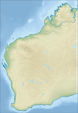 Drysdale River National Park | |
| Nearest town or city | Kalumburu |
| Coordinates | 15°09′41″S 126°46′35″E |
| Established | 1974 |
| Area | 4,482.64 km2 (1,730.8 sq mi)[1] |
| Managing authorities | Department of Environment and Conservation |
| Website | Drysdale River National Park |
| See also | List of protected areas of Western Australia |
The park lies about 100 km (62 mi) south of Kalumburu and 150 km (93 mi) west of Wyndham.[2]
The park is the largest and least accessible in the Kimberley with no public road leading to it and no airstrip within its boundaries.[3] Access to the park is gained via the track from Carson River Station from the Kalumburu Road. Permission must be obtained from the Kalumburu Aboriginal Corporation prior to entering the park. There are no visitor facilities or marked walk trails in the park. Rangers do not patrol the park and no food, fuel or mechanical services exist within the park or at Carson River Station.[4]
The park is a good example of untouched Kimberley, wilderness featuring open woodland, gorges, cliffs, and the pools, waterfalls and creeks of the Drysdale River. The park is home to two large waterfalls, Morgan Falls and Solea Falls, with numerous smaller falls along the course of the river.
The area provides habitat for many rare plants and animals. Almost 600 species of plants are known to exist within the park. About 30 of these plants are aquatic and swamp varieties that inhabit the permanent pools found along the Drysdale and Carson Rivers. About 25 species of fern also inhabit the area, two of which are not found elsewhere. Species such as fan palms, kalumbaru gums and paperbarks are also found along the watercourses.[5]
A variety of fauna also exist within the park, including over 100 species of birds, sugar gliders, bats, wallabies, and salt water crocodiles.[6]
The traditional owners of the area that the river flows through are the Ngarinjin, Miwa and Wilawila peoples.[7]
The first European to visit the area was a surveyor with a squatting company, CA Burrowes, who did so in 1886. Both Brockman and Crossland visited the area in separate expeditions in 1901. The first vehicular track was constructed through the region during an expedition and survey in 1954, it ran from Gibb River Station to Kalumburu. The park was gazetted in September 1974, using the boundaries recommended by the Australian Academy of Science committee on National Parks in 1955.[8]
See also
- Protected areas of Western Australia
References
- "Department of Environment and Conservation 2009–2010 Annual Report". Department of Environment and Conservation. 2010: 48. ISSN 1835-114X. Archived from the original on 11 January 2011. Cite journal requires
|journal=(help) - "About Australia Travel Guides - Drysdale River National Park". 2008. Retrieved 16 December 2008.
- "Drysdale River National Park" (PDF). 2007. Retrieved 16 December 2008.
- "Derby Tourism". 2008. Archived from the original on 10 April 2010. Retrieved 5 May 2010.
- "Department of Environment - Park Finder". 2010. Retrieved 5 May 2010.
- "About Australia-Drysdale River National Park". 2010. Retrieved 5 May 2010.
- "AusAnthrop Australian Aboriginal tribal database". 2009. Archived from the original on 30 May 2008. Retrieved 30 April 2012.
- "Drysdale River National Park (Place ID 106017)". Australian Heritage Database. Department of the Environment. 2010. Retrieved 27 November 2010.