Drinov Peak
Drinov Peak (Bulgarian: Дринов връх, romanized: Drinov Vrah, IPA: [ˈdrinov ˈvrɤx]) is a peak rising to 1630 m in Imeon Range on Smith Island, South Shetland Islands. Situated 3.6 km north-northeast of Antim Peak, 1.9 km north of Slatina Peak, 2.91 km east-southeast of Jireček Point and 1.85 km southwest of Mount Pisgah. Overlooking Ovech Glacier to the southeast, Vetrino Glacier to the north, Yablanitsa Glacier to northwest, and Chuprene Glacier to the southwest. Bulgarian early mapping in 2009. Named after the Bulgarian scientist Marin Drinov (1838–1906), founding chairman of the Bulgarian Academy of Sciences.
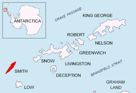
Location of Smith Island in the South Shetland Islands.

Topographic map of Smith Island.
Maps
- Chart of South Shetland including Coronation Island, &c. from the exploration of the sloop Dove in the years 1821 and 1822 by George Powell Commander of the same. Scale ca. 1:200000. London: Laurie, 1822.
- L.L. Ivanov. Antarctica: Livingston Island and Greenwich, Robert, Snow and Smith Islands. Scale 1:120000 topographic map. Troyan: Manfred Wörner Foundation, 2010. ISBN 978-954-92032-9-5 (First edition 2009. ISBN 978-954-92032-6-4)
- South Shetland Islands: Smith and Low Islands. Scale 1:150000 topographic map No. 13677. British Antarctic Survey, 2009.
- Antarctic Digital Database (ADD). Scale 1:250000 topographic map of Antarctica. Scientific Committee on Antarctic Research (SCAR). Since 1993, regularly upgraded and updated.
- L.L. Ivanov. Antarctica: Livingston Island and Smith Island. Scale 1:100000 topographic map. Manfred Wörner Foundation, 2017. ISBN 978-619-90008-3-0
References
- Drinov Peak. SCAR Composite Antarctic Gazetteer
- Bulgarian Antarctic Gazetteer. Antarctic Place-names Commission. (details in Bulgarian, basic data in English)
External links
- Drinov Peak. Copernix satellite image
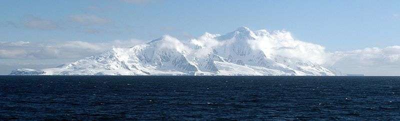
The southeast side of Smith Island from Osmar Strait
This article includes information from the Antarctic Place-names Commission of Bulgaria which is used with permission.
This article is issued from Wikipedia. The text is licensed under Creative Commons - Attribution - Sharealike. Additional terms may apply for the media files.