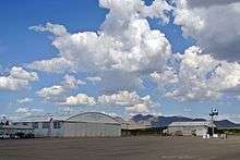
Douglas Municipal Airport (Arizona)
Douglas Municipal Airport (IATA: DGL, ICAO: KDGL, FAA LID: DGL) is a public airport located 2 miles (1.7 nmi; 3.2 km) east of the central business district of Douglas, a city in Cochise County, Arizona, United States. The airport is owned by the city of Douglas.[1] It is not served by any commercial airlines at this time. The end of runway 21 is 800 feet (240 m) north of the Mexico–United States border.
Douglas Municipal Airport | |||||||||||||||
|---|---|---|---|---|---|---|---|---|---|---|---|---|---|---|---|
 2006 USGS photo | |||||||||||||||
| Summary | |||||||||||||||
| Airport type | Public | ||||||||||||||
| Owner | City of Douglas | ||||||||||||||
| Serves | Douglas, Arizona | ||||||||||||||
| Elevation AMSL | 4,173 ft / 1,272 m | ||||||||||||||
| Coordinates | 31°20′33″N 109°30′23″W | ||||||||||||||
| Map | |||||||||||||||
 KDGL Location of Douglas Municipal Airport | |||||||||||||||
| Runways | |||||||||||||||
| |||||||||||||||
| Statistics (2005) | |||||||||||||||
| |||||||||||||||
Douglas Municipal Airport | |
 | |
| Location | E end of 10th Ave., Douglas, Arizona |
|---|---|
| Area | 221.8 acres (89.8 ha) |
| Built | 1928 |
| NRHP reference No. | 75000336[2] |
| Added to NRHP | December 30, 1975 |
Facilities and aircraft
Douglas Municipal Airport covers an area of 640 acres (260 ha) which contains two runways:
- 3/21 has an asphalt pavement measuring 5,760 x 75 ft (1,756 x 23 m)
- 18/36 has a dirt surface measuring 4,095 x 100 ft (1,248 x 30 m).
For the 12-month period ending July 31, 2005, the airport had 7,500 general aviation aircraft operations, an average of 20 per day.[1]
See also
- Bisbee-Douglas International Airport
- List of airports in Arizona
References
- FAA Airport Master Record for DGL (Form 5010 PDF), effective 2007-10-25
- "National Register Information System". National Register of Historic Places. National Park Service. July 9, 2010.
External links
- Douglas Municipal Airport (DGL) at Arizona DOT airport directory
- Resources for this airport:
- FAA airport information for DGL
- AirNav airport information for DGL
- ASN accident history for DGL
- FlightAware airport information and live flight tracker
- SkyVector aeronautical chart for DGL
| Topics | |
|---|---|
| Lists by state |
|
| Lists by insular areas | |
| Lists by associated state | |
| Other areas | |
| Related | |
| |
This article is issued from Wikipedia. The text is licensed under Creative Commons - Attribution - Sharealike. Additional terms may apply for the media files.