Dotnuva
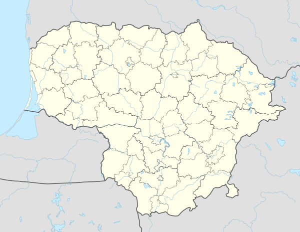
Dotnuva is a small town with a 2003 population of 775 in central Lithuania, 10 km northwest of Kėdainiai, in the Kėdainiai district municipality. It is located on the Dotnuvėlė River. The geographical center of Lithuania, in the village of Ruoščiai, is only a few kilometers away from the town.
Dotnuva | |
|---|---|
Town | |
 | |
 Dotnuva Location of Dotnuva | |
| Coordinates: 55°21′0″N 23°54′0″E | |
| Country | |
| Ethnographic region | Samogitia |
| County | |
| Municipality | Kėdainiai district municipality |
| Eldership | Dotnuva eldership |
| Capital of | Dotnuva eldership |
| First mentioned | 1372 [1] |
| Population (2011) | |
| • Total | 687 |
| Time zone | UTC+2 (EET) |
| • Summer (DST) | UTC+3 (EEST) |
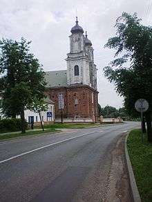
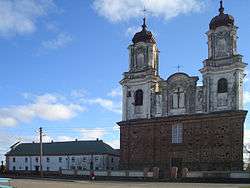
The first mention of the name Dotnuva was in 1372. The Dotnuva estate was known from the 16th century. In 1636 the first wooden church was built. The Brzostowski family, the owners of surrounding land and town, invited Bernardines from Vilnius and in 1701, a Bernardine monastery was established in the town. The monastery was begun to be built in 1768 and the church in 1773–1810. This monastery also kept the primary school similar to the other Bernardine monasteries. The school was opened in 1796 and in beginning of the 19th century managed to grow to the level of high school (gymnasium). But as the monks got involved in the 1831 Uprising against Russian rule, the school was closed in 1836.
The town has a long history of farming education. In 1911-1914 Pyotr Stolypin founded the farming school in the old estate. For this school the new nice building was built (destroyed in 1944). In 1924 Dotnuva Agricultural College was founded in Dotnuva estate, these days called Akademija. On 26 February 1947, the first kolkhoz in Lithuania – the Marytės Melninkaitės kolūkis – was established nearby.
External links
References
- "Akademija, žemdirbių Lietuvos sostinė". Veidas. 7 May 2016.
| Wikimedia Commons has media related to Dotnuva. |