Deeside Way
The Deeside Way is a 41-mile (66 km) rail trail that follows, in part, the bed of the former Deeside Railway. The trail leads along the north bank of the River Dee from Aberdeen to Ballater in Aberdeenshire, Scotland.
| Deeside Way | |
|---|---|
 | |
| Length | 41 miles (66 km) |
| Location | Aberdeenshire, Scotland |
| Trailheads | |
| Use | Walking, cycling and horse riding |
| Elevation | |
| Highest point | 676 feet (206 m)[1] |
| Hiking details | |
| Season | All Year |
| Waymark | Yes |
| Website | http://www.deesideway.org/ |
The track is now part of the National Cycle Network, as National Route 195.
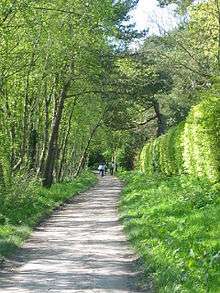
History
_-_geograph.org.uk_-_597200.jpg)
The Deeside Railway was a line that travelled from Aberdeen to Ballater as a stretch of the Great North of Scotland Railway, it closed in 1966 as part of the Beeching cuts. Its tracks have since been removed, except for a small one-mile section used as the Royal Deeside heritage railway, and the path opened to the public on the former route. While in operation, the railway was used by the British Royal Family during travel to their Scottish retreat at Balmoral, hence the local name the Royal Deeside Line.[2]
Interest in using the route for recreational purposes for pedestrians and cyclists began in 1971 with the publication of the Parham Report; in 1992 Kincardine and Deeside District Council undertook a feasibility study into creating the Deeside Way. Some parts of the line were acquired for public ownership and the route has been developed in sections over the years.[3]
The Deeside Way is now almost complete between Duthie Park in Aberdeen and the Station Square in Ballater. There is currently a 1 mile (1.6 km) gap in the route east of Aboyne from Kirkton to the Victory Hall, and plans to extend the path from Ballater to Braemar.[1]
The route

The pathway runs from Duthie Park, Aberdeen to Peterculter, with two breaks across quiet country roads and a larger one at the busy Milltimber Brae. It then leaves the route of the old line, following a country road for around a mile along Coalford Croft to Old Manse Wood, whence there is a narrow path into Drumoak.[4] The route follows the A93 North Deeside Road for a few hundred yards to a signposted path that rejoins the former railway line to Crathes, where it is necessary to use another short stretch of the A93 and the A957 to a minor road onto the path once more. This leads past Milton of Crathes, and alongside the Deeside Railway to arrive in Bellfield Park in Banchory.[5]
The route then continues on to Potarch, where work was carried out in 2010 to repair footpaths around Scolty Hill which now forms part of the route.[6]
From Potarch, the path runs over a bridge before heading alongside the River Dee, and into Kincardine O'Neil.[7]
A bridge across Holburn Street in Aberdeen was built in 2005, and in March 2010 another bridge was opened over West Cults Road.[8]
There are plans to eventually improve the line so that all breaks will be bridged providing a safe unbroken path from the Duthie Park to Banchory. The route is to connect up to Ballater via Kincardine O'Neil, instead of following the original line through Lumphanan. Only the route between Banchory and Potarch, and Kincardine O'Neil and Aboyne remain to be completed in order for the path to run completely from Aberdeen to Ballater.
Laying of tarmac along sections of the path within built-up areas of Aberdeen has taken place to improve from the current path which floods leading to thick mud patches during the autumn and winter months.
See also
References
- "Deeside Way". LDWA.
- "About the Line". www.deeside-railway.co.uk. Retrieved 30 May 2020.
- "Deeside Way". www.deesideway.org. Retrieved 30 May 2020.
- "Aberdeen to Drumoak". www.deesideway.org.
- "Drumoak to Banchory". www.deesideway.org.
- "Path repairs to start on Scotly Hill". Deeside Piper. 19 February 2009. Archived from the original on 4 October 2011.
- "Banchory-Aboyne path plan unveiled". Deeside Piper. 30 October 2008. Archived from the original on 1 November 2014.
- Aberdeen City Council (2010). "New footbridge leading to historic Deeside Way opened" Archived 14 March 2012 at the Wayback Machine