De Graff, Kansas
De Graff is an unincorporated community in Butler County, Kansas, United States.[1] It is located on U.S. Route 77 approximately 7.7 miles (12.4 km) north of I-35 (Kansas Turnpike)
De Graff, Kansas | |
|---|---|
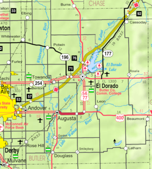 KDOT map of Butler County (legend) | |
| Coordinates: 37°58′52″N 96°51′46″W[1] | |
| Country | United States |
| State | Kansas |
| County | Butler |
| Township | Lincoln |
| Elevation | 1,401 ft (427 m) |
| Time zone | UTC-6 (CST) |
| • Summer (DST) | UTC-5 (CDT) |
| Area code | 620 |
| FIPS code | 20-17325 [1] |
| GNIS ID | 474396 [1] |


History
In 1877, the Florence, El Dorado, and Walnut Valley Railroad Company built a branch line from Florence to El Dorado,[2] and a station called De Graff was built. In 1881, the rail line was extended to Douglass, then later to Arkansas City.[3] The line was leased and operated by the Atchison, Topeka and Santa Fe Railway. The line from Florence through Burns to El Dorado was abandoned in 1942.[4] The original branch line connected Florence through El Dorado to Arkansas City.
De Graff was founded around a train station in 1877, then stagnated after the railroad was abandoned in 1942.[5] De Graff had a post office from 1887 until 1942.[6]
Climate
The climate in this area is characterized by hot, humid summers and generally mild to cool winters. According to the Köppen Climate Classification system, De Graff has a humid subtropical climate, abbreviated "Cfa" on climate maps.[7]
Education
The community is served by El Dorado USD 490 public school district.
Infrastructure
U.S. Route 77 highway runs north-south on the east side of De Graff, and follows roughly parallel to the old railway.
References
- Geographic Names Information System (GNIS) details for De Graff, Kansas; United States Geological Survey (USGS); October 13, 1978.
- Marion County Kansas : Past and Present; Sondra Van Meter; MB Publishing House; LCCN 72-92041; 344 pages; 1972.
- 1935 Rand McNally Standard Map of Kansas
- Railway Abandonment 1942
- Blackmar, Frank Wilson (1912). Kansas: A Cyclopedia of State History, Embracing Events, Institutions, Industries, Counties, Cities, Towns, Prominent Persons, Etc. Standard Publishing Company. pp. 504.
- "Kansas Post Offices, 1828-1961 (archived)". Kansas Historical Society. Archived from the original on October 9, 2013. Retrieved 5 June 2014.
- Climate Summary for De Graff, Kansas
Further reading
External links
- Walter's Pumpkin Patch, 0.5 mile south of De Graff
Municipalities and communities of Butler County, Kansas, United States | ||
|---|---|---|
| Cities |  Map of Kansas highlighting Butler County | |
| Unincorporated communities | ||
| Ghost towns | ||
| Townships | ||
| Footnotes | †This populated place is designated a Census-Designated Place (CDP) by the United States Census Bureau, ‡This populated place also has portions in an adjacent county or counties. | |