Dawson Street Residential Historic District
The Dawson Street Residential Historic District, in Thomasville, Georgia, is a 200-acre (0.81 km2) historic district which was listed on the National Register of Historic Places in 1984. It then included 380 contributing buildings and three contributing sites.[1]
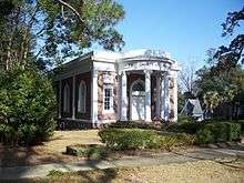
First Church of Christ, Scientist, on N. Dawson St.
Dawson Street Residential Historic District | |
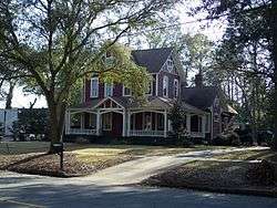 House on N. Dawson | |
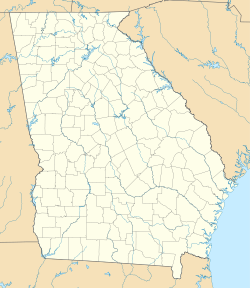  | |
| Location | Roughly bounded by North Blvd., Madison, Jackson, and Hansell Sts., Thomasville, Georgia |
|---|---|
| Coordinates | 30.844167°N 83.981944°W |
| Area | 200 acres (0.81 km2) |
| Architect | Multiple |
| Architectural style | Late 19th And 20th Century Revivals, Late Victorian |
| NRHP reference No. | 84001251[1] |
| Added to NRHP | September 7, 1984 |
It is located to the north of the city's commercial center and its courthouse square. As well as houses, the district includes several churches, two historic cemeteries (one for whites and one for blacks), a historic city park, and pecan orchards associated with some of the houses.[2]
It includes two properties already separately-listed on the National Register:
- Hardy Bryan House (or Carter House), 312 North Broad Street, a Greek Revival house built by a carpenter/builder which is believed to be one of the earliest surviving houses in Thomasville;
- Lapham-Patterson House (1885), 626 North Dawson Street, a National Historic Landmark.[2]
Also notable in the district are:
References
- "National Register Information System". National Register of Historic Places. National Park Service. July 9, 2010.
- Carolyn Brooks (June 13, 1984). "National Register of Historic Places Inventory/Nomination: Dawson Street Residential Historic District". National Park Service. Retrieved April 20, 2017. With 55 photos from 1983.
External links

| Topics | |
|---|---|
| Lists by state |
|
| Lists by insular areas | |
| Lists by associated state | |
| Other areas | |
| Related | |
| |
This article is issued from Wikipedia. The text is licensed under Creative Commons - Attribution - Sharealike. Additional terms may apply for the media files.