Dalton Township, Wayne County, Indiana
Dalton Township is one of fifteen townships in Wayne County, Indiana, United States. As of the 2010 census, its population was 566 and it contained 239 housing units.[2]
Dalton Township | |
|---|---|
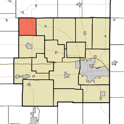 Location in Wayne County | |
| Coordinates: 39°58′40″N 85°09′33″W | |
| Country | United States |
| State | Indiana |
| County | Wayne |
| Government | |
| • Type | Indiana township |
| Area | |
| • Total | 15.79 sq mi (40.9 km2) |
| • Land | 15.75 sq mi (40.8 km2) |
| • Water | 0.04 sq mi (0.1 km2) 0.25% |
| Elevation | 1,181 ft (360 m) |
| Population (2010) | |
| • Total | 566 |
| • Density | 35.9/sq mi (13.9/km2) |
| Time zone | UTC-5 (Eastern (EST)) |
| • Summer (DST) | UTC-4 (EDT) |
| Area code(s) | 765 |
| GNIS feature ID | 453252 |
History
Dalton Township was organized in 1847.[3]
Geography
According to the 2010 census, the township has a total area of 15.79 square miles (40.9 km2), of which 15.75 square miles (40.8 km2) (or 99.75%) is land and 0.04 square miles (0.10 km2) (or 0.25%) is water.[2] The streams of Corey Run, Flight Run, Franklin Run, Little Creek, Little Four Mile Creek, Mono Run, Propeller Run, Show Run, Single Run, West River and Wing Branch run through this township.
Unincorporated towns
(This list is based on USGS data and may include former settlements.)
Adjacent townships
- Union Township, Randolph County (northeast)
- Perry Township (east)
- Jefferson Township (south)
- Liberty Township, Henry County (southwest)
- Blue River Township, Henry County (west)
Major highways
References
- "Dalton Township, Wayne County, Indiana". Geographic Names Information System. United States Geological Survey. Retrieved 2009-09-24.
- United States Census Bureau cartographic boundary files
- "US Board on Geographic Names". United States Geological Survey. October 25, 2007. Retrieved 2017-05-09.
- "Population, Housing Units, Area, and Density: 2010 - County -- County Subdivision and Place -- 2010 Census Summary File 1". United States Census. Archived from the original on 2020-02-12. Retrieved 2013-05-10.
- Young, Andrew White (1872). History of Wayne County, Indiana, from Its First Settlement to the Present Time. R. Clarke & Company. pp. 204.
External links
Municipalities and communities of Wayne County, Indiana, United States | ||
|---|---|---|
| City | Map of Indiana highlighting Wayne County | |
| Towns | ||
| Townships | ||
| Unincorporated communities | ||
This article is issued from Wikipedia. The text is licensed under Creative Commons - Attribution - Sharealike. Additional terms may apply for the media files.