Dadeville, Missouri
Dadeville is a village in Dade County, Missouri, United States. The population was 234 at the 2010 census.
Dadeville, Missouri | |
|---|---|
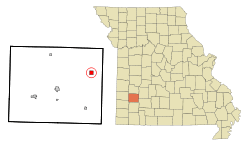 Location of Dadeville, Missouri | |
| Coordinates: 37°28′42″N 93°40′30″W | |
| Country | United States |
| State | Missouri |
| County | Dade |
| Area | |
| • Total | 0.99 sq mi (2.56 km2) |
| • Land | 0.99 sq mi (2.56 km2) |
| • Water | 0 sq mi (0 km2) |
| Elevation | 1,086 ft (331 m) |
| Population | |
| • Total | 234 |
| • Estimate (2016)[3] | 229 |
| • Density | 240/sq mi (91/km2) |
| Time zone | UTC-6 (Central (CST)) |
| • Summer (DST) | UTC-5 (CDT) |
| ZIP code | 65635 |
| Area code(s) | 417 |
| FIPS code | 29-17992[4] |
| GNIS feature ID | 0729868[5] |
History
There have two Dade County towns called Dadeville: an earlier Dadeville was founded in the 1840s and went extinct after the county seat was established at Greenfield.[6] The current site of Dadeville was first called Melville.[6] A post office called Melville opened in 1853, and the name was changed to Dadeville in 1858.[7] The village is named after Dade County.[8]
Geography
Dadeville is located at 37°28′42″N 93°40′30″W (37.478334, -93.675039).[9]
According to the United States Census Bureau, the village has a total area of 0.99 square miles (2.56 km2), all land.[1]
Demographics
| Historical population | |||
|---|---|---|---|
| Census | Pop. | %± | |
| 1880 | 243 | — | |
| 1900 | 466 | — | |
| 1910 | 401 | −13.9% | |
| 1920 | 333 | −17.0% | |
| 1930 | 272 | −18.3% | |
| 1940 | 248 | −8.8% | |
| 1950 | 208 | −16.1% | |
| 1960 | 142 | −31.7% | |
| 1970 | 149 | 4.9% | |
| 1980 | 216 | 45.0% | |
| 1990 | 220 | 1.9% | |
| 2000 | 224 | 1.8% | |
| 2010 | 234 | 4.5% | |
| Est. 2016 | 229 | [3] | −2.1% |
| U.S. Decennial Census[10] | |||
2010 census
As of the census[2] of 2010, there were 234 people, 90 households, and 69 families living in the village. The population density was 236.4 inhabitants per square mile (91.3/km2). There were 104 housing units at an average density of 105.1 per square mile (40.6/km2). The racial makeup of the village was 96.2% White, 0.9% Native American, 0.4% Asian, and 2.6% from two or more races. Hispanic or Latino of any race were 2.1% of the population.
There were 90 households, of which 34.4% had children under the age of 18 living with them, 61.1% were married couples living together, 11.1% had a female householder with no husband present, 4.4% had a male householder with no wife present, and 23.3% were non-families. 18.9% of all households were made up of individuals, and 11.1% had someone living alone who was 65 years of age or older. The average household size was 2.60 and the average family size was 2.99.
The median age in the village was 44 years. 25.6% of residents were under the age of 18; 6.4% were between the ages of 18 and 24; 19.7% were from 25 to 44; 29% were from 45 to 64; and 19.2% were 65 years of age or older. The gender makeup of the village was 46.6% male and 53.4% female.
2000 census
As of the census[4] of 2000, there were 224 people, 93 households, and 66 families living in the village. The population density was 225.5 people per square mile (87.4/km2). There were 103 housing units at an average density of 103.7 per square mile (40.2/km2). The racial makeup of the village was 96.88% White, 1.34% Native American, 0.45% from other races, and 1.34% from two or more races. Hispanic or Latino of any race were 0.89% of the population.
There were 93 households, out of which 26.9% had children under the age of 18 living with them, 64.5% were married couples living together, 4.3% had a female householder with no husband present, and 28.0% were non-families. 23.7% of all households were made up of individuals, and 12.9% had someone living alone who was 65 years of age or older. The average household size was 2.41 and the average family size was 2.82.
In the village, the population was spread out, with 21.9% under the age of 18, 10.7% from 18 to 24, 24.6% from 25 to 44, 23.2% from 45 to 64, and 19.6% who were 65 years of age or older. The median age was 39 years. For every 100 females, there were 88.2 males. For every 100 females age 18 and over, there were 84.2 males.
The median income for a household in the village was $27,000, and the median income for a family was $30,000. Males had a median income of $21,250 versus $15,000 for females. The per capita income for the village was $11,135. About 19.1% of families and 16.0% of the population were below the poverty line, including 13.4% of those under the age of eighteen and 15.9% of those 65 or over.
Notable person
- Mount Etna Morris—former State Treasurer of Missouri, born and raised in Dadeville.
References
- "US Gazetteer files 2010". United States Census Bureau. Archived from the original on 2012-01-25. Retrieved 2012-07-08.
- "U.S. Census website". United States Census Bureau. Retrieved 2012-07-08.
- "Population and Housing Unit Estimates". Retrieved June 9, 2017.
- "U.S. Census website". United States Census Bureau. Retrieved 2008-01-31.
- "US Board on Geographic Names". United States Geological Survey. 2007-10-25. Retrieved 2008-01-31.
- "Dade County Place Names, 1928–1945 (archived)". The State Historical Society of Missouri. Archived from the original on 24 June 2016. Retrieved 25 September 2016.CS1 maint: BOT: original-url status unknown (link)
- "Post Offices". Jim Forte Postal History. Archived from the original on 6 March 2016. Retrieved 25 September 2016.
- Eaton, David Wolfe (1916). How Missouri Counties, Towns and Streams Were Named. The State Historical Society of Missouri. pp. 283.
- "US Gazetteer files: 2010, 2000, and 1990". United States Census Bureau. 2011-02-12. Retrieved 2011-04-23.
- "Census of Population and Housing". Census.gov. Retrieved June 4, 2015.
Municipalities and communities of Dade County, Missouri, United States | ||
|---|---|---|
| Cities | 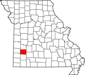 Map of Missouri highlighting Dade County | |
| Villages | ||
| Townships | ||
| Unincorporated communities | ||
| Ghost towns | ||
| Footnotes | ‡This populated place also has portions in an adjacent county or counties | |