Custer City, Oklahoma
Custer City is a town in Custer County, Oklahoma, United States. Custer City is northeast of Clinton and northwest of Weatherford along Oklahoma 33.[5] The population was 375 at the 2010 census.
Custer City, Oklahoma | |
|---|---|
 Custer City, Oklahoma Location of Custer City, Oklahoma | |
| Coordinates: 35.6637681°N 98.8869234°W | |
| Country | United States |
| State | Oklahoma |
| County | Custer |
| Area | |
| • Total | 0.61 sq mi (1.58 km2) |
| • Land | 0.61 sq mi (1.58 km2) |
| • Water | 0.00 sq mi (0.00 km2) |
| Elevation | 1,772 ft (540 m) |
| Population (2010) | |
| • Total | 375 |
| • Estimate (2018)[2] | 383 |
| • Density | 626.84/sq mi (241.93/km2) |
| Time zone | UTC-6 (Central (CST)) |
| • Summer (DST) | UTC-5 (CDT) |
| ZIP code | 73639 |
| Area code(s) | 580 |
| FIPS code | 40-18950[3] |
| GNIS feature ID | 1091900[4] |
Geography
Custer City is located at 35°39′56″N 98°53′06″W.[6]
According to the United States Census Bureau, the town has a total area of 0.6 square miles (1.6 km2), all of it land.
Demographics
| Historical population | |||
|---|---|---|---|
| Census | Pop. | %± | |
| 1910 | 854 | — | |
| 1920 | 671 | −21.4% | |
| 1930 | 698 | 4.0% | |
| 1940 | 641 | −8.2% | |
| 1950 | 479 | −25.3% | |
| 1960 | 448 | −6.5% | |
| 1970 | 486 | 8.5% | |
| 1980 | 530 | 9.1% | |
| 1990 | 443 | −16.4% | |
| 2000 | 393 | −11.3% | |
| 2010 | 375 | −4.6% | |
| Est. 2018 | 383 | [2] | 2.1% |
| U.S. Decennial Census[7] | |||
As of the census[3] of 2000, there were 393 people, 169 households, and 110 families residing in the town. The population density was 653.2 people per square mile (252.9/km2). There were 206 housing units at an average density of 342.4 per square mile (132.6/km2). The racial makeup of the town was 94.66% White, 3.56% Native American, 0.51% from other races, and 1.27% from two or more races. Hispanic or Latino of any race were 1.53% of the population.
There were 169 households, out of which 29.0% had children under the age of 18 living with them, 56.2% were married couples living together, 5.9% had a female householder with no husband present, and 34.9% were non-families. 32.5% of all households were made up of individuals, and 13.0% had someone living alone who was 65 years of age or older. The average household size was 2.33 and the average family size was 2.93.
In the town, the population was spread out, with 24.4% under the age of 18, 8.7% from 18 to 24, 23.4% from 25 to 44, 26.5% from 45 to 64, and 17.0% who were 65 years of age or older. The median age was 39 years. For every 100 females, there were 95.5 males. For every 100 females age 18 and over, there were 103.4 males.
The median income for a household in the town was $30,500, and the median income for a family was $39,000. Males had a median income of $33,571 versus $13,409 for females. The per capita income for the town was $15,165. About 18.4% of families and 27.1% of the population were below the poverty line, including 54.8% of those under age 18 and 14.1% of those age 65 or over.
Notable people
- William Brinkley (1917–1993), author and reporter
- Tom Turner (1916-1986), Major League Baseball player
References
- "2018 U.S. Gazetteer Files". United States Census Bureau. Retrieved Feb 12, 2020.
- "Population and Housing Unit Estimates". Retrieved June 4, 2019.
- "U.S. Census website". United States Census Bureau. Retrieved 2008-01-31.
- "US Board on Geographic Names". United States Geological Survey. 2007-10-25. Retrieved 2008-01-31.
- "Custer City, Oklahoma". Google Maps. Retrieved April 2, 2020.
- "US Gazetteer files: 2010, 2000, and 1990". United States Census Bureau. 2011-02-12. Retrieved 2011-04-23.
- "Census of Population and Housing". Census.gov. Retrieved June 4, 2015.
External links
- Wilson, Linda D. "Custer City," Encyclopedia of Oklahoma History and Culture, 2009. Accessed March 18, 2015.
Municipalities and communities of Custer County, Oklahoma, United States | ||
|---|---|---|
| Cities | 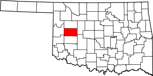 Custer County map | |
| Towns | ||
| Unincorporated communities | ||
| Ghost town | ||
| Footnotes | ‡This populated place also has portions in an adjacent county or counties | |