Curry Township, Sullivan County, Indiana
Curry Township is one of nine townships in Sullivan County, Indiana, United States. As of the 2010 census, its population was 3,559 and it contained 1,643 housing units.[1]
Curry Township | |
|---|---|
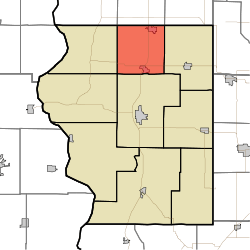 Location in Sullivan County | |
| Coordinates: 39°12′51″N 87°23′56″W | |
| Country | |
| State | |
| County | Sullivan |
| Government | |
| • Type | Indiana township |
| Area | |
| • Total | 35.12 sq mi (91.0 km2) |
| • Land | 34.95 sq mi (90.5 km2) |
| • Water | 0.17 sq mi (0.4 km2) 0.48% |
| Elevation | 545 ft (166 m) |
| Population (2010) | |
| • Total | 3,559 |
| • Density | 101.8/sq mi (39.3/km2) |
| ZIP codes | 47850, 47879 |
| GNIS feature ID | 453250 |
The township is named after William Curry, who was the area's first settler when he arrived there in 1817 from Kentucky.[2]
Geography
According to the 2010 census, the township has a total area of 35.12 square miles (91.0 km2), of which 34.95 square miles (90.5 km2) (or 99.52%) is land and 0.17 square miles (0.44 km2) (or 0.48%) is water.[1]
Cities, towns, villages
Unincorporated towns
- Baldridge at 39.223096°N 87.372241°W
- Curryville at 39.186985°N 87.392519°W
- East Shelburn at 39.174486°N 87.379741°W
- Standard at 39.19643°N 87.389186°W
- Wilfred at 39.186708°N 87.352518°W
(This list is based on USGS data and may include former settlements.)
Adjacent townships
- Linton Township, Vigo County (north)
- Pierson Township, Vigo County (northeast)
- Jackson Township (east)
- Hamilton Township (south)
- Turman Township (southwest)
- Fairbanks Township (west)
- Prairie Creek Township, Vigo County (northwest)
Cemeteries
The township contains these four cemeteries: Douglas Chapel, Ebenezer, McKinney and West Lawn.
Major highways
Airports and landing strips
- Austin Air Ads Airport
School districts
- Northeast School Corporation
Political districts
- Indiana's 8th congressional district
- State House District 45
- State Senate District 39
References
- United States Census Bureau 2008 TIGER/Line Shapefiles
- United States Board on Geographic Names (GNIS)
- IndianaMap
- "Population, Housing Units, Area, and Density: 2010 - County -- County Subdivision and Place -- 2010 Census Summary File 1". United States Census. Archived from the original on 2020-02-12. Retrieved 2013-05-10.
- Wolfe, Thomas Jefferson (1909). History of Sullivan County, Indiana. New York, Chicago: Lewis Publishing Company. pp. 43.
External links
Places adjacent to Curry Township, Sullivan County, Indiana | |
|---|---|
Municipalities and communities of Sullivan County, Indiana, United States | ||
|---|---|---|
| Cities | Map of Indiana highlighting Sullivan County | |
| Towns | ||
| Townships | ||
| Unincorporated communities |
| |
| Ghost towns | ||
| Footnotes | ‡This populated place also has portions in an adjacent county or counties | |
This article is issued from Wikipedia. The text is licensed under Creative Commons - Attribution - Sharealike. Additional terms may apply for the media files.