Crooks, South Dakota
Crooks is a city in Minnehaha County, South Dakota, United States and is a suburb of Sioux Falls. The population was 1,269 at the 2010 census. Crooks was named New Hope until 1904.[6] The town's present name honors W. A. Crooks, a local politician.[7]
Crooks, South Dakota | |
|---|---|
 Location in Minnehaha County and the state of South Dakota | |
| Coordinates: 43°39′41″N 96°48′33″W | |
| Country | United States |
| State | South Dakota |
| County | Minnehaha |
| Government | |
| • Mayor | F. Butch Oseby[1] |
| Area | |
| • Total | 0.81 sq mi (2.09 km2) |
| • Land | 0.81 sq mi (2.09 km2) |
| • Water | 0.00 sq mi (0.00 km2) |
| Elevation | 1,588 ft (484 m) |
| Population | |
| • Total | 1,269 |
| • Estimate (2018)[4] | 1,340 |
| • Density | 1,664.60/sq mi (642.55/km2) |
| Time zone | UTC−6 (Central (CST)) |
| • Summer (DST) | UTC−5 (CDT) |
| ZIP code | 57020 |
| Area code(s) | 605 |
| FIPS code | 46-14740 |
| GNIS feature ID | 1265631[5] |
| Website | City of Crooks |
Geography
Crooks is located at 43°39′41″N 96°48′33″W (43.661488, -96.809148).[8]
According to the United States Census Bureau, the city has a total area of 0.77 square miles (1.99 km2), all of it land.[9]
Crooks has been assigned the ZIP code 57020 and the FIPS place code 14740.
Demographics
| Historical population | |||
|---|---|---|---|
| Census | Pop. | %± | |
| 1980 | 594 | — | |
| 1990 | 671 | 13.0% | |
| 2000 | 859 | 28.0% | |
| 2010 | 1,269 | 47.7% | |
| Est. 2018 | 1,340 | [4] | 5.6% |
| U.S. Decennial Census[10] 2018 Estimate[11] | |||
2010 census
At the 2010 census there were 1,269 people, 431 households, and 345 families living in the city. The population density was 1,648.1 inhabitants per square mile (636.3/km2). There were 440 housing units at an average density of 571.4 per square mile (220.6/km2). The racial makeup of the city was 98.2% White, 0.1% Native American, 0.2% Asian, 0.5% from other races, and 1.1% from two or more races. Hispanic or Latino of any race were 2.0%.[3]
Of the 431 households 48.0% had children under the age of 18 living with them, 66.6% were married couples living together, 10.9% had a female householder with no husband present, 2.6% had a male householder with no wife present, and 20.0% were non-families. 15.3% of households were one person and 3.8% were one person aged 65 or older. The average household size was 2.94 and the average family size was 3.29.
The median age was 31.4 years. 32.9% of residents were under the age of 18; 5.8% were between the ages of 18 and 24; 32.6% were from 25 to 44; 24.1% were from 45 to 64; and 4.6% were 65 or older. The gender makeup of the city was 50.7% male and 49.3% female.
2000 census
At the 2000 census, there were 859 people, 282 households, and 232 families living in the city. The population density was 1,324.3 people per square mile (510.2/km²). There were 289 housing units at an average density of 445.6 per square mile (171.7/km²). The racial makeup of the city was 98.14% White, 1.05% Native American, 0.23% Asian, and 0.58% from two or more races.
Of the 282 households 54.3% had children under the age of 18 living with them, 70.6% were married couples living together, 8.9% had a female householder with no husband present, and 17.7% were non-families. 13.1% of households were one person and 3.9% were one person aged 65 or older. The average household size was 3.05 and the average family size was 3.38.
The age distribution was 34.3% under the age of 18, 9.2% from 18 to 24, 34.2% from 25 to 44, 19.0% from 45 to 64, and 3.3% 65 or older. The median age was 30 years. For every 100 females, there were 100.2 males. For every 100 females age 18 and over, there were 98.6 males.
The median household income was $54,583, and the median family income was $56,528. Males had a median income of $31,065 versus $25,064 for females. The per capita income for the city was $17,512. About 0.8% of families and 1.7% of the population were below the poverty line, including 1.0% of those under age 18 and 4.3% of those age 65 or over.
References
- "Mayor and Council - City of Crooks, South Dakota". cityofcrooks.net. Retrieved December 22, 2019.
- "2018 U.S. Gazetteer Files". United States Census Bureau. Retrieved February 22, 2020.
- "U.S. Census website". United States Census Bureau. Retrieved 2012-06-21.
- "Population and Housing Unit Estimates". United States Census Bureau. June 27, 2019. Retrieved June 4, 2019.
- "US Board on Geographic Names". United States Geological Survey. 2007-10-25. Retrieved 2008-01-31.
- Johnson, Vernell; Louise Johnson (1998). A Pictorial History of South Dakota. Heritage House Publishing, pg. 66.
- Federal Writers' Project (1940). South Dakota place-names, v.1-3. University of South Dakota. p. 32.
- "US Gazetteer files: 2010, 2000, and 1990". United States Census Bureau. 2011-02-12. Retrieved 2011-04-23.
- "US Gazetteer files 2010". United States Census Bureau. Archived from the original on January 12, 2012. Retrieved 2012-06-21.
- United States Census Bureau. "Census of Population and Housing". Retrieved September 23, 2013.
Municipalities and communities of Minnehaha County, South Dakota, United States | ||
|---|---|---|
| Cities | 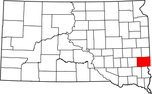 | |
| Towns | ||
| CDPs | ||
| Other unincorporated communities | ||
| Townships | ||
| Footnotes | ‡This populated place also has portions in an adjacent county or counties | |