Crawley, Hampshire
Crawley is a small village in Hampshire, England.[2][3] It is a few miles from the county town (and former capital) of Winchester. It is a civil parish within the City of Winchester local government district. The village is the location of Crawley Court, currently the headquarters of broadcast company Arqiva.
| Crawley | |
|---|---|
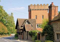 The Dower House in Crawley | |
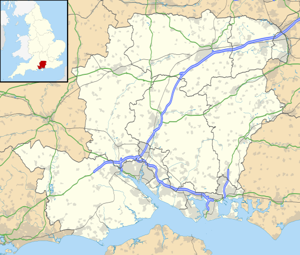 Crawley Location within Hampshire | |
| Population | 418 (2011 Census)[1] |
| OS grid reference | SU4278834791 |
| District | |
| Shire county | |
| Region | |
| Country | England |
| Sovereign state | United Kingdom |
| Post town | WINCHESTER |
| Postcode district | SO21 |
| Dialling code | 01962 |
| Police | Hampshire |
| Fire | Hampshire |
| Ambulance | South Central |
| UK Parliament | |
Geography of the Civil Parish
The North Eastern boundary of the Parish runs along the Western side of the A272 from a location 1.6 km (1 mi) South East of the A272 and A30 junction to a point 2.3 km (1.4 mi) further South East along the A272, at this point it turns South West, along a field boundary for 850m (0.6 mi).The B3049 (Winchester to Stockbridge road) passes through the Southern portion of the Civil Parish from the cross roads near Rack and Manger cottages to the East side of Turnpike Copse a distance of 2.6 km (1.6 mi). Another short length of the B3049 runs along the line of part of the Southern boundary of the Parish for a distance of 760 m (830 yds), this is the section of the B3049 from the lodge at Tate's Plantation to Ball Down Farm. Four roads each generally wider than 4m converge upon Crawley village, all meeting at the junction adjacent to Crawley pond. The most Westerly of these roads leaves the B3049 at Folly farm and heads in a North Eastery direction, passing Crawley Court, after a total distance of 1.4 km (0.9 mi) from the B3049 it arrives at St Marys Church. From the Church the lane travels in an Easterly direction forming the main street of the village finally it reaches the junction at the pond. The distance from the Church to the Crawley pond junction is 0.68 km (0.42 mi).[4]
References
- "Cavil Parish population 2011". Neighbourhood Statistics. Office for National Statistics. Retrieved 13 December 2016.
- Ordnance Survey: Landranger map sheet 185 Winchester & Basingstoke (Andover & Romsey) (Map). Ordnance Survey. 2013. ISBN 9780319228845.
- "Ordnance Survey: 1:50,000 Scale Gazetteer" (csv (download)). www.ordnancesurvey.co.uk. Ordnance Survey. 1 January 2016. Retrieved 18 February 2016.
- http://streetmap.co.uk/idld.srf?x=442686&y=134850&z=120&sv=442686,134850&st=4&mapp=idld.srf&dn=828&ax=442686&ay=134850&lm=0
| Wikimedia Commons has media related to Crawley, Hampshire. |
Electoral Wards and Parishes in the City of Winchester District, Hampshire, England (2016 boundary changes). | ||
|---|---|---|
| Wonston and Micheldelver | ||
| The Worthies | ||
| Alresford and Itchen | ||
| Winchester |
| |
| Badger Farm and Oliver's Battery |
| |
| Colden Common and Twyford | ||
| Upper Meon Valley | ||
| Bishops Waltham | ||
| Central Meon Valley | ||
| Whiteley and Shedfield | ||
| Denmead | ||
| Southwick and Wickham | ||
(Wards ordered from north-west corner, across the map, and then progressively south and east) | ||