County of Livingstone, Queensland
The County of Livingstone is a county (a cadastral division) in Queensland, Australia. It is centred on the city of Rockhampton and includes most of the Rockhampton Region.[1][2] The county was created on 1 September 1855 by royal proclamation under the Waste Lands Australia Act 1846.[3] On 7 March 1901, the Governor issued a proclamation legally dividing Queensland into counties under the Land Act 1897.[4] Its schedule described Livingstone thus:
Bounded on the south by the county of Deas Thompson and the southern boundaries of the parishes of Plews, Bouldercombe, Mooninera and Playfair; on the west by the western boundaries of the parishes of Playfair, Stanwell, Neerkol, Limestone, Morinish, Yaamba, Canoona and Werribee; on the north by the northern boundaries of the parishes of Werribee, Rosslynn and Yeppoon, and on the east by the Pacific Ocean,—inclusive of Great Keppel, North Keppel, and other adjacent islands.
| Livingstone Queensland | |||||||||||||||
|---|---|---|---|---|---|---|---|---|---|---|---|---|---|---|---|
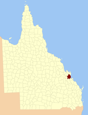 Location within Queensland | |||||||||||||||
| |||||||||||||||
Parishes
Livingstone is divided into parishes, as listed below:
| Parish | LGA | Coordinates | Towns |
|---|---|---|---|
| Archer | Rockhampton | 23°22′S 150°36′E | North Rockhampton, Lakes Creek |
| Barmoya | Rockhampton | 23°07′S 150°34′E | |
| Bouldercombe | Rockhampton | 23°32′S 150°26′E | Bouldercombe |
| Calioran | Rockhampton | 23°11′S 150°20′E | |
| Canoona | Rockhampton | 22°57′S 150°21′E | |
| Cawarral | Rockhampton | 23°14′S 150°38′E | Cawarral |
| Cecil | Rockhampton | 23°33′S 150°39′E | |
| Faraday | Rockhampton | 23°16′S 150°16′E | Ridgelands |
| Fitzroy | Rockhampton | 23°12′S 150°27′E | The Caves |
| Gavial | Rockhampton | 23°28′S 150°35′E | Midgee |
| Gracemere | Rockhampton | 23°27′S 150°27′E | Gracemere, Kabra |
| Herbert | Rockhampton | 23°28′S 150°51′E | |
| Hewittville | Rockhampton | 23°14′S 150°46′E | Emu Park, Cooee Bay |
| Jardine | Rockhampton | 23°05′S 150°25′E | Milman |
| Karkol | Rockhampton | 23°21′S 150°26′E | |
| Keppel | Rockhampton | 23°08′S 150°55′E | Great Keppel Island |
| Limestone | Rockhampton | 23°22′S 150°15′E | |
| Meadow Flats | Rockhampton | 23°21′S 150°49′E | Keppel Sands |
| Moonmera | Rockhampton | 23°36′S 150°19′E | |
| Morinish | Rockhampton | 23°12′S 150°10′E | |
| Murchison | Rockhampton | 23°17′S 150°30′E | Norman Gardens, Kawana |
| Neerkol | Rockhampton | 23°25′S 150°18′E | |
| Nicholson | Rockhampton | 23°18′S 150°24′E | Alton Downs |
| Playfair | Rockhampton | 23°33′S 150°11′E | Wycarbah |
| Plews | Rockhampton | 23°35′S 150°33′E | |
| Rockhampton | Rockhampton | 23°24′S 150°30′E | Rockhampton, Port Curtis |
| Rosslyn | Rockhampton | 22°59′S 150°33′E | Rossmoya |
| Stanwell | Rockhampton | 23°29′S 150°16′E | Stanwell |
| Thozet | Rockhampton | 23°27′S 150°41′E | |
| Werribee | Rockhampton | 22°52′S 150°29′E | |
| Wiseman | Rockhampton | 23°22′S 150°23′E | |
| Yaamba | Rockhampton | 23°04′S 150°18′E | Yaamba |
| Yeppoon | Rockhampton | 23°07′S 150°43′E | Yeppoon |
References
- "Livingstone (entry 19794)". Queensland Place Names. Queensland Government. Retrieved 8 September 2015.
- Port Curtis District, County of Livingstone Maps - F5 Series at Queensland Archives.
- "Proclamation". New South Wales Government Gazette. 29 June 1855. p. 1855:1737–1738.
- "A Proclamation". Queensland Government Gazette. 75. 8 March 1901. pp. 967–980.