Cornucopia, Oregon
Cornucopia is a ghost town built during the gold mining boom of the 1880s in Eastern Oregon, United States. The town was officially platted in 1886 and was a mining town with various levels of success until it was abandoned in 1942. It is now primarily a tourist attraction as a ghost town.[1] It is located east of Baker City high in the mountains of Pine Valley almost due north of Halfway, Oregon, on Oregon Route 86.
Cornucopia | |
|---|---|
.jpg) Cornucopia 1913 | |
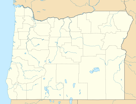 Cornucopia Location in Oregon | |
| Coordinates: | |
| Country | United States |
| State | Oregon |
| County | Baker |
| Elevation | 4,741 ft (1,445 m) |
| Time zone | Pacific |
History
In 1884 a man by the name Lon Simmons discovered gold on the far east edge of Oregon. By July 1885 there were at least 500 men living in the area, forming a town that became known as Cornucopia.[2] The name means "Horn of Plenty," which was appropriate due to the large amount of gold discovered.[2] The town only continued to grow as wealth flowed out of the area. The primary mining companies were Last Chance, Queen of the West, Union-Companion, and the Red Jacket.[3] In 1902 the Oregon Daily Journal claimed that "the Cornucopia group of gold mines contains what is probably the largest ore body in the Pacific Northwest, if not in the United States". Around the same time there were up to 700 men working for the mining company Cornucopia Mines of Oregon, making it the 6th largest mining operation in the United States at the time.[2] However, the mixture of old equipment and horses being the only form of transportation greatly hindered the town's success. In the same year, for unknown reasons, the mining companies neglected to pay a collective $40,122 dollar engineering bill.[4] This caused foreclosure proceedings and affected the mine's success until the claim was settled on February 7, 1905, allowing the mine to grow again.
There were large gold strikes in both November 1915 and towards the end of 1921, which kept the town booming.[2] Technological advances such as electricity, pneumatic drills, and the railroad expanding to be along the Snake River all occurred in early 1922. These advances combined with the late 1921 gold strike allowed a massive mill to be constructed. This mill was considered a twenty-stamp mill, meaning it had twenty giant hammers used to crush ore, and could produce 60 tons of ore each day. This crushed ore was then put through a chemical treatment that extracted the gold.[5]
However, the wall street crash of 1929 even affected a mining town in Oregon. Mining was halted and people left town. By 1930 the census stated that only 10 people currently lived in Cornucopia. Although, it only took a few years for the mining plants to open back up again, and by 1934 the mines were processing gold once again. By 1938 the mining company was raking in money, making a profit of $100,000 in September (Equivalent to $1,727,681 on 3/20/2017[6]). The mines continued to grow more as time went on; Cornucopia was responsible for 66% of the gold in Oregon in 1939. The census in 1940, just 10 years after the town was practically deserted during the beginning of the great depression, enumerated 352 people and the mines were the 7th largest in the nation.[2] However, in the beginning of 1942 President Roosevelt closed all gold mining operations in America so that miners could focus on producing metals for war. The town became abandoned and never recovered.
Culture
During most of Cornucopia's time the people in the town were separated from the rest of the world, thus they relied on each other for entertainment. Many people in the town learned to play instruments such as fiddle, piano, and drums.[3] The miners also loved to dress up for the town's Saturday night dances. Miners worked 10 hour days while in later times mill workers worked 12 hours a day, both working 7 days a week. Because of the constant work, holidays were very important to the townsfolk. The most important ones were Christmas and the Fourth of July, however Labor Day was also celebrated with a town wide picnic that consisted of many contests, such as tug-of-war.[3] At the peak of its existence, Cornucopia had multiple general stores, a boardinghouse, saloons, a hotel, a post office, and a school.
Geography
Cornucopia is located in Baker County, north of Carson, Oregon, south-east of Red Mountain, and west of Snake River. The nearest City is Baker City, OR (56 mi driving South West). Cornucopia has multiple creeks within close proximity, including Pine Creek, Elk Creek, and Panter Creek with East Fork Falls as short distance north. The region is mountainous and full of fir trees. Due to Cornucopia's elevation (4,741 ft), the region receives high snowfall during the winter months.[7] Cornucopia sits on the Southern border of the Eagle Cap Wilderness in the Wallowa Mountains. The gold mines are located north-west of the town center at 45.0126585°N 117.2135096°W. And the mine water treatment plant is located at 45.01028°N 117.1950°W.
Directions
Cornucopia, Oregon is only accessible from the South along the Cornucopia Highway, beginning in Halfway, Oregon. The Cornucopia Highway is the main road connecting Halfway, Jimtown, and Carson, Oregon along the valley before entering Cornucopia 5.5 miles after Carson, Oregon.[8]
Climate
| Climate data for Cornucopia, Oregon (351852) (Based off data collected from 07/01/1909 to 10/31/1972) | |||||||||||||
|---|---|---|---|---|---|---|---|---|---|---|---|---|---|
| Month | Jan | Feb | Mar | Apr | May | Jun | Jul | Aug | Sep | Oct | Nov | Dec | Year |
| Average precipitation inches (mm) | 6.73 (171) |
5.36 (136) |
4.52 (115) |
3.19 (81) |
2.62 (67) |
2.27 (58) |
0.65 (17) |
0.92 (23) |
1.56 (40) |
2.87 (73) |
5.94 (151) |
6.55 (166) |
43.2 (1,100) |
| Average snowfall inches (cm) | 70.6 (179) |
46.0 (117) |
27.5 (70) |
10.2 (26) |
1.2 (3.0) |
0.2 (0.51) |
0 (0) |
0 (0) |
0.2 (0.51) |
4.7 (12) |
28.7 (73) |
55.5 (141) |
244.8 (622.02) |
| Source: The Western Regional Climate Center[9] | |||||||||||||
Ghost Town Reputation
Cornucopia has become a tourist attraction in Oregon due to its reputation as a ghost town and due to deaths that have occurred there. In response to the growing popularity of the town, the Cornucopia Lodge was built in 2008.[3]
References
- Bailey, Barbara Ruth (1982). Main Street: Northeastern Oregon. Oregon Historical Society. p. 20. ISBN 0-87595-073-6.
- Hall, Sharon (24 Nov 2015). "Ghost Town Wednesday: Cornucopia, Oregon". digging-history.com. Retrieved 20 March 2017.
- "Area History and Information". www.cornucopialodge.com. Retrieved 20 March 2017.
- Smith, Jim (2012). Oregon's Ghost Towns. p. 13.
- "Cornucopia". oregongold.net. 17 Jun 2011. Retrieved 20 March 2017.
- https://data.bls.gov/cgi-bin/cpicalc.pl?cost1=100000&year1=1938&year2=2017
- "Cornucopia, Oregon (351852)". Retrieved May 25, 2016.
- "Google Maps". Google Maps. Retrieved 2017-03-22.
- "Cornucopia, Oregon". Retrieved May 25, 2016.
External links
- A video of abandoned buildings around Cornucopia
- Cornucopia Lodge
- Videos on ghost towns, including Cornucopia, from 1988
- Cornucopia, Baker County, Oregon
- Cornucopia
- Inflation conversion
Municipalities and communities of Baker County, Oregon, United States | ||
|---|---|---|
| Cities | 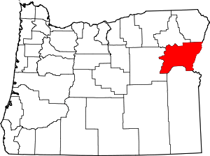 Baker County map | |
| Unincorporated communities | ||
| Ghost towns | ||
| Footnotes |
| |