Coppock, Iowa
Coppock is a city in Henry, Jefferson, and Washington counties in the U.S. state of Iowa. The population was 47 at the 2010 census.
Coppock, Iowa | |
|---|---|
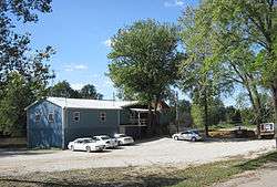 Eagle's Nest in Coppock | |
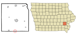 Location of Coppock, Iowa | |
| Coordinates: 41°9′46″N 91°42′58″W | |
| Country | |
| State | |
| Counties | Henry, Washington, Jefferson |
| Area | |
| • Total | 0.24 sq mi (0.62 km2) |
| • Land | 0.23 sq mi (0.60 km2) |
| • Water | 0.01 sq mi (0.03 km2) |
| Elevation | 633 ft (193 m) |
| Population | |
| • Total | 47 |
| • Estimate (2016)[3] | 47 |
| • Density | 204/sq mi (78.9/km2) |
| Time zone | UTC-6 (Central (CST)) |
| • Summer (DST) | UTC-5 (CDT) |
| ZIP code | 52654 |
| Area code(s) | 319 |
| FIPS code | 19-16140 |
| GNIS feature ID | 0465626 |
The Washington County portion of Coppock is part of the Iowa City, Iowa Metropolitan Statistical Area. There is only one business open to the public, a tavern/boat landing. Coppock was the site of a battle in 1882 between the Iowa Central Railway and the narrow-gauge Burlington and Western Railway for locations of bridges across the Skunk River.[4] The Burlington and Western was later widened and taken over by the Chicago, Burlington and Quincy and the Iowa Central was taken over by the Minneapolis and St. Louis.
Geography
Coppock is located at 41°9′46″N 91°42′58″W (41.162639, -91.715996).[5] The town is on the Skunk River just above its confluence with Crooked Creek.
According to the United States Census Bureau, the city has a total area of 0.24 square miles (0.62 km2), of which 0.23 square miles (0.60 km2) is land and 0.01 square miles (0.03 km2) is water.[1]
Recreation
The Chicago, Burlington and Quincy and its narrow gauge affiliates the Burlington and Northwestern and Burlington and Western ran an advertisement in 1883 featuring Coppock Forrests and Trite's Park. The park, on the banks of the Skunk River, offered skiffs for rent, and it had a steam launch and a "tobbogan slide" into the river, all within walking distance of the B&NW station.[6]
Demographics
| Historical populations | ||
|---|---|---|
| Year | Pop. | ±% |
| 1910 | 105 | — |
| 1920 | 104 | −1.0% |
| 1930 | 93 | −10.6% |
| 1940 | 93 | +0.0% |
| 1950 | 81 | −12.9% |
| 1960 | 61 | −24.7% |
| 1970 | 58 | −4.9% |
| 1980 | 47 | −19.0% |
| 1990 | 50 | +6.4% |
| 2000 | 57 | +14.0% |
| 2010 | 47 | −17.5% |
| 2016 | 47 | +0.0% |
| Source:"U.S. Census website". United States Census Bureau. Retrieved 2020-03-29. and Iowa Data Center Source: | ||
2010 census
As of the census[2] of 2010, there were 47 people, 17 households, and 14 families living in the city. The population density was 204.3 inhabitants per square mile (78.9/km2). There were 19 housing units at an average density of 82.6 per square mile (31.9/km2). The racial makeup of the city was 93.6% White and 6.4% from two or more races.
There were 17 households, of which 23.5% had children under the age of 18 living with them, 58.8% were married couples living together, 11.8% had a female householder with no husband present, 11.8% had a male householder with no wife present, and 17.6% were non-families. 17.6% of all households were made up of individuals, and 11.8% had someone living alone who was 65 years of age or older. The average household size was 2.76 and the average family size was 2.79.
The median age in the city was 39.5 years. 17% of residents were under the age of 18; 15% were between the ages of 18 and 24; 23.5% were from 25 to 44; 27.7% were from 45 to 64; and 17% were 65 years of age or older. The gender makeup of the city was 48.9% male and 51.1% female.
2000 census
As of the census[8] of 2000, there were 57 people, 22 households, and 13 families living in the city. The population density was 243.7 people per square mile (95.7/km2). There were 27 housing units at an average density of 115.4 per square mile (45.3/km2). The racial makeup of the city was 98.25% White, and 1.75% from two or more races.
There were 22 households, out of which 27.3% had children under the age of 18 living with them, 45.5% were married couples living together, 13.6% had a female householder with no husband present, and 40.9% were non-families. 31.8% of all households were made up of individuals, and 13.6% had someone living alone who was 65 years of age or older. The average household size was 2.59 and the average family size was 3.46.
In the city, the population was spread out, with 28.1% under the age of 18, 7.0% from 18 to 24, 33.3% from 25 to 44, 15.8% from 45 to 64, and 15.8% who were 65 years of age or older. The median age was 36 years. For every 100 females, there were 90.0 males. For every 100 females age 18 and over, there were 95.2 males.
The median income for a household in the city was $26,750, and the median income for a family was $29,583. Males had a median income of $28,333 versus $13,750 for females. The per capita income for the city was $11,051. There were 15.4% of families and 30.4% of the population living below the poverty line, including 60.0% of under eighteens and 40.0% of those over 64.
References
- "US Gazetteer files 2010". United States Census Bureau. Archived from the original on 2012-07-02. Retrieved 2012-05-11.
- "U.S. Census website". United States Census Bureau. Retrieved 2012-05-11.
- "Population and Housing Unit Estimates". Retrieved June 9, 2017.
- David Lotz and Charles Franzen, 'Rails to a County Seat', The Print Shop, Washington Iowa, 1989; page 40.
- "US Gazetteer files: 2010, 2000, and 1990". United States Census Bureau. 2011-02-12. Retrieved 2011-04-23.
- David Lotz and Charles Franzen, 'Rails to a County Seat', The Print Shop, Washington Iowa, 1989; page 42.
- "Census of Population and Housing". Census.gov. Retrieved June 4, 2015.
- "U.S. Census website". United States Census Bureau. Retrieved 2008-01-31.
Municipalities and communities of Henry County, Iowa, United States | ||
|---|---|---|
| Cities | Map of Iowa highlighting Henry County | |
| Unincorporated community | ||
| Footnotes | ‡This populated place also has portions in an adjacent county or counties | |
Municipalities and communities of Jefferson County, Iowa, United States | ||
|---|---|---|
| Cities | Map of Iowa highlighting Jefferson County | |
| Townships | ||
| Unincorporated communities | ||
| Footnotes | ‡This populated place also has portions in an adjacent county or counties | |
Municipalities and communities of Washington County, Iowa, United States | ||
|---|---|---|
| Cities | Map of Iowa highlighting Washington County | |
| Townships | ||
| Unincorporated communities | ||
| Footnotes | ‡This populated place also has portions in an adjacent county or counties | |