Connorville, Ohio
Connorville is an unincorporated community and census-designated place (CDP) in Jefferson County, in the U.S. state of Ohio.[2]
Connorville, Ohio | |
|---|---|
 Connorville  Connorville | |
| Coordinates: 40°11′34″N 80°42′47″W | |
| Country | United States |
| State | Ohio |
| County | Jefferson |
| Township | Warren |
| Elevation | 680 ft (210 m) |
| Time zone | UTC-5 (Eastern (EST)) |
| • Summer (DST) | UTC-4 (EDT) |
| Area code(s) | 740 |
| FIPS code | 39-18420 |
| GNIS Feature ID | 1060995 |
History
Connorville originally had a coal mine employing 60 men.[3] A post office called Connorville was established in 1899, and remained in operation until 1958.[4] Besides the post office, Connorville had a country store.[5]
Geography
Connorville is in southern Jefferson County, in the center of Warren Township. Ohio State Route 150 runs along the southern side of the community, leading east 1.5 miles (2.4 km) to Rayland and west 5 miles (8 km) to Dillonvale. Connorville is in the valley of Short Creek, which flows east to the Ohio River at Rayland.
References
- "US Board on Geographic Names". United States Geological Survey. 2007-10-25. Retrieved 2008-01-31.
- U.S. Geological Survey Geographic Names Information System: Connorville, Ohio
- Doyle, Joseph Beatty (1910). 20th Century History of Steubenville and Jefferson County, Ohio and Representative Citizens. Richmond-Arnold Publishing Company. p. 260.
- "Jefferson County". Jim Forte Postal History. Archived from the original on 29 January 2016. Retrieved 2 January 2016.
- Doyle, Joseph Beatty (1910). 20th Century History of Steubenville and Jefferson County, Ohio and Representative Citizens. Richmond-Arnold Publishing Company. p. 738.
Municipalities and communities of Jefferson County, Ohio, United States | ||
|---|---|---|
| Cities | 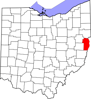 Map of Ohio highlighting Jefferson County | |
| Villages | ||
| Townships | ||
| CDPs | ||
| Other unincorporated communities |
| |
| Footnotes | ‡This populated place also has portions in an adjacent county or counties | |
This article is issued from Wikipedia. The text is licensed under Creative Commons - Attribution - Sharealike. Additional terms may apply for the media files.