Concepción del Oro Municipality
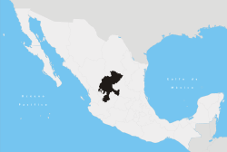
Concepción del Oro is one of the 58 municipalities in the Mexican state of Zacatecas. It is located on the northern part of the state and it is bounded by the municipalities of Mazapil and El Salvador; it also lies next to the states of Coahuila and San Luis Potosí. The municipality covers a total surface area of 2,559 square kilometers (988 sq mi).[2]
Municipality of Concepción del Oro | |
|---|---|
Municipality | |
 | |
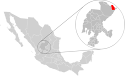 Location of Concepción del Oro within Zacatecas and Mexico | |
| Coordinates: 24°42′N 101°25′W | |
| Country | Mexico |
| State | Zacatecas |
| Municipal seat | Concepción del Oro |
| Largest city | Concepción del Oro |
| Founded | 1587 |
| Municipality | 1857 |
| Government | |
| • Municipal President | J. Jesús Martínez Horta |
| Area | |
| • Total | 2,559 km2 (988 sq mi) |
| Elevation | 2,070 m (6,790 ft) |
| Population (2005)[1] | |
| • Total | 11,857 |
| • Largest city | 6,653 Concepción del Oro |
| Time zone | UTC-6 (Central (US Central)) |
| • Summer (DST) | UTC-5 (Central) |
| Postal Code | 98200, 98204, 98205, 98209-98212 |
| Area code(s) | 842 |
| Website | https://web.archive.org/web/20070901221445/http://www.concepciondeloro.gob.mx/ |
Population
In the 2005 census Concepción del Oro reported a population of 11,857.[1] Of these, 6,653 lived in the municipal seat and the remainder lived in surrounding rural communities.
Climate
| Climate data for Concepción del Oro (1951–2010) | |||||||||||||
|---|---|---|---|---|---|---|---|---|---|---|---|---|---|
| Month | Jan | Feb | Mar | Apr | May | Jun | Jul | Aug | Sep | Oct | Nov | Dec | Year |
| Record high °C (°F) | 29.5 (85.1) |
30.0 (86.0) |
32.0 (89.6) |
36.0 (96.8) |
39.5 (103.1) |
35.5 (95.9) |
34.0 (93.2) |
32.5 (90.5) |
32.0 (89.6) |
37.0 (98.6) |
29.0 (84.2) |
29.5 (85.1) |
39.5 (103.1) |
| Average high °C (°F) | 18.0 (64.4) |
20.1 (68.2) |
23.3 (73.9) |
26.3 (79.3) |
28.1 (82.6) |
28.6 (83.5) |
27.4 (81.3) |
27.3 (81.1) |
25.9 (78.6) |
23.8 (74.8) |
21.7 (71.1) |
18.8 (65.8) |
24.1 (75.4) |
| Daily mean °C (°F) | 10.8 (51.4) |
12.6 (54.7) |
15.2 (59.4) |
18.3 (64.9) |
20.3 (68.5) |
21.3 (70.3) |
20.7 (69.3) |
20.5 (68.9) |
19.1 (66.4) |
16.7 (62.1) |
14.2 (57.6) |
11.8 (53.2) |
16.8 (62.2) |
| Average low °C (°F) | 3.7 (38.7) |
5.1 (41.2) |
7.1 (44.8) |
10.4 (50.7) |
12.6 (54.7) |
14.0 (57.2) |
13.9 (57.0) |
13.6 (56.5) |
12.4 (54.3) |
9.5 (49.1) |
6.6 (43.9) |
4.8 (40.6) |
9.5 (49.1) |
| Record low °C (°F) | −7.5 (18.5) |
−6.0 (21.2) |
−5.0 (23.0) |
0.0 (32.0) |
6.0 (42.8) |
7.0 (44.6) |
7.0 (44.6) |
7.0 (44.6) |
3.5 (38.3) |
−0.5 (31.1) |
−3.5 (25.7) |
−11.0 (12.2) |
−11.0 (12.2) |
| Average precipitation mm (inches) | 26.9 (1.06) |
13.6 (0.54) |
12.4 (0.49) |
20.8 (0.82) |
34.7 (1.37) |
51.6 (2.03) |
77.0 (3.03) |
61.3 (2.41) |
59.4 (2.34) |
34.6 (1.36) |
17.6 (0.69) |
24.8 (0.98) |
434.7 (17.11) |
| Average precipitation days (≥ 0.1 mm) | 3.4 | 2.5 | 2.0 | 3.4 | 6.1 | 7.5 | 9.9 | 8.5 | 8.6 | 5.3 | 2.6 | 3.9 | 63.7 |
| Source: Servicio Meteorologico Nacional[3][4] | |||||||||||||
Economy
Agriculture is one of the main economical activities in Concepción del Oro, it is based in temporary harvesting of mainly: beans, maize, oats, barley and wheat.
References
- Link to tables of population data from Census of 2005 Archived 2013-04-06 at the Wayback Machine INEGI: Instituto Nacional de Estadística, Geografía e Informática
- "Archived copy". Archived from the original on 2007-09-30. Retrieved 2008-12-10.CS1 maint: archived copy as title (link) "Concepción del Oro", Encyclopedia de Municipios
- "Estado de Zacatecas-Estacion: Concepción del Oro". Normales Climatologicas 1951–2010 (in Spanish). Servicio Meteorologico Nacional. Archived from the original on 4 March 2016. Retrieved 22 April 2015.
- "Extreme Temperatures and Precipitation for Concepción del Oro 1961–2011" (in Spanish). Servicio Meteorológico Nacional. Archived from the original on 4 March 2016. Retrieved 22 April 2015.
| Wikimedia Commons has media related to Concepción del Oro Municipality. |
Zacatecas (capital) | ||
| Municipalities and (municipal seats) |
|  |
This article is issued from Wikipedia. The text is licensed under Creative Commons - Attribution - Sharealike. Additional terms may apply for the media files.