Conca, Corse-du-Sud
Conca is a commune in the Corse-du-Sud department of France on the island of Corsica. It is the southern terminus of the GR 20 walking route.
Conca | |
|---|---|
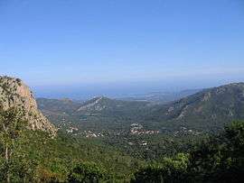 A view of the village of Conca from the GR20 | |
Location of Conca 
| |
 Conca 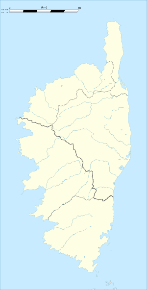 Conca | |
| Coordinates: 41°44′09″N 9°20′02″E | |
| Country | France |
| Region | Corsica |
| Department | Corse-du-Sud |
| Arrondissement | Sartène |
| Canton | Bavella |
| Intercommunality | Côte des Nacres |
| Government | |
| • Mayor (2001–2008) | François Mosconi |
| Area 1 | 77.96 km2 (30.10 sq mi) |
| Population (2017-01-01)[1] | 1,100 |
| • Density | 14/km2 (37/sq mi) |
| Time zone | UTC+01:00 (CET) |
| • Summer (DST) | UTC+02:00 (CEST) |
| INSEE/Postal code | 2A092 /20135 |
| Elevation | 0–1,445 m (0–4,741 ft) (avg. 250 m or 820 ft) |
| 1 French Land Register data, which excludes lakes, ponds, glaciers > 1 km2 (0.386 sq mi or 247 acres) and river estuaries. | |
Population
| Historical population | ||
|---|---|---|
| Year | Pop. | ±% |
| 1800 | 343 | — |
| 1806 | 376 | +9.6% |
| 1821 | 420 | +11.7% |
| 1831 | 424 | +1.0% |
| 1836 | 487 | +14.9% |
| 1841 | 538 | +10.5% |
| 1846 | 588 | +9.3% |
| 1851 | 558 | −5.1% |
| 1856 | 558 | +0.0% |
| 1861 | 590 | +5.7% |
| 1866 | 617 | +4.6% |
| 1872 | 619 | +0.3% |
| 1876 | 655 | +5.8% |
| 1881 | 665 | +1.5% |
| 1886 | 726 | +9.2% |
| 1891 | 754 | +3.9% |
| 1896 | 806 | +6.9% |
| 1901 | 1,015 | +25.9% |
| 1906 | 1,026 | +1.1% |
| 1911 | 1,078 | +5.1% |
| 1921 | 1,093 | +1.4% |
| 1926 | 1,095 | +0.2% |
| 1931 | 1,181 | +7.9% |
| 1936 | 1,254 | +6.2% |
| 1946 | 1,057 | −15.7% |
| 1954 | 1,051 | −0.6% |
| 1962 | 399 | −62.0% |
| 1968 | 432 | +8.3% |
| 1975 | 481 | +11.3% |
| 1982 | 546 | +13.5% |
| 1990 | 783 | +43.4% |
| 1999 | 770 | −1.7% |
| 2008 | 1,038 | +34.8% |
References
- "Populations légales 2017". INSEE. Retrieved 6 January 2020.
| Wikimedia Commons has media related to Conca. |
| Authority control |
|
|---|
This article is issued from Wikipedia. The text is licensed under Creative Commons - Attribution - Sharealike. Additional terms may apply for the media files.