Columbus Municipal Airport (Indiana)
Columbus Municipal Airport (IATA: CLU, ICAO: KBAK, FAA LID: BAK) is three miles north of Columbus, in Bartholomew County, Indiana, United States.[1]
Columbus Municipal Airport | |||||||||||||||
|---|---|---|---|---|---|---|---|---|---|---|---|---|---|---|---|
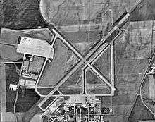 USGS photo - 7 Aug 1997 | |||||||||||||||
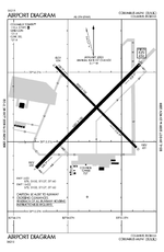 FAA diagram | |||||||||||||||
| Summary | |||||||||||||||
| Airport type | Public | ||||||||||||||
| Owner | City of Columbus | ||||||||||||||
| Location | Columbus, Indiana | ||||||||||||||
| Elevation AMSL | 656 ft / 200 m | ||||||||||||||
| Coordinates | 39°15′43″N 085°53′47″W | ||||||||||||||
| Map | |||||||||||||||
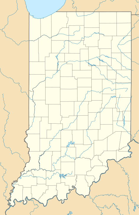 BAK Location of airport in Indiana/United States  BAK BAK (the United States) | |||||||||||||||
| Runways | |||||||||||||||
| |||||||||||||||
| Statistics | |||||||||||||||
| |||||||||||||||
- For the military use of this facility, see Bakalar Air Force Base
Most U.S. airports use the same three-letter location identifier for the FAA and IATA, but this airport is BAK to the FAA and CLU to the IATA.[2]

History
The airport is on the site of the former World War II Atterbury Army Airfield, a U.S. Army Air Forces facility, and Bakalar Air Force Base, a Cold War-era U.S. Air Force installation utilized primarily by the Air Force Reserve. It was the host base for the 434th Troop Carrier Wing twice, from 1949-1952 and again from 1953-1969.
Facilities
Columbus Municipal Airport covers 2,000 acres (810 ha) at an elevation of 656 feet (200 m). It has two concrete runways: 5/23 is 6,400 by 150 feet (1,951 x 46 m) and 14/32 is 5,000 by 100 feet (1,524 x 30 m).[1]
In 2005 the airport had 39,155 aircraft operations, average 107 per day: 91% general aviation and 9% military. In 2015, 77 aircraft were based at the airport: 58 single-engine, 8 multi-engine, 7 jet, 2 helicopter, 1 glider and 1 ultra-light.[1]
Terminal building
The airport completely renovated its terminal building in 2015.
References
- FAA Airport Master Record for BAK (Form 5010 PDF), effective 2009-05-07.
- "CLU - Columbus [Muni], IN, US - Airport - Great Circle Mapper". gc.kls2.com.
External links
- Columbus Municipal Airport
- Aerial photo from Indiana Department of Transportation
- FAA Airport Diagram for Columbus Municipal (BAK) (PDF), effective June 18, 2020
- FAA Terminal Procedures for Columbus Municipal (BAK), effective June 18, 2020
- Resources for this airport:
- FAA airport information for BAK
- AirNav airport information for KBAK
- ASN accident history for CLU
- FlightAware airport information and live flight tracker
- NOAA/NWS weather observations: current, past three days
- SkyVector aeronautical chart, Terminal Procedures