Columbia Township, Whitley County, Indiana
Columbia Township is one of nine townships in Whitley County, Indiana, United States. As of the 2010 census, its population was 11,047 and it contained 4,799 housing units.[2]
Columbia Township | |
|---|---|
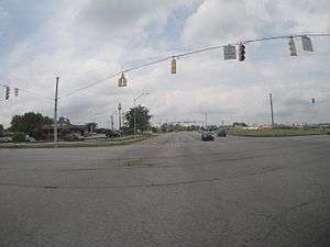 Intersection of U.S. 30 and State Highway 9 in Columbia Township | |
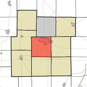 Location in Whitley County | |
| Coordinates: 41°08′05″N 85°30′45″W | |
| Country | United States |
| State | Indiana |
| County | Whitley |
| Government | |
| • Type | Indiana township |
| Area | |
| • Total | 36.73 sq mi (95.1 km2) |
| • Land | 36.71 sq mi (95.1 km2) |
| • Water | 0.02 sq mi (0.05 km2) 0.05% |
| Elevation | 830 ft (253 m) |
| Population (2010) | |
| • Total | 11,047 |
| • Density | 301/sq mi (116/km2) |
| Time zone | UTC-5 (Eastern (EST)) |
| • Summer (DST) | UTC-4 (EDT) |
| Area code(s) | 260 |
| GNIS feature ID | 453242 |
Geography
According to the 2010 census, the township has a total area of 36.73 square miles (95.1 km2), of which 36.71 square miles (95.1 km2) (or 99.95%) is land and 0.02 square miles (0.052 km2) (or 0.05%) is water.[2] The streams of Blue Babe Branch, Blue River and Stony Creek run through this township.
Cities and towns
- Columbia City (vast majority)
Unincorporated towns
(This list is based on USGS data and may include former settlements.)
Adjacent townships
- Thorncreek Township (north)
- Union Township (east)
- Jefferson Township (southeast)
- Washington Township (south)
- Cleveland Township (southwest)
- Richland Township (west)
Cemeteries
The township contains five cemeteries: Bethel, Nolt, Oak Grove, Saint Peters and South Park.
References
- "Columbia Township, Whitley County, Indiana". Geographic Names Information System. United States Geological Survey. Retrieved 2009-09-24.
- United States Census Bureau cartographic boundary files
- "US Board on Geographic Names". United States Geological Survey. October 25, 2007. Retrieved 2017-05-08.
- "Population, Housing Units, Area, and Density: 2010 - County -- County Subdivision and Place -- 2010 Census Summary File 1". United States Census. Archived from the original on 2020-02-12. Retrieved 2013-05-10.
External links
Municipalities and communities of Whitley County, Indiana, United States | ||
|---|---|---|
| City | Map of Indiana highlighting Whitley County | |
| Towns | ||
| Townships | ||
| CDP | ||
| Other unincorporated communities | ||
| Footnotes | ‡This populated place also has portions in an adjacent county or counties | |
This article is issued from Wikipedia. The text is licensed under Creative Commons - Attribution - Sharealike. Additional terms may apply for the media files.