Colle della Rho
The Collle della Rho (in Italian[1]) or Col de la Roue (in French[2]) is a mountain col at 2,541 metres (8,337 ft), in the Cottian Alps.
| Colle della Rho | |
|---|---|
| Col de la Roue, Colle della Rhô | |
 | |
| Elevation | 2,541 m (8,337 ft) |
| Traversed by | dirt road and bridle path |
| Location | Savoie, France / Province of Turin, Italy |
| Range | Cottian Alps |
| Coordinates | 45°06′58″N 6°38′34″E |
 Col de la Roue Location of Colle della Rho in the Alps | |
Toponymy
The col was named in Latin Collis Rotae (literally Col of the Wheel), the same meaning of its present-day French name, Col da Roue. On the official Italian maps at the beginning of the 20th century was added a "h" to an old name of the col, Colle della Rô, turning it in Colle della Rhô. Leter on the circumflex accent was lost ending up in Colle della Rho, the present-day most common Italian name of the col.[3] However, on some editions of the Italian official maps of IGM[4] and on the technical map adopted by the Regione Piemonte [5] the circumflex accent still appears.
History
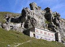
The Colle della Rho during antiquity was one of the most frequented connetions between Susa Valley and Maurienne, and close to it some Roman coins have been found. From the middle ages on several battles and skirmish occurred on the pass, which was located at first on the border between Dauphiné and Savoy (up to the Peace of Utrecht, 1713) and later, from 1860 on, between France and Italy.[3] The last fights near the col were connected to the italian invasion of France (June 1940).[6]
Geography
The pass is located on the border between France and Italy. It connects Bardonecchia (Italy) to Fourneaux and Modane (France). It consists in a whide saddle between the Gran Bagna (3,089 m, SW of the col) and the Roc de Jany (2,659 m, East), a satellite summit of the Punta Nera. The road over the mountain pass is not paved, and is a popular hike with mountain bike.[7]
References
- R.Aruga; P.Losana; A.Re (1985). "Sottogruppo Fréjus". Alpi Cozie Settentrionali. Guida dei Monti d'Italia (in Italian). San Donato Milanese: Club Alpino Italiano - Touring Club Italiano. p. 270.
- Official French 1:25.000 IGM maps (Map). IGN. Retrieved 2019-03-29.
- Bellino Tripi, Eleonora; Ceragioli, Filippo; Molino, Aldo (2005). Alta Valle di Susa (in Italian). Torino: Cda&Vivalda. pp. 151–154. ISBN 88-7480-065-7.
- Official Italian 1:25.000 IGM maps (Map). Istituto Geografico Militare. Retrieved 2019-03-29.
- Carta Tecnica Regionale raster 1:10.000 (vers.3.0), Regione Piemonte, year 2007
- Minola, Mauro (2010). Battaglie di confine della Seconda Guerra Mondiale (in Italian). Sant'Ambrogio di Torino: Susalibri. pp. 85–92. ISBN 978-88-88916-67-5.
- Guido Borio. "Colle della Rho-Colle di Valle Stretta" (in Italian). Retrieved 2019-03-29.