Coleorton
Coleorton (/kəˈlɔːrtən/ kə-LOR-tən) is a village and civil parish in North West Leicestershire, England. It is situated on the A512 road approximately 2 miles (3.2 km) east of Ashby de la Zouch. Nearby villages include Newbold, to the north, Thringstone to the east, and Swannington to the south-east.
| Coleorton | |
|---|---|
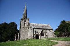 Church of St Mary the Virgin | |
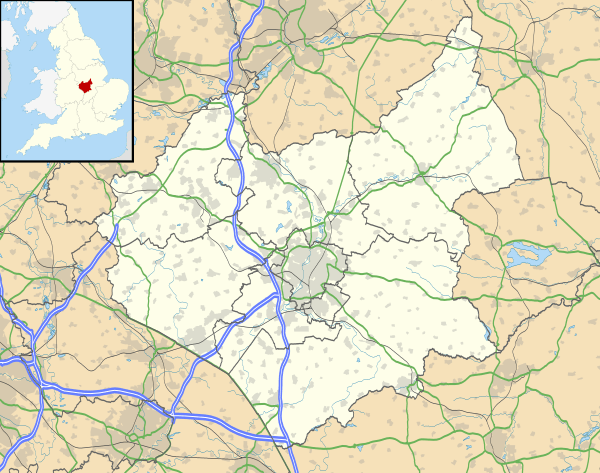 Coleorton Location within Leicestershire | |
| Population | 1,177 (Including Farm Town. 2011) |
| OS grid reference | SK404172 |
| Civil parish |
|
| District | |
| Shire county | |
| Region | |
| Country | England |
| Sovereign state | United Kingdom |
| Post town | COALVILLE |
| Postcode district | LE67 |
| Dialling code | 01530 |
| Police | Leicestershire |
| Fire | Leicestershire |
| Ambulance | East Midlands |
| UK Parliament | |
In the 2001 census, the population of the parish was 1,016,[1] increasing to 1,177 at the 2011 census.[2]
Formerly an ancient parish in West Goscote hundred, Coleorton became part of Ashby de la Zouch Rural District which was created in 1894.[3]
Coal mining was an important industry in the area since the 15th century.[4] In 1572, the miners worked in gangs of 10-20 men, with the gang paid one shilling for each 'rook' they dug out (the rook was a fixed quantity, believed to be c. 1-2 tons).[5] Coleorton Colliery, which was between Coleorton and Swannington, is now closed, and a woodland Coleorton Wood was planted in 1991-2 on the colliery site as part of the National Forest.[6] Opencast mining operated between 1985 and 1995.[4]
Coleorton was the birthplace of William Stenson (1771–1861), founder of Whitwick Colliery and 'Father of Coalville'
The Grade II* listed Coleorton Hall, in the west of the parish, was built in 1804-8 for the art patron Sir George Beaumont. William Wordsworth was a regular and frequent guest of Sir George Beaumont at the Hall. Between 1948 and 1997 the house was owned by the National Coal Board and used as offices, and it has now been converted into apartments.[7][8]
Coleorton has a post office and is served by three public bus services.
References
- "Census: Key Statistics: Parish Headcounts: Area: Coleorton CP (Parish)". Office for National Statistics. Retrieved 1 July 2008.
- "Civil Parish population 2011". Neighbourhood Statistics. Office for National Statistics. Retrieved 10 June 2016.
- "Coleorton AP/CP Leicestershire through time". A Vision of Britain Through Time. Retrieved 1 July 2008.
- Hartley, R. F. (January 2000). "An Archaeological Resource Assessment of Post-Medieval Leicestershire" (PDF). East Midlands Archaeological Research Framework Project. University of Leicester. Archived from the original (PDF) on 7 December 2008. Retrieved 1 July 2008.
- R.A. McKinley, 'Mining', in Victoria County History of Leicestershire, vol. III (1955), p. 32
- "The National Forest - Woodlands - Coleorton Wood". National Forest Company. 2005. Retrieved 1 July 2008.
- Lennox, Marsya (18 June 2004). "Property: Apartments at Coleorton Hall". Birmingham Post. Retrieved 1 July 2008.
- "Coleorton Hall Garden of Special Historic Interest" (PDF). North West Leicestershire District Council. Retrieved 1 July 2008.
External links
| Wikimedia Commons has media related to Coleorton. |
Towns and villages of North West Leicestershire | ||
|---|---|---|
| Towns | 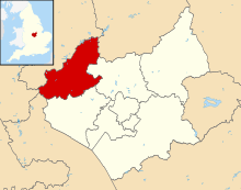 | |
| Large villages | ||
| Small villages |
| |
| Hamlets |
| |