Colborne Parish, New Brunswick
Colborne is a Canadian parish in Restigouche County, New Brunswick.[2]
Colborne | |
|---|---|
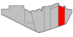 Location within Restigouche County. | |
| Coordinates: 47.8875°N 66.27°W | |
| Country | |
| Province | |
| County | Restigouche |
| Established | 1839 |
| Area | |
| • Land | 754.96 km2 (291.49 sq mi) |
| Population (2016)[1] | |
| • Total | 227 |
| • Density | 0.3/km2 (0.8/sq mi) |
| • Pop 2011-2016 | |
| • Dwellings | 144 |
| Time zone | UTC-4 (AST) |
| • Summer (DST) | UTC-3 (ADT) |
Delineation
Colborne Parish is defined in the Territorial Division Act[3] as being bounded:
- West by Dalhousie and Balmoral Parishes; south by the County line; east by a line running true south from the mouth of Benjamin River, and north by Chaleur Bay including Heron Island and all the other islands in front.
Communities
Parish population total does not include incorporated municipalities (in bold or italics).
- Benjamin River
- Blackland
- Caribou Depot
- Charlo including:
- Mountain Brook
- River Charlo
- Upper Charlo
- New Mills
- Upper Crossing
- Lorne, New Brunswick - Technically the Northwestern part of Lorne. The Community of Lorne is Divided into 2 Parishes. Anyone from the Colborne part of the community is considered "Colbornian" as an ongoing joke for multiple generations.
Demographics
Population
| Canada census – Colborne Parish, New Brunswick community profile | |||
|---|---|---|---|
| 2016 | 2011 | 2006 | |
| Population: | 227 (+12.4% from 2011) | 202 (-13.7% from 2006) | 234 (-13.3% from 2001) |
| Land area: | 754.96 km2 (291.49 sq mi) | 754.95 km2 (291.49 sq mi) | 754.15 km2 (291.18 sq mi) |
| Population density: | 0.3/km2 (0.78/sq mi) | 0.3/km2 (0.78/sq mi) | 0.3/km2 (0.78/sq mi) |
| Median age: | 55.8 (M: 55.8, F: 55.7) | 50.5 (M: 49.3, F: 53.8) | 51.8 (M: 49.2, F: 54.5) |
| Total private dwellings: | 144 | 102 | 140 |
| Median household income: | $39,808 | $.N/A | $.N/A |
| Notes: 2011 & 2006 income data for this area has been suppressed for data quality or confidentiality reasons. – References: 2016[4] 2011[5] 2006[6] earlier[7] | |||
| Historical Census Data Colborne Parish, NB | |||||||||||||||||||||||||||||
|---|---|---|---|---|---|---|---|---|---|---|---|---|---|---|---|---|---|---|---|---|---|---|---|---|---|---|---|---|---|
|
|
| |||||||||||||||||||||||||||
| [8][1] | |||||||||||||||||||||||||||||
Language
| Canada Census Mother Tongue - Colborne Parish, New Brunswick[8] | ||||||||||||||||||
|---|---|---|---|---|---|---|---|---|---|---|---|---|---|---|---|---|---|---|
| Census | Total | English |
French |
English & French |
Other | |||||||||||||
| Year | Responses | Count | Trend | Pop % | Count | Trend | Pop % | Count | Trend | Pop % | Count | Trend | Pop % | |||||
2011 |
200 |
160 | 80.00% | 35 | 17.50% | 0 | 0.00% | 5 | 2.50% | |||||||||
2006 |
235 |
200 | 85.11% | 15 | 6.38% | 20 | 8.51% | 0 | 0.00% | |||||||||
2001 |
275 |
250 | 90.91% | 25 | 9.09% | 0 | 0.00% | 0 | 0.00% | |||||||||
1996 |
250 |
205 | n/a | 82.00% | 45 | n/a | 18.00% | 0 | n/a | 0.00% | 0 | n/a | 0.00% | |||||
Access Routes
Highways and numbered routes that run through the parish, including external routes that start or finish at the parish limits:[9]
See also
References
- "Census Profile, 2016 Census: Colborne Parish, New Brunswick". Statistics Canada. Retrieved August 26, 2019.
- New Brunswick Provincial Archives - Colborne Parish
- "Territorial Division Act (R.S.N.B. 1973, c. T-3)". Government of New Brunswick website. Retrieved 18 August 2016.
- "2016 Community Profiles". 2016 Canadian Census. Statistics Canada. February 21, 2017. Retrieved 2019-08-26.
- "2011 Community Profiles". 2011 Canadian Census. Statistics Canada. July 5, 2013. Retrieved 2014-03-16.
- "2006 Community Profiles". 2006 Canadian Census. Statistics Canada. March 30, 2011. Retrieved 2014-03-16.
- "2001 Community Profiles". 2001 Canadian Census. Statistics Canada. February 17, 2012.
- Statistics Canada: 1996, 2001, 2006, 2011 census
- Atlantic Canada Back Road Atlas ISBN 978-1-55368-618-7 Pages 6, 14-15
Places adjacent to Colborne Parish, New Brunswick | |
|---|---|
| Subdivisions |
|
|---|---|
| Cities | |
| Counties | |
| |
This article is issued from Wikipedia. The text is licensed under Creative Commons - Attribution - Sharealike. Additional terms may apply for the media files.