Clontycarnaghan
Clontycarnaghan (from Irish: Cluainte Chearnacháin meaning "Kernaghan’s Meadows") is a townland in the civil parish of Templeport, County Cavan, Ireland. It lies in the Roman Catholic parish of Templeport and barony of Tullyhaw.
Geography
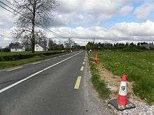
Clontycarnaghan is bounded on the north by Mullanacre Upper townland in Tomregan parish, on the west by Corneen and Munlough North townlands, on the south by Urhannagh and Bofealan townlands and on the east by Sralahan and Moher townlands in Tomregan parish. Its chief geographical features are Slieve Rushen mountain on whose southern slope it lies, the Crooked River (Ireland), waterfalls, mountain bogs, forestry plantations, spring wells and dug wells. It forms part of the Slieve Rushen Bog Natural Heritage Area . Clontycarnaghan is traversed by the national secondary N87 road (Ireland), minor roads and rural lanes. The townland covers 371 statute acres.[1]
History
Until the 19th century the modern townland of Corneen formed a sub-division of Clontycarnaghan.
The 1609 Baronial Map depicts the townland as Cloncarnagh.[2]
The 1652 Commonwealth Survey spells the name as Cloontikarnaghan.
The 1665 Down Survey map depicts it as Carnagh.[3]
William Petty's 1685 map depicts it as Carnagh.[4]
In the Plantation of Ulster by grant dated 4 June 1611, along with other lands, King James VI and I granted the two polls of Clonekarnehan to Callo O'Gowne, gentleman.[5]
The O'Gowne lands in Clontycarnaghan were confiscated in the Cromwellian Act for the Settlement of Ireland 1652 and were distributed as follows-
The 1652 Commonwealth Survey lists the proprietor as Thomas Thornton and the tenant as Hugh O'Backaghan.
In the Hearth Money Rolls compiled on 29 September 1663[6] there were two Hearth Tax payers in Clunticarnagh- William Mathers and Walter Rice.
A grant dated 3 November 1666 was made by King Charles II of England to Sir Tristram Beresford, 1st Baronet which included, inter alia, the lands of Clantacannagh.[7] By grant dated 11 September 1670 from King Charles II of England to said Sir Tristram Beresford, the said lands of Clantacannagh were included in the creation of a new Manor of Beresford.[8]
The 1790 Cavan Carvaghs list spells the name as Clontecarnahan.[9]
The Tithe Applotment Books for 1827 (which spell it Clintecarnahan) list sixteen tithepayers in the townland.[10]
The Clontycarnaghan Valuation Office Field books are available for December 1839.[11][12][13][14]
Griffith's Valuation of 1857 lists twenty four landholders in the townland.[15]
Census
| Year | Population | Males | Females | Total Houses | Uninhabited |
|---|---|---|---|---|---|
| 1841 | 121 | 50 | 71 | 22 | 2 |
| 1851 | 72 | 36 | 36 | 21 | 2 |
| 1861 | 104 | 45 | 59 | 19 | 1 |
| 1871 | 87 | 45 | 42 | 16 | 0 |
| 1881 | 80 | 43 | 37 | 17 | 0 |
| 1891 | 69 | 30 | 39 | 16 | 0 |
In the 1901 census of Ireland, there are sixteen families listed in the townland, [16] and in the 1911 census of Ireland, there are seventeen families listed in the townland.[17]
Antiquities
The only structures of historical interest in the townland appear to be footsticks and footbridges over the Crooked River.[18]
References
- "IreAtlas". Retrieved 29 February 2012.
- National Archives Dublin
- Trinity College Dublin: The Down Survey of Ireland.
- The Hearth Money Rolls for the Baronies of Tullyhunco and Tullyhaw, County Cavan, edited by Rev. Francis J. McKiernan, in Breifne Journal. Vol. I, No. 3 (1960), pp. 247-263
- Bawnboy/Clontycarnaghan
- Bawnboy/Clontycarnaghan/ Census of Ireland 1911
- 25 inch OS Map
External links
Places in County Cavan | ||
|---|---|---|
| Towns |  | |
| Villages |
| |
| Townlands | ||
| ||