Clear Creek, Utah
Clear Creek is a small census-designated place on the western edge of Carbon County, Utah, United States. It is located at the south end of State Route 96 and the Pleasant Valley Branch of the Union Pacific Railroad (ex-D&RGW).
Clear Creek, Utah Clear Creek Summer Camp | |
|---|---|
Location in Carbon County and the state of Utah. | |
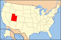 Location of Utah in the United States | |
| Coordinates: 39°38′40″N 111°09′45″W | |
| Country | United States |
| State | Utah |
| County | Carbon |
| Founded | 1870s |
| Area | |
| • Total | 0.20 sq mi (0.53 km2) |
| • Land | 0.20 sq mi (0.53 km2) |
| • Water | 0.0 sq mi (0.0 km2) |
| Elevation | 8,743 ft (2,665 m) |
| Population (2010) | |
| • Total | 4 |
| • Density | 20/sq mi (7.6/km2) |
| GNIS feature ID | 2584759[1] |
History
Clear Creek was founded in the 1870s as a logging camp that supplied lumber to the nearby mining town of Winter Quarters.[2] About twenty years after Clear Creek was founded, coal was discovered beneath the town and a mine was developed. In 1898, the Denver and Rio Grande Western Railroad built a spur line from Scofield to the mine at Clear Creek. Two years later, the Utah Fuel Company built 25 homes, a hotel, a store, a hospital, a schoolhouse, a workshop, and a water plant in the town.[2][3] From 1910–1920, 2,000 tons of coal was being mined per day, and Clear Creek had about 600 residents. In 1930, the need for coal began to decrease, and by 1955, the mine had cut production and the town's population had decreased to 150.[3] According to the 2010 Census, there were four people residing in town.[4]
The town is currently used as a recreation and camp area for various schools and programs, with cabins, a restroom and shower area, and a recreation and eating area.
Climate
Clear Creek has a warm-summer humid continental climate (Köppen Dfb), bordering on subarctic (Dfc). Summertime is generally mild to warm, with nights dropping into the 30's and 40's, and wintertime is cold and snowy, with a yearly average of 237 inches (603 cm) of snow accumulation. Wintry days may be observed as late as June or as early as September due to the Town's location in the Wasatch Mountain Range.
| Climate data for CLEAR CREEK, UTAH | |||||||||||||
|---|---|---|---|---|---|---|---|---|---|---|---|---|---|
| Month | Jan | Feb | Mar | Apr | May | Jun | Jul | Aug | Sep | Oct | Nov | Dec | Year |
| Average high °F (°C) | 31.2 (−0.4) |
34.0 (1.1) |
38.2 (3.4) |
47.8 (8.8) |
57.9 (14.4) |
69.2 (20.7) |
76.8 (24.9) |
74.2 (23.4) |
67.0 (19.4) |
56.7 (13.7) |
41.7 (5.4) |
34.3 (1.3) |
52.4 (11.3) |
| Average low °F (°C) | 6.5 (−14.2) |
8.2 (−13.2) |
12.7 (−10.7) |
21.7 (−5.7) |
28.4 (−2.0) |
35.0 (1.7) |
41.8 (5.4) |
40.7 (4.8) |
33.7 (0.9) |
26.7 (−2.9) |
16.8 (−8.4) |
9.3 (−12.6) |
23.5 (−4.7) |
| Average precipitation inches (mm) | 2.69 (68) |
2.30 (58) |
2.41 (61) |
1.82 (46) |
1.42 (36) |
1.29 (33) |
1.48 (38) |
1.99 (51) |
1.57 (40) |
1.52 (39) |
1.65 (42) |
2.89 (73) |
24.05 (611) |
| Average snowfall inches (cm) | 46.2 (117) |
36.7 (93) |
42.1 (107) |
23.0 (58) |
8.7 (22) |
0.7 (1.8) |
0.1 (0.25) |
0 (0) |
1.7 (4.3) |
8.3 (21) |
25.0 (64) |
43.3 (110) |
237.3 (603) |
| Source: The Western Regional Climate Center [5] | |||||||||||||
References
- U.S. Geological Survey Geographic Names Information System: Clear Creek
- "Clear Creek". Western Mining & Railroad Museum. Archived from the original on May 13, 2014. Retrieved May 12, 2014.
- Carr, Stephen L. (1986) [1972]. The Historical Guide to Utah Ghost Towns. Salt Lake City, Utah: Western Epics. p. 75. ISBN 978-0-914740-30-8.
- "Geographic Identifiers: 2010 Census Summary File 1 (G001): Clear Creek CDP, Utah". U.S. Census Bureau, American Factfinder. Archived from the original on February 13, 2020. Retrieved August 11, 2015.
- "CLEAR CREEK, UTAH (421472)". Retrieved December 19, 2015.
External links
| Wikimedia Commons has media related to Clear Creek, Utah. |
Places adjacent to Clear Creek, Utah | ||||||||||
|---|---|---|---|---|---|---|---|---|---|---|
| ||||||||||
Municipalities and communities of Carbon County, Utah, United States | ||
|---|---|---|
| Cities | 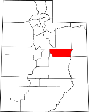 Map of Utah highlighting Carbon County | |
| Town | ||
| CDPs | ||
| Indian reservation | ||
| Ghost towns | ||
| Footnotes | ‡This populated place also has portions in an adjacent county or counties | |