Cisa Pass
The Cisa Pass or La Cisa Pass is a mountain pass in Italy that marks the division between the Ligurian and Tuscan Apennines. It is located on the border between northern Tuscany (Province of Massa-Carrara) and Emilia-Romagna (Province of Parma), near the source of the Magra River at an altitude of 1,040 meters (3,414 feet) above sea level.[1]
| Cisa Pass | |
|---|---|
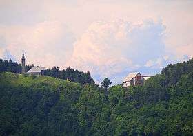 The Cisa Pass seen from the south | |
| Elevation | 1,041 m (3,415 ft) |
| Traversed by | |
| Location | Italy |
| Range | Apennine Mountains |
| Coordinates | 44°28′18″N 9°55′42″E |
 Cisa Pass Location of Cisa Pass | |
Notes
- Webster's New Geographical Dictionary, Third Edition, p. 59
References
- Webster's New Geographical Dictionary, Third Edition. Springfield, Massachusetts: Merriam-Webster, Inc., 1997. ISBN 0-87779-546-0.
This article is issued from Wikipedia. The text is licensed under Creative Commons - Attribution - Sharealike. Additional terms may apply for the media files.