Christopher Creek, Arizona
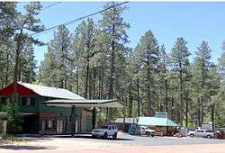
Christopher Creek is a census-designated place in northern Gila County in the state of Arizona. Situated at the base of the Mogollon Rim, the community lies at an elevation of 5,961 feet (1,817 m),[2] and is located approximately 23.5 miles (37.82 km) northeast of Payson, just off SR 260. The population as of the 2010 U.S. Census was 156.[5]
Christopher Creek, Arizona | |
|---|---|
 | |
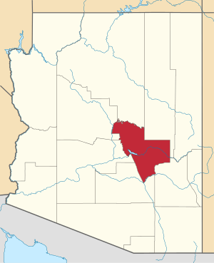
 Location of Christopher Creek in Gila County, Arizona. | |
 Christopher Creek Location of Christopher Creek in Gila County, Arizona.  Christopher Creek Christopher Creek (the United States) | |
| Coordinates: 34°21′17.98″N 111°1′17.90″W | |
| Country | |
| State | |
| County | Gila |
| Area | |
| • Total | 3.03 sq mi (7.86 km2) |
| • Land | 3.03 sq mi (7.86 km2) |
| • Water | 0.00 sq mi (0.00 km2) |
| Elevation | 5,961 ft (1,817 m) |
| Population | |
| • Total | 156 |
| • Estimate (2016)[4] | 76 |
| Time zone | UTC−7 (MST) |
| • Summer (DST) | UTC−7 (no DST/PDT) |
| ZIP code | 85541 |
| Area code(s) | 928 |
| FIPS code | 04-13140 |
| GNIS ID(s) | 2582755 |
Tourism, retirement and timbering are the foundations of Christopher Creek's economy.
See also
Christopher Creek - Geological feature
References
- "2016 U.S. Gazetteer Files". United States Census Bureau. Retrieved Jul 18, 2017.
- "Feature Detail Report for: Christopher Creek". Geographic Names Information System. United States Geological Survey.
- U.S. Census Bureau (2010). "2010 Census Interactive Population Search". U.S. Government. Archived from the original on 2013-08-19.
- "Population and Housing Unit Estimates". Retrieved June 9, 2017.
- "2010 Census Interactive Population Search". census.gov. Archived from the original on 2014-04-13. Retrieved 2014-04-13.
- "Census of Population and Housing". Census.gov. Retrieved June 4, 2016.
- "Route Schedule/Stops". Retrieved 2020-01-27.
This article is issued from Wikipedia. The text is licensed under Creative Commons - Attribution - Sharealike. Additional terms may apply for the media files.