Chipata
The city of Chipata is the administrative centre of the Eastern Province of Zambia and Chipata District. It was declared the 5th city of the country, after Lusaka, Ndola, Kitwe and Livingstone, by President Edgar Lungu on 24 February 2017. The city has undergone rapid economic and infrastructure growth in the years, leading up to city status.[1]
Chipata | |
|---|---|
 | |
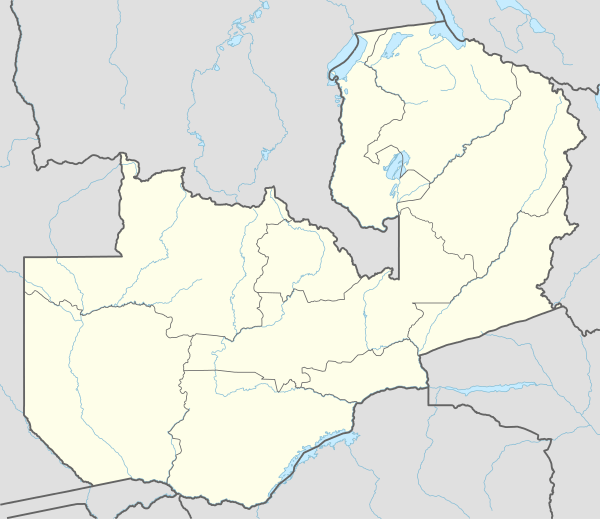 Chipata Location in Zambia | |
| Coordinates: 13°38′43″S 32°38′47″E | |
| Country | |
| Province | Eastern Province |
| District | Chipata District |
| Founded | 1899 |
| City status | 2017 |
| Government | |
| • Type | Local Government |
| • Mayor | Sinoya Mwale |
| Elevation | 3,875 ft (1,181 m) |
| Population (2010) | |
| • Total | 455,783 |
| • Density | 176/sq mi (68.1/km2) |
| Time zone | UTC+2 (CAT) |
| Climate | Aw |
Location
Chipata is located approximately 570 kilometres (354 mi), east of Lusaka, the capital city of Zambia.[2] This is about 150 kilometres (93 mi) west of Lilongwe, the capital city of Malawi.[3] The geographical coordinates of Chipata are 13°38'43.0"S, 32°38'47.0"E (Latitude:13°38'43.0"S; Longitude:32°38'47.0"E).[4] The average elevation of Chipata is 1,181 metres (3,875 ft), above sea level.[5]
Overview
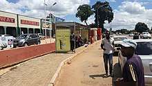
Having a modern market, a central hospital, shopping malls, a university, some colleges and a number of schools, Chipata is the business and administrative hub of the region. The town boasts a four star hotel, a golf course, an airport, and a "welcome arch". Developed areas includes Kalongwezi, Moth, and Little Bombay.
Chipata is the regional head of the Ngoni of Zambia. The Ngoni adopted the languages of the tribes they conquered, so Chewa and Nsenga are the principal languages, although Tumbuka and English are widely spoken, plus some Indian languages, as a large number of Zambian Indians live in the town. It is located near the border with Malawi, and lies on the Great East Road which connects the capitals Lilongwe 150 kilometres (93 mi) to the east,[3] and Lusaka 570 kilometres (354 mi) to the west.[4] It is a popular access point for the South Luangwa National Park.
History
Chipata's name comes from the Chewa word "Chimpata" meaning "large space," in reference to the town's situation in a shallow valley between hills. The name of the central neighbourhood of Kapata, the original centre of town, comes from the Chewa word meaning "small space."
Chipata was formerly known as Fort Jameson (and informally as "Fort Jimmy"), being named after Leander Starr Jameson, the 19th-century British politician and adventurer. Even during the colonial period, few agreed that Jameson, who is mainly known for his part in the infamous Jameson Raid, fully deserved the honour of having any town named after him. Like 'Fort Manning' and 'Fort Rosebery', Fort Jameson was called a "fort" because the local government offices, the "boma", were once fortified.
Fort Jameson was the capital of the British protectorate of North-Eastern Rhodesia between 1900 and 1911.
Suburbs
- Kalongwezi
- Kalongwezi Extension
- Kapata
- Umodzi
- Moth
- Muchini
- Nabvutika
- Little Bombay
- Mchenga
- Damview
- Old Gym
- New Gym
- Chimwemwe
- Magazine
- Eastrise
- Walela
- Chawama
- Munga
- Chipata Motel
- Nadalitsika
- Katopola
- Maferendum
- Rose
- Hillview
- Gash
- Msekera
- Messengers
- David Kaunda area
- Hollywood
- Kalongola site and service
- Hillview
- Chimzere
- Gondar Barracks
- Highlands
- Aslot
Government
The mayor of the city of Chipata is the head of the city government.
Population
With a population of about 455,783 in 2010,[6] the Chipata district is believed to be the 3rd largest district of the country. The city of Chipata had 116.600 inhabitants in 2010.[7] The predominant ethnic groups in the city are the Chewa, Tumbuka, Ngoni and Nsenga.[8]
Economy
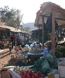
A significant amount of trade occurs between Zambia and Malawi via Chipata. The city also has a bustling down town area known as "Down Shops" which has a lot of shops and other businesses mainly run by Zambians of Indian Origin. Most notable shops are Kavulamungu Bargain Centre and Ally and Sons.
Tourism
The Nc'wala ceremony of the Ngoni people takes place at Mutenguleni on the outskirts of Chipata. The ceremony celebrates the first fruits harvest and is usually held at the end of February.[1]
Education
Primary education
- SPS (Shakespeare private school)
- Hillside Primary School
- Mpezeni Primary School
- Chipata Primary School
- Kapata Primary School
- Chongololo School
- St Anne's Primary School
- Trinity private School
- Mem private School
- Lunkwakwa Primary school
- St. Betty Primary school
- Munga Primary school
- Mchini Primary school
- Nadalisika primary school
Msekera primary school
Secondary education
- Anoya Zulu Boys Secondary School
- Chizongwe Technical Secondary School
- St. Monicas Girls Secondary School
- Chipata Day Secondary School
- Hillside Girls High School
- St. Atanazio Secondary School
- St. Mary's Seminary School
- Damview Secondary School
- Muziphas high school
- Katopola Day secondary school
- Kanjala Day secondary school
- St Magrets Girls secondary school
- Lutembwe Day secondary school
- Mazimoyo Day Secondary school
- Gondar Day secondary school
- St Monicas Girls Secondary School
Tertiary education
- Chipata Teacher's Training College
- Chipata Trades Training Institute
- Chipata School of Nursing
- DMI-St. Eugene University
Transport
An extension of the Sena railway, connecting the city of Chipata to the territory of Malawi (via Mchinji) was opened in August 2011.[9] Chipata will now act as the Zambian railhead and entry point from Malawi and beyond. In the pipeline since 1982, the short link, about 35 kilometres (22 mi), provides a through-route for rail traffic from Zambia via Malawi to the Indian Ocean deep-water port at Nacala in Mozambique.[10] The route and alignment of the line has been laid out, including the site of Chipata station and the basic station building.[11]
The route will provide an alternative to two existing rail routes to the Indian Ocean, at Dar es Salaam and Beira. In 2015 it was proposed to build a rail link to Serenje, a small town on the TAZARA Railway line.[12]
Rivers
Chipata has four major streams pouring into the Luangwa river.The Luangwa river rises in the Lilonda and Mafinga Hills in north-east Zambia at an elevation of around 1500 meters near the border with Tanzania and Malawi, and flows in a southwestarly direction through a broad valley.[13] The water from the streams and the Luangwa river is used for farming by the inhabitants around the district.
Soil and Vegetation
There are three main soil types namely Acrisols, Fersiallitic soils, and Lithosols. There are four vegetation types, the main one being the Brachystegia (Miombo) woodland and Munga vegetation types.
Climate
| Climate data for Chipata | |||||||||||||
|---|---|---|---|---|---|---|---|---|---|---|---|---|---|
| Month | Jan | Feb | Mar | Apr | May | Jun | Jul | Aug | Sep | Oct | Nov | Dec | Year |
| Record high °C (°F) | 32.1 (89.8) |
31.8 (89.2) |
32.4 (90.3) |
32.7 (90.9) |
32.2 (90.0) |
29.9 (85.8) |
29.9 (85.8) |
33.0 (91.4) |
36.1 (97.0) |
37.5 (99.5) |
38.0 (100.4) |
34.9 (94.8) |
38.0 (100.4) |
| Average high °C (°F) | 27.2 (81.0) |
27.4 (81.3) |
27.8 (82.0) |
27.6 (81.7) |
26.6 (79.9) |
25.0 (77.0) |
24.9 (76.8) |
27.1 (80.8) |
30.3 (86.5) |
32.1 (89.8) |
31.2 (88.2) |
28.1 (82.6) |
27.9 (82.2) |
| Daily mean °C (°F) | 22.1 (71.8) |
22.0 (71.6) |
22.0 (71.6) |
21.4 (70.5) |
20.0 (68.0) |
18.2 (64.8) |
18.1 (64.6) |
20.4 (68.7) |
23.9 (75.0) |
25.6 (78.1) |
24.9 (76.8) |
22.6 (72.7) |
21.8 (71.2) |
| Average low °C (°F) | 18.2 (64.8) |
18.0 (64.4) |
17.9 (64.2) |
16.7 (62.1) |
14.2 (57.6) |
11.7 (53.1) |
11.8 (53.2) |
14.2 (57.6) |
17.7 (63.9) |
19.9 (67.8) |
19.6 (67.3) |
18.6 (65.5) |
16.5 (61.7) |
| Record low °C (°F) | 13.2 (55.8) |
13.2 (55.8) |
11.8 (53.2) |
9.7 (49.5) |
6.5 (43.7) |
3.3 (37.9) |
4.0 (39.2) |
3.7 (38.7) |
7.2 (45.0) |
12.4 (54.3) |
12.8 (55.0) |
13.3 (55.9) |
3.3 (37.9) |
| Average precipitation mm (inches) | 252.7 (9.95) |
225.4 (8.87) |
166.9 (6.57) |
49.6 (1.95) |
4.4 (0.17) |
1.1 (0.04) |
0.3 (0.01) |
0.0 (0.0) |
0.8 (0.03) |
13.1 (0.52) |
81.9 (3.22) |
220.7 (8.69) |
1,016.9 (40.04) |
| Average precipitation days (≥ 1.0 mm) | 20 | 18 | 14 | 7 | 0 | 0 | 0 | 0 | 0 | 1 | 9 | 19 | 88 |
| Average relative humidity (%) | 80.7 | 81.5 | 78.8 | 72.1 | 64.4 | 59.8 | 55.9 | 48.9 | 42.7 | 45.2 | 56.6 | 75.4 | 63.5 |
| Mean monthly sunshine hours | 158.1 | 148.4 | 201.5 | 234.0 | 266.6 | 258.0 | 260.4 | 275.9 | 276.0 | 269.7 | 216.0 | 167.4 | 2,732 |
| Source: NOAA[14] | |||||||||||||
See also
- Railway stations in Zambia
- Railway stations in Malawi
- Transport in Zambia
- Transport in Malawi
References
- Mwendabai, Darlington (25 February 2017). "Chipata: Newest city on the hills". Zambia Daily Mail. Lusaka. Retrieved 22 November 2018.
- Globefeed.com (22 November 2018). "Distance between Lusaka, Zambia and Chipata, Zambia". Globefeed.com. Retrieved 22 November 2018.
- Viajes Con Mochila (September 2015). "Traveling through Zambia with backpack. Chipata to Lilongwe (it´s only 150 km)". Nomad-as.com. Retrieved 22 November 2018.
- "Location of Chipata, Zambia". Retrieved 22 November 2018.
- Floodmap.net (22 November 2018). "Elevation of Chipata, Zambia". Floodmap.net. Retrieved 22 November 2018.
- Central Statistical Office Zambia (14 November 2018). "The Population of Chipata in 2010". Citypopulation.info Quoting Central Statistical Office Zambia. Retrieved 23 November 2018.
- Largest cities of Zambia retrieved 20 june 2019
- University, Africa EENI Global Business School &. "Study in Chipata (Oriental province, Zambia)". Africa EENI Global Business School & University. Retrieved 2020-05-26.
- Afrol Staff Writer (21 September 2011). "Zambia, Malawi finally connected by rail". Kroderen, Norway: Afrol.com. Retrieved 23 November 2018.
- News Agencies (26 August 2007). "New rail link to boost Southern African trade" (Archived from the original). Mail&Guardian Online. Retrieved 23 November 2018.
- Google. "Location of Chipata Railway Station" (Map). Google Maps. Google.
- Community News (3 August 2017). "Chipata-Tazara railway project hits a snag". Chipata, Zambia: Breeze FM Chipata. Retrieved 23 November 2018.
- "Luangwa River In Zambia". AfricanMecca Safaris. Retrieved 2020-05-30.
- "Chipata MET Climate Normals 1961–1990". National Oceanic and Atmospheric Administration. Retrieved March 8, 2015.
External links
| Wikivoyage has a travel guide for Chipata. |
| Authority control |
|
|---|