Chester Township, Clinton County, Ohio
Chester Township is one of the thirteen townships of Clinton County, Ohio, United States. As of the 2010 census the population was 1,967.[3]
Chester Township, Clinton County, Ohio | |
|---|---|
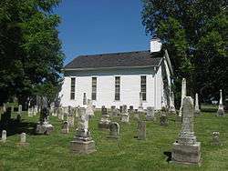 Jonahs Run Baptist Church | |
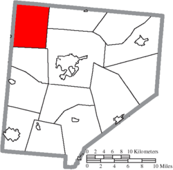 Location of Chester Township in Clinton County | |
| Coordinates: 39°31′12″N 83°56′26″W | |
| Country | United States |
| State | Ohio |
| County | Clinton |
| Area | |
| • Total | 31.9 sq mi (82.7 km2) |
| • Land | 31.6 sq mi (81.8 km2) |
| • Water | 0.3 sq mi (0.9 km2) |
| Elevation | 1,001 ft (305 m) |
| Population (2010) | |
| • Total | 1,967 |
| • Density | 62/sq mi (24.0/km2) |
| Time zone | UTC-5 (Eastern (EST)) |
| • Summer (DST) | UTC-4 (EDT) |
| FIPS code | 39-13974[2] |
| GNIS feature ID | 1085877[1] |
Geography
Located in the northwest corner of the county, it borders the following townships:
- Caesarscreek Township, Greene County - northeast
- Liberty Township - east
- Union Township - southeast
- Adams Township - south
- Massie Township, Warren County - southwest
- Wayne Township, Warren County - west
- Spring Valley Township, Greene County - northwest
Caesar Creek State Park is partially located in Chester Township.
No municipalities are located in Chester Township.
New Burlington is a ghost town contained in the township.
Transportation
Major roads are Interstate 71 and State Routes 73 and 380.
Name and history
Chester Township was organized in 1810.[4]
It is one of five Chester Townships statewide.[5]
Government
The township is governed by a three-member board of trustees, who are elected in November of odd-numbered years to a four-year term beginning on the following January 1. Two are elected in the year after the presidential election and one is elected in the year before it. There is also an elected township fiscal officer,[6] who serves a four-year term beginning on April 1 of the year after the election, which is held in November of the year before the presidential election. Vacancies in the fiscal officership or on the board of trustees are filled by the remaining trustees.
References
- Clinton County Historical Society. Clinton County, Ohio, 1982. Wilmington, Ohio: The Society, 1982.
- Ohio Atlas & Gazetteer. 6th ed. Yarmouth, Maine: DeLorme, 2001. ISBN 0-89933-281-1
- Ohio. Secretary of State. The Ohio municipal and township roster, 2002-2003. Columbus, Ohio: The Secretary, 2003.
- "US Board on Geographic Names". United States Geological Survey. 2007-10-25. Retrieved 2008-01-31.
- "U.S. Census website". United States Census Bureau. Retrieved 2008-01-31.
- "Geographic Identifiers: 2010 Demographic Profile Data (G001): Chester township, Clinton County, Ohio". U.S. Census Bureau, American Factfinder. Archived from the original on January 24, 2015. Retrieved January 22, 2015.
- Brown, Albert J. (1915). History of Clinton County, Ohio: Its People, Industries, and Institutions. B.F. Bowen. pp. 257.
- "Detailed map of Ohio" (PDF). United States Census Bureau. 2000. Retrieved 2007-02-16.
- §503.24, §505.01, and §507.01 of the Ohio Revised Code. Accessed 4/30/2009.
External links
Municipalities and communities of Clinton County, Ohio, United States | ||
|---|---|---|
| City | 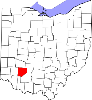 Map of Ohio highlighting Clinton County | |
| Villages | ||
| Townships | ||
| Unincorporated communities | ||
| Ghost town | ||
| Footnotes | ‡This populated place also has portions in an adjacent county or counties | |