Cheshire, Ohio
Cheshire /ˈtʃɛʃər/[6] is a village in Gallia County, Ohio, United States, along the Ohio River. The population was 132 at the 2010 census. It is part of the Point Pleasant, WV–OH Micropolitan Statistical Area.
Cheshire | |
|---|---|
Village | |
 Cheshire, 2004 | |
 Location of Cheshire, Ohio | |
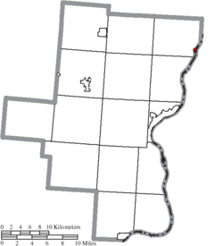 Location of Cheshire in Gallia County | |
| Coordinates: 38°56′44″N 82°6′43″W | |
| Country | United States |
| State | Ohio |
| County | Gallia |
| Township | Cheshire |
| Area | |
| • Total | 0.78 sq mi (2.02 km2) |
| • Land | 0.77 sq mi (1.99 km2) |
| • Water | 0.01 sq mi (0.03 km2) |
| Elevation | 568 ft (173 m) |
| Population | |
| • Total | 132 |
| • Estimate (2019[4]) | 128 |
| • Density | 171.4/sq mi (66.2/km2) |
| Time zone | UTC-5 (Eastern (EST)) |
| • Summer (DST) | UTC-4 (EDT) |
| ZIP code | 45620 |
| Area code(s) | 740 |
| FIPS code | 39-13932[5] |
| GNIS feature ID | 1039033[2] |
History
Cheshire, Ohio, was named for the county of Cheshire in England.[7]
Town buyout by American Electric Power
By 2000, the village was plagued by toxic sulfurous gas clouds and acid rain from the nearby coal-fired Gavin Power Plant, as an unintended consequence of pollution-control technology. Residents hired lawyers requesting a buyout. The plant's owner, American Electric Power (AEP), thoroughly investigated the claims and found that no long term injuries/illnesses resulted from the cloud but decided it could use the land to expand plant property for future technologies. In 2002, AEP reached a settlement with residents that was effectively a $20 million buyout.[8] Most of the 221 residents agreed to leave the town and absolve the company from future property or health claims, while some remain through either deals with the company or refusal to sell their property. The company announced plans to demolish the existing structures and construct a dock facility for coal barges, but has not yet begun work on constructing them.
In 2004, the remaining villagers of Cheshire and residents of the surrounding area took steps to expand the village limits by annexing properties within about a mile north and west of the previous village limits.[9][10]
Geography
Cheshire is located at 38°56′44″N 82°06′43″W.[11]
According to the United States Census Bureau, the village has a total area of 0.78 square miles (2.02 km2), of which 0.77 square miles (1.99 km2) is land and 0.01 square miles (0.03 km2) is water.[1]
Demographics
| Historical population | |||
|---|---|---|---|
| Census | Pop. | %± | |
| 1870 | 276 | — | |
| 1960 | 369 | — | |
| 1970 | 315 | −14.6% | |
| 1980 | 297 | −5.7% | |
| 1990 | 250 | −15.8% | |
| 2000 | 221 | −11.6% | |
| 2010 | 132 | −40.3% | |
| Est. 2019 | 128 | [4] | −3.0% |
| U.S. Decennial Census[12] | |||
2010 census
As of the census[3] of 2010, there were 132 people, 67 households, and 36 families living in the village. The population density was 171.4 inhabitants per square mile (66.2/km2). There were 76 housing units at an average density of 98.7 per square mile (38.1/km2). The racial makeup of the village was 96.2% White, 0.8% African American, 2.3% from other races, and 0.8% from two or more races. Hispanic or Latino of any race were 1.5% of the population.
There were 67 households, of which 17.9% had children under the age of 18 living with them, 44.8% were married couples living together, 4.5% had a female householder with no husband present, 4.5% had a male householder with no wife present, and 46.3% were non-families. 41.8% of all households were made up of individuals, and 20.9% had someone living alone who was 65 years of age or older. The average household size was 1.97 and the average family size was 2.67.
The median age in the village was 52 years. 15.2% of residents were under the age of 18; 6.9% were between the ages of 18 and 24; 16.6% were from 25 to 44; 37.1% were from 45 to 64; and 24.2% were 65 years of age or older. The gender makeup of the village was 53.0% male and 47.0% female.
2000 census
As of the census[5] of 2000, there were 221 people, 93 households, and 59 families living in the village. The population density was 1,201.2 people per square mile (474.0/km2). There were 110 housing units at an average density of 597.9 per square mile (236.0/km2). The racial makeup of the village was 98.19% White, 1.36% African American and 0.45% Native American.
There were 93 households, out of which 29.0% had children under the age of 18 living with them, 53.8% were married couples living together, 6.5% had a female householder with no husband present, and 35.5% were non-families. 33.3% of all households were made up of individuals, and 18.3% had someone living alone who was 65 years of age or older. The average household size was 2.38 and the average family size was 3.05.
In the village, the population was spread out, with 25.8% under the age of 18, 7.7% from 18 to 24, 25.8% from 25 to 44, 24.0% from 45 to 64, and 16.7% who were 65 years of age or older. The median age was 40 years. For every 100 females, there were 93.9 males. For every 100 females age 18 and over, there were 95.2 males.
The median income for a household in the village was $30,179, and the median income for a family was $31,786. Males had a median income of $31,250 versus $21,667 for females. The per capita income for the village was $13,926. About 11.4% of families and 12.4% of the population were below the poverty line, including 23.8% of those under the age of 18 and none of those 65 or over.
Education
Public education in the village of Cheshire is provided by the Gallia County Local School District.
Notable people
- Frank Cremeans, U.S. Representative from Ohio
- Harvey V. Higley, businessman
See also
- List of cities and towns along the Ohio River
References
- "US Gazetteer files 2010". United States Census Bureau. Archived from the original on 2012-01-25. Retrieved 2013-01-06.
- "US Board on Geographic Names". United States Geological Survey. 2007-10-25. Retrieved 2008-01-31.
- "U.S. Census website". United States Census Bureau. Retrieved 2013-01-06.
- "Population and Housing Unit Estimates". Retrieved May 21, 2020.
- "U.S. Census website". United States Census Bureau. Retrieved 2008-01-31.
- "A Pronunciation Guide to Places in Ohio". E.W.Scripps School of Journalism. Retrieved 2008-12-19.
- Gannett, Henry (1905). The Origin of Certain Place Names in the United States. Govt. Print. Off. pp. 79.
- Hawthorn, Michael (17 April 2002). "AEP Agrees To Buy Out Entire Town". Columbus Dispatch. Retrieved 2009-01-07.
- Price, Rita (20 August 2004). "AEP Fighting Annexation Petition". Columbus Dispatch. Retrieved 2009-01-07.
- Price, Rita (11 February 2005). "Nearly Deserted Cheshire Still Attempting To Add Residents". Columbus Dispatch. Retrieved 2009-01-07.
- "US Gazetteer files: 2010, 2000, and 1990". United States Census Bureau. 2011-02-12. Retrieved 2011-04-23.
- "Census of Population and Housing". Census.gov. Retrieved June 4, 2015.
External links
- Cheshire, Ohio at Forgotten Ohio
- The Cheshire Transaction: One Small Ohio Town. One Power Plant. One Unusual Buyout Proposal. A documentary film
Municipalities and communities of Gallia County, Ohio, United States | ||
|---|---|---|
| Villages | 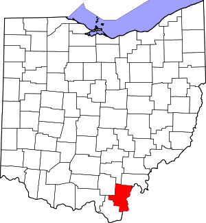 Map of Ohio highlighting Gallia County | |
| Townships | ||
| CDP | ||
| Unincorporated communities | ||