Chebaa (Hasbaiya)
Chebaa (Arabic: شبعا; also transliterated Shebaa) is a town on the south-eastern tip of Lebanon. It has a largely Sunni Muslim population of 25,000 people. It is situated at an altitude of approximately 1,500 m (4,900 ft) above sea level; spread across two steep rocky mountainsides.[3] It lies adjacent to the contested Shebaa farms—which sit between the town and the Golan Heights.[4] Before 1967, residents of Shebaa farmed in the disputed Shebaa farms territory.[5]
Chebaa شبعا | |
|---|---|
Village | |
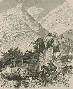 Chebaa, in the 1880s[2] | |
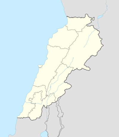 Chebaa Location within Lebanon | |
| Coordinates: 33°20′55″N 35°44′55″E | |
| Country | |
| Governorate | Nabatieh Governorate |
| District | Hasbaya District |
| Time zone | UTC+2 (EET) |
| • Summer (DST) | UTC+3 (EEST) |
| Dialing code | +961 |
The town houses several thousand Syrian refugees.[6]
Educational Establishments
| Educational establishments | Chebaa (Hasbaiya) (2005-2006) | Lebanon (2005-2006) |
|---|---|---|
| Number of Schools | 4 | 2788 |
| Public School | 2 | 1763 |
| Private School | 2 | 1025 |
| Students schooled in the public schools | 435 | 439905 |
| Students schooled in the private schools | 145 | 471409 |
References
- Wilson, 1881, vol 2, p. 129
- Wilson, 1881, vol 2, p. 129
- Nour Samaha (2 Jul 2013). "The strange case of Lebanon's Shebaa". Al Jazeera. Retrieved 12 June 2015.
- Krista Eileen Wiegand (2011). Enduring Territorial Disputes: Strategies of Bargaining, Coercive Diplomacy, and Settlement (illustrated ed.). University of Georgia Press. p. 146. ISBN 9780820337388.
- Krista Eileen Wiegand (2011). Enduring Territorial Disputes: Strategies of Bargaining, Coercive Diplomacy, and Settlement (illustrated ed.). University of Georgia Press. pp. 157–8. ISBN 9780820337388.
- Samya Kullab; Ghinwa Obeid (27 Feb 2015). "Shebaa, the town caught in the middle". The Daily Star. Retrieved 12 June 2015.
Bibliography
- Wilson, C.W., ed. (c. 1881). Picturesque Palestine, Sinai and Egypt. 2. New York: D. Appleton.
External links
- Localliban: Centre de resource sur le developpement local: www.localiban.org
Capital: Hasbaya | ||
| Towns and villages |  | |
| Other | ||
This article is issued from Wikipedia. The text is licensed under Creative Commons - Attribution - Sharealike. Additional terms may apply for the media files.