Chatsworth, Georgia
Chatsworth is a city in Murray County, Georgia, United States. It is part of the Dalton, Georgia Metropolitan Statistical Area. The population was 3,531 at the 2000 census and 4,299 in 2010. The city is the county seat of Murray County.[5]
Chatsworth, Georgia | |
|---|---|
 Downtown Chatsworth | |
 Location in Murray County and the state of Georgia | |
| Coordinates: 34°46′20″N 84°46′44″W | |
| Country | United States |
| State | Georgia |
| County | Murray |
| Area | |
| • Total | 5.33 sq mi (13.80 km2) |
| • Land | 5.32 sq mi (13.77 km2) |
| • Water | 0.01 sq mi (0.02 km2) |
| Elevation | 745 ft (227 m) |
| Population (2010) | |
| • Total | 4,299 |
| • Estimate (2018)[2] | 4,318 |
| • Density | 812.11/sq mi (313.53/km2) |
| Time zone | UTC-5 (Eastern (EST)) |
| • Summer (DST) | UTC-4 (EDT) |
| ZIP code | 30705 |
| Area code(s) | 706/762 |
| FIPS code | 13-15508[3] |
| GNIS feature ID | 0327417[4] |
| Website | http://www.chatsworthga.gov |

According to a popular legend, the town received its name after a road sign with the word "Chatsworth" fell off a passing freight train nearby. Someone put the sign on a post, and the name stuck.[6][7]
Just east of Chatsworth are Fort Mountain and the Fort Mountain State Park.
History
Founded in 1905 as a depot on the Louisville and Nashville Railroad. It was incorporated as a town in 1906 and as a city in 1923. In 1915, the seat of Murray County transferred to Chatsworth from Spring Place.[8]
Geography
Chatsworth is located at 34°46′20″N 84°46′44″W (34.772336, -84.778977).[9] According to the United States Census Bureau, the city has a total area of 4.7 square miles (12 km2), of which 4.7 square miles (12 km2) is land, and 0.04 square miles (0.10 km2) (0.42%) is water.
Demographics
| Historical population | |||
|---|---|---|---|
| Census | Pop. | %± | |
| 1910 | 314 | — | |
| 1920 | 472 | 50.3% | |
| 1930 | 607 | 28.6% | |
| 1940 | 1,001 | 64.9% | |
| 1950 | 1,214 | 21.3% | |
| 1960 | 1,184 | −2.5% | |
| 1970 | 2,706 | 128.5% | |
| 1980 | 2,493 | −7.9% | |
| 1990 | 2,865 | 14.9% | |
| 2000 | 3,531 | 23.2% | |
| 2010 | 4,299 | 21.8% | |
| Est. 2018 | 4,318 | [2] | 0.4% |
| U.S. Decennial Census[10] | |||
As of the census[3] of 2010, there were 4,299 people, 1,587 households, and 1,071 families residing in the city. The population density was 749.5 people per square mile (289.5/km²). There were 1,546 housing units at an average density of 328.1 per square mile (126.7/km²). The racial makeup of the city was 99.1% White, 0.5% African American, 0.1% Native American, 0.1% Asian, 0.2% Pacific Islander, 0% from other races, and 0% from two or more races. Hispanic or Latino of any race were 0% of the population.
Education
Murray County School District
The Murray County School District holds preschool to grade twelve, and consists of six elementary schools, two middle schools, two high schools, and once had an academy school.[11] The district has 451 full-time teachers and over 7,345 students.[12]
Notable people
- Jody Ridley - NASCAR driver
- James Vann and Joseph Vann - owners of Chief Vann House
- Ryan Scoggins - Amateur porn star
References
- "2018 U.S. Gazetteer Files". United States Census Bureau. Retrieved Feb 12, 2020.
- "Population and Housing Unit Estimates". Retrieved June 4, 2019.
- "U.S. Census website". United States Census Bureau. Retrieved 2008-01-31.
- "US Board on Geographic Names". United States Geological Survey. 2007-10-25. Retrieved 2008-01-31.
- "Find a County". National Association of Counties. Archived from the original on 2011-05-31. Retrieved 2011-06-07.
- "Murray County Website". Archived from the original on 7 February 2007. Retrieved 19 May 2017.CS1 maint: BOT: original-url status unknown (link)
- Krakow, Kenneth K. (1975). Georgia Place-Names: Their History and Origins (PDF). Macon, GA: Winship Press. p. 39. ISBN 0-915430-00-2.
- Hellmann, Paul T. (May 13, 2013). Historical Gazetteer of the United States. Routledge. p. 223. ISBN 1135948593. Retrieved 30 November 2013.
- "US Gazetteer files: 2010, 2000, and 1990". United States Census Bureau. 2011-02-12. Retrieved 2011-04-23.
- "Census of Population and Housing". Census.gov. Retrieved June 4, 2015.
- Murray County Schools, Retrieved April 09, 2012.
- School Stats, Retrieved June 24, 2010.
External links
| Wikimedia Commons has media related to Chatsworth, Georgia. |
Municipalities and communities of Murray County, Georgia, United States | ||
|---|---|---|
| City | 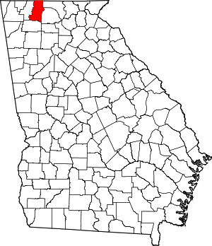 Map of Georgia highlighting Murray County | |
| Town | ||
| Unincorporated communities | ||
| Authority control |
|
|---|