Charfield
Charfield is a village and civil parish in Gloucestershire, England, south-west of Wotton-under-Edge near the Little Avon River and the villages of Falfield and Cromhall.
| Charfield | |
|---|---|
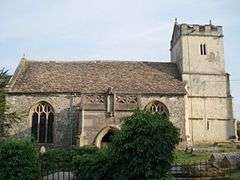 St. James church, Churchend | |
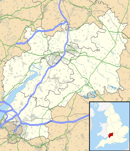 Charfield Location within Gloucestershire | |
| Population | 2,538 (2011)[1] |
| OS grid reference | ST7292 |
| Civil parish |
|
| Unitary authority | |
| Ceremonial county | |
| Region | |
| Country | England |
| Sovereign state | United Kingdom |
| Post town | WOTTON-UNDER-EDGE |
| Postcode district | GL12 |
| Police | Avon and Somerset |
| Fire | Avon |
| Ambulance | South Western |
| UK Parliament | |
Village
Charfield is a medium-sized village of about 2,500 residents with three pubs, the Pear Tree, Railway Tavern and The Plough Inn, a convenience store with Post Office and two churches. There are six main housing areas. Farm Lees, Longs View, Manor Lane and Woodlands have existed for some time. Two new housing developments were built in 2018-2019: St James Mews, opposite St James Church, and Charfield Village, at the eastern end of the village near the Renishaw PLC site. The primary school has around 250 students.
Governance
An electoral ward with the same name exists. This ward starts in the east in Charfield and then stretches west to Falfield. The ward's population at the 2011 census was 4,678.[2]
The parish council has responsibility for local issues, including setting an annual precept (local rate) to cover the council's operating costs and producing annual accounts for public scrutiny. The parish council evaluates local planning applications and works with the local police, district council officers, and neighbourhood watch groups on matters of crime, security, and traffic. The parish council's role also includes initiating projects for the maintenance and repair of parish facilities, such as the Memorial Hall and playing field and playground, as well as consulting with the district council on the maintenance, repair, and improvement of highways, drainage, footpaths, public transport, and street cleaning. Conservation matters (including trees and listed buildings) and environmental issues are also of interest to the council.
The parish council is also a burial authority, and has its own burial ground in nearby Churchend.
Railway
The Bristol-Birmingham main railway line runs through the village. Charfield railway station closed in January 1965 but still stands, and discussions continue about the viability of re-opening it. The costs of re-opening would be shared between Gloucestershire and South Gloucestershire Councils since, although the station would be in South Gloucestershire, the nearby Gloucestershire town of Wotton-under-Edge would be a principal beneficiary.
The railway line marks the division of the village between two different telephone areas (01453-54x based on Wotton-under-Edge, and 01454-26x based on Falfield). The village is on the outer limits of both areas. The village has now been fibre-enabled, allowing FTTC connections.
Railway history
The Charfield railway disaster was a fatal train crash which occurred on 13 October 1928. The Leeds to Bristol LMS night mail train crashed under a road bridge near Charfield railway station, killing 15 and injuring 23. Amongst the dead were two children whose remains remain unidentified.
Charfield Memorial Hall and Playing Field
Charfield Memorial Hall and Playing Field is in the centre of Charfield. The Hall has recently been refurbished and the play area upgraded with new equipment.[3]
See also
References
- "Parish population 2011". Retrieved 19 March 2015.
- "Ward population 2011". Retrieved 19 March 2015.
- Charfield Community website
External links
| Wikimedia Commons has media related to Charfield. |