Cerro Capurata
Cerro Capurata, also known as Elena Capurata[2] or Quimsachatas[3] is a stratovolcano in the Andes of Bolivia and Chile. Capurata is covered with ice.[4] To the south of Capurata lies Cerro Casparata and straight west Guallatiri.[2]
| Cerro Capurata | |
|---|---|
| Elena Capurata, Nevados de Quimsachata | |
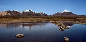 Cerro Capurata is in the center. | |
| Highest point | |
| Elevation | 6,013 m (19,728 ft) |
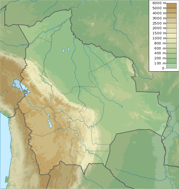
| Coordinates | 18°24′54″S 69°02′45″W |
| Geography | |
 Cerro Capurata | |
| Countries | Chile and Bolivia |
| Parent range | Andes |
| Climbing | |
| First ascent | 7 October 1967 by Ignacio Morlans and Pedro Rosende[1] |
Compared to Acotango and Humurata, Capurata's rocks are relatively well preserved. Some hydrothermal alteration, partly associated with fumarolic activity, is present however.[5] The total volume of the edifice is 19 cubic kilometres (4.6 cu mi).[6] Sulfur deposits formed by solfataras are also found on Capurata.[7]
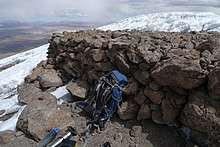
Incan Ruins
Capurata has a 10x5 metre ruin sitting on the top, towards north side. The structure is probably incan and it was photographed by Pedro Hauck during his last ascent in 2014[8]. The ruin is ofter buried under snow during winter.[9]
First Ascent
A light party of the Club Andino de Chile, Sección Santiago, made the first ascent of this snow volcano (19,653 feet) on the Chilean-Bolivian border. Police Captain Pedro Rosendo and Ignacio Morlans reached the top on October 7, 1967. After this, the fourth expedition of the club to this area, there remain unclimbed only the twin peaks of Pusupata and Umorata (both 5730 meters or 18,799 feet) and Larancagua (5830 meters or 19,128 feet).[10]
Elevation
It has an official height of 5990 metres[11], although two different expeditions have registered altitudes above 6000 meters using regular handheld GPS devices (6013[12][2] and 6014[13][14]).
Based on the elevation provided by the available Digital elevation models SRTM (5,979m[15]), SRTM2 (5,979 meters[16]), ASTER (5,979 meters[17]) and TanDEM-X 90m (6.019 meters[18]) and one handheld GPS survey by Maximo Kausch on July 2013 when he measured 6013m.[19]
The height of the nearest key col is 5,441 meters[3] so its prominence is 570 meters. Capurata is listed as a mountain based on the Dominance system [20] and its dominance is 9.48%. This information was obtained during a research by Suzanne Imber in 2014[21].
References
- "South America: Patagonia" (PDF). Alpine Journal. Retrieved 10 April 2016.
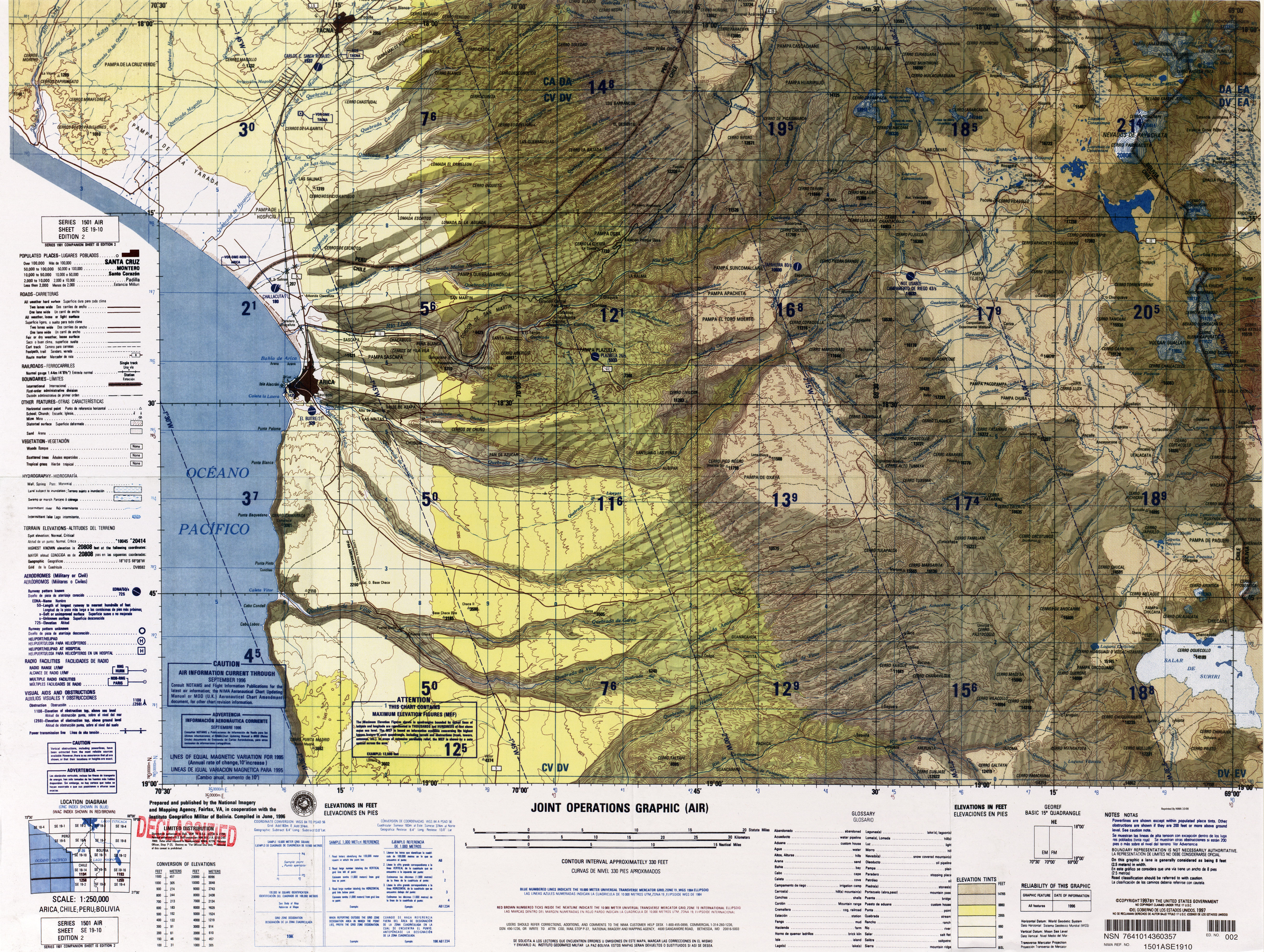
- "SE 19-10 Arica, Chile; Peru; Bolivia". Latin America, Joint Operations Graphic 1:250,000 [Not for navigational use]. University of Texas. Retrieved 10 April 2016.
- "Andean Mountains - All above 5000m". Andes Specialists. Retrieved 2020-04-12.
- Ochsenius, Claudio (1986). "La Glaciación Puna durante el Wisconsin, Desglaciación y Máximo Lacustre en la Transición Wisconsin-Holoceno y Refugios de Megafauna Postglaciales en la Puna y Desierto de Atacama" (PDF). Revista de Geografía Norte Grande (in Spanish). 13: 36. Archived from the original (PDF) on 2016-03-04. Retrieved 10 April 2016.
- Watts, Robert B.; Clavero Ribes, Jorge; Sparks, R. Stephen J. (30 September 2014). "Origen y emplazamiento del Domo Tinto, volcán Guallatiri, Norte de Chile". Andean Geology. 41 (3). doi:10.5027/andgeoV41n3-a04.
- Aravena, Diego; Villalón, Ignacio; Pablo, Sánchez. "Igneous Related Geothermal Resource in the Chilean Andes" (PDF). World Geothermal Congress 2015. Retrieved 10 April 2016.
- Avila-Salinas, Waldo (1991). "Petrologic and tectonic evolution of the Cenozoic volcanism in the Bolivian western Andes". Andean Magmatism and Its Tectonic Setting. 265. p. 248. doi:10.1130/SPE265-p245. ISSN 0072-1077.
- "Todas as montanhas de 6 mil metros da Bolívia". AltaMontanha (in Portuguese). 2015-02-08. Retrieved 2020-04-13.
- "File:Ruins at the top of Capurata.jpg", Wikipedia, retrieved 2020-04-13
- "AAC Publications - South America, Chile, Cerro Capurata, Northern Andes". publications.americanalpineclub.org. Retrieved 2020-04-13.
- Zeil, Werner (December 1964). "Die Verbreitung des jungen Vulkanismus in der Hochkordillere Nordchiles". Geologische Rundschau (in German). Springer Verlag. 53 (2): 751. doi:10.1007/BF02054561. ISSN 1432-1149.
- "Maximo Kausch llega a la mitad de su proyecto andino y 'descubre' un nuevo seismil". Desnivel. 2 September 2013. Retrieved 20 December 2016.
- "Medição ajuda a confirmar nova montanha de 6 mil metros na fronteira Bolívia/Chile". AltaMontanha (in Portuguese). 2014-09-10. Retrieved 2020-04-13.
- Quintero, Santiago. "Diario de Expedición: Bolivia, 14 x Seis mil en 60 Días". Retrieved 20 December 2016.
- USGS, EROS Archive,. "USGS EROS Archive - Digital Elevation - SRTM Coverage Maps". Retrieved 12 April 2020.CS1 maint: extra punctuation (link)
- NASA, Jet Propulsion Laboratory,. "Shuttle Radar Topographic Mission - Filled Data V2". Retrieved 12 April 2020.CS1 maint: extra punctuation (link)
- Ferranti, Jonathan,. "DIGITAL ELEVATION DATA Filled SRTM Raw Data, Last revision 26 May 2014". Retrieved 12 April 2020.CS1 maint: extra punctuation (link)
- TanDEM-X, TerraSAR-X,. "Copernicus Space Component Data Access". Retrieved 12 April 2020.CS1 maint: extra punctuation (link)
- "Andean Mountains - All above 5000m". Andes Specialists. Retrieved 2020-04-12.
- "Dominance - Page 2". www.8000ers.com. Retrieved 2020-04-12.
- ap507. "Academic and adventurer describes the incredible task of climbing and cataloguing one of the most remote regions of the South American Andes mountains — University of Leicester". www2.le.ac.uk. Retrieved 2020-04-12.