Cedar Creek (North Dakota)
Cedar Creek (also called the Cedar River) is a tributary of the Cannonball River in southwestern North Dakota in the United States.
| Cedar Creek | |
|---|---|
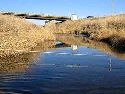 USGS Gage House reflected in Cedar Creek, North Dakota | |
| Physical characteristics | |
| Source | |
| ⁃ location | Slope County, North Dakota |
| ⁃ coordinates | 46°18′14″N 103°20′49″W |
| ⁃ elevation | 2,963 ft (903 m) |
| Mouth | |
⁃ location | Confluence with the Cannonball River, Grant County, North Dakota |
⁃ coordinates | 46°07′29″N 101°18′40″W |
⁃ elevation | 1,860 ft (570 m) |
| Basin features | |
| Progression | Cedar Creek → Cannonball → Missouri → Mississippi → Gulf of Mexico |
| GNIS ID | 1034769 |
It rises near White Butte, south of Amidon in the badlands of Slope County. It flows ESE, north of Whetstone Butte, then east, north of the Cedar River National Grassland, forming the northern border of Sioux County and the Standing Rock Indian Reservation. It joins the Cannonball approximately 15 mi (24 km) southwest of Shields.[1]
See also
- List of North Dakota rivers
This article is issued from Wikipedia. The text is licensed under Creative Commons - Attribution - Sharealike. Additional terms may apply for the media files.