Castallack
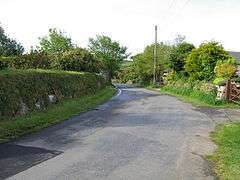
Castallack is a hamlet in the civil parish of Paul in west Cornwall, England, UK. It is on a minor road between Sheffied and Lamorna.[1]
| Castallack | |
|---|---|
 Castallack | |
 Castallack Location within Cornwall | |
| OS grid reference | SW451253 |
| Civil parish |
|
| Unitary authority | |
| Ceremonial county | |
| Region | |
| Country | England |
| Sovereign state | United Kingdom |
| Post town | PENZANCE |
| Postcode district | TR19 |
| Dialling code | 01736 |
| Police | Devon and Cornwall |
| Fire | Cornwall |
| Ambulance | South Western |
| UK Parliament | |
Castallack lies within the Cornwall Area of Outstanding Natural Beauty (AONB). Almost a third of Cornwall has AONB designation, with the same status and protection as a National Park.
Castallack Roundago (grid reference SW44822540) is a good example of a Romano-British round despite it having been partly destroyed in the 19th-century.[2]
Granite from the Castallack quarries was used mainly for gravestones, activity finished in the mid-1980s.[3]}}</ref>
References
- Ordnance Survey: Landranger map sheet 203 Land's End & Isles of Scilly (Map). Ordnance Survey. 2009. ISBN 978-0-319-23289-7.
- Anon (2006). Kirkham, Graham; Herring, Peter (eds.). "Castallack Roundago". Cornish Archaeology / Hendhyscans Kernow. Cornwall Archaeological Society. 41–42 (2002–3): 186. ISSN 0070-024X.
- Bristow, Colin (2014). "The Geology Of The Building And Decorative Stones Of Cornwall. Supplementary Publications. Granite and Elvans". ResearchGate. Geological Society London Special Publications (Geol Soc Spec Publ). doi:10.1144/SP391.6. Retrieved 30 August 2019.
External links

Cornwall Portal | |
| Unitary authorities | |
| Major settlements |
|
| Rivers | |
| Topics | |
This article is issued from Wikipedia. The text is licensed under Creative Commons - Attribution - Sharealike. Additional terms may apply for the media files.