Carrollton Township, Carroll County, Missouri
Carrollton Township is one of twenty townships in Carroll County, Missouri, USA. As of the 2000 census, its population was 4,355.
Carrollton Township | |
|---|---|
 Location in Carroll County | |
| Coordinates: 39°22′06″N 093°29′36″W | |
| Country | United States |
| State | Missouri |
| County | Carroll |
| Area | |
| • Total | 35.59 sq mi (92.17 km2) |
| • Land | 35.51 sq mi (91.98 km2) |
| • Water | 0.07 sq mi (0.19 km2) 0.21% |
| Elevation | 738 ft (225 m) |
| Population (2000) | |
| • Total | 4,355 |
| • Density | 122.6/sq mi (47.3/km2) |
| GNIS feature ID | 0766405 |
Carrollton Township was established in 1872, and named after the community of Carrollton.[1]
Geography
Carrollton Township covers an area of 35.59 square miles (92.2 km2) and contains one incorporated settlement, Carrollton (the county seat). According to the USGS, it contains three cemeteries: Mount Zion, Saint Marys and Willis Chapel.
The stream of Cottonwood Branch runs through this township.
References
- "Carroll County Place Names, 1928–1945 (archived)". The State Historical Society of Missouri. Archived from the original on 24 June 2016. Retrieved 10 September 2016.CS1 maint: BOT: original-url status unknown (link)
External links
Municipalities and communities of Carroll County, Missouri, United States | ||
|---|---|---|
| Cities | 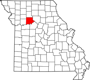 Map of Missouri highlighting Carroll County | |
| Village | ||
| Townships | ||
| Unincorporated communities | ||
| Ghost towns | ||
| Footnotes | ‡This populated place also has portions in an adjacent county or counties | |
This article is issued from Wikipedia. The text is licensed under Creative Commons - Attribution - Sharealike. Additional terms may apply for the media files.