Carriçal
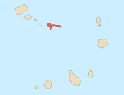
Carriçal is a settlement in the eastern part of the island of São Nicolau, Cape Verde. It is situated on the south coast, 8 km southeast of Juncalinho and 24 km east of Ribeira Brava. It is the easternmost settlement on the island. Some 8 km east is the island's easternmost point, Ponta Leste. The place was mentioned as Currissal in the 1747 map by Jacques-Nicolas Bellin.[2]
Carriçal | |
|---|---|
Settlement | |
 | |
| Coordinates: 16.554°N 24.081°W | |
| Country | Cape Verde |
| Island | São Nicolau |
| Municipality | Ribeira Brava |
| Civil parish | Nossa Senhora do Rosário |
| Elevation | 14 m (46 ft) |
| Population (2010)[1] | |
| • Total | 190 |
| ID | 31208 |
References
- "2010 Census results". Instituto Nacional de Estatística Cabo Verde (in Portuguese). 24 November 2016.
- Jacques-Nicolas Bellin (1747). "Carte des Isles du Cap Verd = Kaart van de Eilanden van Kabo Verde" (in French).
The island of São Nicolau | ||||||
|---|---|---|---|---|---|---|
| Ribeira Brava |
|  | ||||
| Tarrafal de São Nicolau |
| |||||
| Mountains | ||||||
| Other topics | ||||||
This article is issued from Wikipedia. The text is licensed under Creative Commons - Attribution - Sharealike. Additional terms may apply for the media files.